
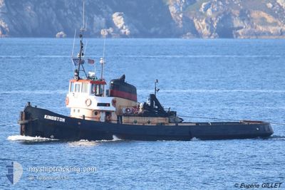
KINGSTON
Other Type
Current Trip
| Time Travelled | 8 days |
|---|---|
| Remaining Time | --- |
| Distance Travelled | 103.66 nm |
| Remaining Distance | --- |
| AVG Speed | 5.9 Noeuds |
| MAX Speed | 9.4 Noeuds |
| AVG Wind | 16.4 knots |
| MAX Wind | 22.8 knots |
| MIN Temp | 9.9°C / 49.82°F |
| MAX Temp | 10.9°C / 51.62°F |
| Tirant d eau | 4 m |
| Position reçue | 7 d depuis |
Current Position
| Longitude | -4.96662° |
|---|---|
| Latitude | 52.02753° |
| Etat | Restricted manoeuverability |
| Vitesse | 3.9 Noeuds |
| Parcours | 144.8° |
| Zone | Irish Sea and St. George's Channel |
| Station | T-AIS |
| Position reçue | 7 d depuis |
Info
Information
The current position of KINGSTON is in Irish Sea and St. George's Channel with coordinates 52.02753° / -4.96662° as reported on 2024-04-12 05:07 by AIS to our vessel tracker app. The vessel's current speed is 3.9 Noeuds
The vessel KINGSTON (IMO: 534443700, MMSI: 235013963) is a Other Type It's sailing under the flag of [GB] United Kingdom.
In this page you can find informations about the vessels current position, last detected port calls, and current voyage information. If the vessels is not in coverage by AIS you will find the latest position.
The current position of KINGSTON is detected by our AIS receivers and we are not responsible for the reliability of the data. The last position was recorded while the vessel was in Coverage by the Ais receivers of our vessel tracking app.
The current draught of KINGSTON as reported by AIS is 4 meters
Weather
| Temperature | 10°C / 50°F |
|---|---|
| Wind Speed | 16 knots |
| Direction | 195° SSW |
| Pressure | 1025.6 hPa |
| Humidity | 88.4 % |
| Cloud Coverage | 94 % |
Featured Company
Last Port Calls
| Port | Arrival | Departure | Time In Port |
|---|---|---|---|
| 2024-04-09 11:44 | 2024-04-11 02:40 | 1 d | |
| 2024-04-02 12:06 | 2024-04-09 11:15 | 6 d | |
| 2024-03-21 13:23 | 2024-03-31 18:23 | 10 d | |
| 2024-03-20 22:58 | 2024-03-20 23:55 | 57 m | |
| 2024-03-11 17:57 | 2024-03-19 13:30 | 7 d | |
| 2024-03-10 06:58 | |||
| 2024-03-04 01:39 | 2024-03-04 01:44 | 5 m | |
| 2024-02-28 10:19 | 2024-03-02 17:06 | 3 d | |
| 2024-02-27 07:09 |
Most Visited Ports (Last year)
| Port | Arrivals | |
|---|---|---|
| 15 | ||
| 6 | ||
| 5 | ||
| 4 | ||
| 3 | ||
| 3 |
Last Trips
| Origin | Departure | Destination | Arrival | Distance | |
|---|---|---|---|---|---|
| 2024-04-09 12:15 | 2024-04-09 12:44 | 1.38 nm | |||
| 2024-03-31 19:23 | 2024-04-02 13:06 | 357.59 nm | |||
| 2024-03-21 00:55 | 2024-03-21 13:23 | 123.60 nm | |||
| 2024-03-19 14:30 | 2024-03-20 23:58 | 261.17 nm | |||
| 2024-03-10 06:58 | 2024-03-11 18:57 | 303.18 nm | |||
| 2024-03-02 18:06 | 2024-03-04 02:39 | 234.64 nm | |||
| 2024-02-27 07:09 | 2024-02-28 11:19 | 255.69 nm |
Events
| Heure | Evenement | Détails | Position/ Destination | Info |
|---|---|---|---|---|
| 2024-04-12 05:07 | Hors de la zone couverte |
52.02753 / -4.96662
Irish Sea and St. George's Channel
GBFIS
|
Vitesse: 3.9 kn Parcours: 144.8° |
|
| 2024-04-11 22:44 | Changement de destination | GBFIS NLDHR |
52.17195 / -5.52918
GBFIS
|
Vitesse: 5.8 kn Parcours: 94.7° |
| 2024-04-11 22:35 | Dans la zone couverte |
52.17597 / -5.53858
Irish Sea and St. George's Channel
NLDHR
|
Vitesse: 2.6 kn Parcours: 132.1° |
|
| 2024-04-11 05:57 | Hors de la zone couverte |
53.09714 / -4.91993
Irish Sea and St. George's Channel
NLDHR
|
Vitesse: 5.1 kn Parcours: 209.8° |
|
| 2024-04-11 02:40 | PORT DE DEPART |
|
53.31721 / -4.61123
NLDHR
|
Vitesse: 1.9 kn Parcours: 511° |
| 2024-04-11 02:32 | Démarrage |
53.31323 / -4.61974
[GB] HOLYHEAD
|
Vitesse: 3.2 kn Parcours: 93.3° |
|
| 2024-04-11 02:31 | Etat Changé | Restricted manoeuverability Moored |
53.31332 / -4.62095
[GB] HOLYHEAD
|
Vitesse: 3.1 kn Parcours: 96.2° |
| 2024-04-10 13:31 | Changement d'ETA | 2024/04/16 03:00 2024/04/16 15:00 |
53.31406 / -4.62300
[GB] HOLYHEAD
|
Vitesse: Parcours: 511° |
| 2024-04-10 13:25 | Changement d'ETA | 2024/04/16 15:00 2024/04/02 15:00 |
53.31401 / -4.62305
[GB] HOLYHEAD
|
Vitesse: Parcours: 511° |
| 2024-04-09 17:02 | Etat Changé | Moored Restricted manoeuverability |
53.31399 / -4.62305
[GB] HOLYHEAD
|
Vitesse: Parcours: 511° |