
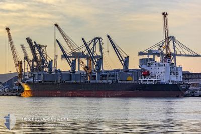
KINGFISHER D
Bulk Carrier
Current Trip
| Time Travelled | 9 days |
|---|---|
| Remaining Time | --- |
| Distance Travelled | 1523.70 nm |
| Remaining Distance | --- |
| AVG Speed | 9.6 Noeuds |
| MAX Speed | 9.6 Noeuds |
| AVG Wind | 12 knots |
| MAX Wind | 38.8 knots |
| MIN Temp | 7.6°C / 45.68°F |
| MAX Temp | 25.9°C / 78.62°F |
| Tirant d eau | 9.8 m |
| Position reçue | 1 d depuis |
Current Position
| Longitude | 14.31633° |
|---|---|
| Latitude | 36.54044° |
| Etat | Under way using engine |
| Vitesse | 10.1 Noeuds |
| Parcours | 285.5° |
| Zone | Mediterranean Sea - Eastern Basin |
| Station | T-AIS |
| Position reçue | 1 d depuis |
Info
Information
The current position of KINGFISHER D is in Mediterranean Sea - Eastern Basin with coordinates 36.54044° / 14.31633° as reported on 2024-04-24 10:25 by AIS to our vessel tracker app. The vessel's current speed is 10.1 Noeuds
The vessel KINGFISHER D (IMO: 9238117, MMSI: 538003253) is a Bulk Carrier that was built in 2002 ( 22 Age ). It's sailing under the flag of [MH] Marshall Is.
In this page you can find informations about the vessels current position, last detected port calls, and current voyage information. If the vessels is not in coverage by AIS you will find the latest position.
The current position of KINGFISHER D is detected by our AIS receivers and we are not responsible for the reliability of the data. The last position was recorded while the vessel was in Coverage by the Ais receivers of our vessel tracking app.
The current draught of KINGFISHER D as reported by AIS is 9.8 meters
Weather
| Temperature | 14.9°C / 58.82°F |
|---|---|
| Wind Speed | 8 knots |
| Direction | 99° E |
| Pressure | 1011.9 hPa |
| Humidity | 70.8 % |
| Cloud Coverage | 5 % |
Featured Company
Events
| Heure | Evenement | Détails | Position/ Destination | Info |
|---|---|---|---|---|
| 2024-04-25 14:39 | Arret | 3.16 nm, East of BIZERTE |
37.27667 / 9.92666
BIZERTE
|
Vitesse: Parcours: -1° |
| 2024-04-24 10:35 | Etat Changé | Default Under way using engine |
36.54800 / 14.28246
BIZERTE
|
Vitesse: 10.1 kn Parcours: 285.5° |
| 2024-04-24 10:25 | Hors de la zone couverte |
36.54044 / 14.31633
Mediterranean Sea - Eastern Basin
BIZERTE
|
Vitesse: 10.1 kn Parcours: 285.5° |
|
| 2024-04-24 10:05 | Etat Changé | Under way using engine Default |
36.52516 / 14.38502
BIZERTE
|
Vitesse: 10 kn Parcours: 285° |
| 2024-04-24 09:51 | Etat Changé | Default Under way using engine |
36.51333 / 14.43167
BIZERTE
|
Vitesse: 10.1 kn Parcours: 284.6° |
| 2024-04-24 09:23 | Etat Changé | Under way using engine Default |
36.49541 / 14.52768
BIZERTE
|
Vitesse: 10 kn Parcours: 285° |
| 2024-04-24 09:18 | Etat Changé | Default Under way using engine |
36.49166 / 14.54333
BIZERTE
|
Vitesse: 10.1 kn Parcours: 282.7° |
| 2024-04-24 08:41 | Changement de destination | BIZERTE SFAX |
36.47008 / 14.66652
BIZERTE
|
Vitesse: 9.7 kn Parcours: 282° |
| 2024-04-24 08:19 | Etat Changé | Under way using engine Default |
36.45768 / 14.74225
SFAX
|
Vitesse: 10 kn Parcours: 280° |
| 2024-04-24 08:03 | Etat Changé | Default Under way using engine |
36.44833 / 14.79667
SFAX
|
Vitesse: 10.6 kn Parcours: 283° |