
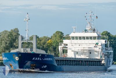
KARL-JAKOB K.
General Cargo
Current Trip
| Time Travelled | 14 days |
|---|---|
| Remaining Time | 41 mins |
| Distance Travelled | 313.59 nm |
| Remaining Distance | 12.46 nm |
| AVG Speed | 8.4 Noeuds |
| MAX Speed | 13.4 Noeuds |
| AVG Wind | 10.3 knots |
| MAX Wind | 23 knots |
| MIN Temp | 1.6°C / 34.88°F |
| MAX Temp | 18.5°C / 65.3°F |
| Tirant d eau | 3.6 m |
| Position reçue | 1 m depuis |
Current Position
| Longitude | 9.61503° |
|---|---|
| Latitude | 53.58422° |
| Etat | Under way using engine |
| Vitesse | 13.6 Noeuds |
| Parcours | 136.2° |
| Zone | North Sea |
| Station | T-AIS |
| Position reçue | 1 m depuis |
Info
Information
The current position of KARL-JAKOB K. is in North Sea with coordinates 53.58422° / 9.61503° as reported on 2024-04-19 20:46 by AIS to our vessel tracker app. The vessel's current speed is 13.6 Noeuds and is heading at the port of HAMBURG. The estimated time of arrival as calculated by MyShipTracking vessel tracking app is 2024-04-19 21:28 LT
The vessel KARL-JAKOB K. (IMO: 9344409, MMSI: 244008000) is a General Cargo that was built in 2006 ( 18 Age ). It's sailing under the flag of [NL] Netherlands.
In this page you can find informations about the vessels current position, last detected port calls, and current voyage information. If the vessels is not in coverage by AIS you will find the latest position.
The current position of KARL-JAKOB K. is detected by our AIS receivers and we are not responsible for the reliability of the data. The last position was recorded while the vessel was in Coverage by the Ais receivers of our vessel tracking app.
The current draught of KARL-JAKOB K. as reported by AIS is 3.6 meters
Weather
| Temperature | 5°C / 41°F |
|---|---|
| Wind Speed | 15 knots |
| Direction | 358° N |
| Pressure | 1005.6 hPa |
| Humidity | 92.5 % |
| Cloud Coverage | 100 % |
Featured Company
Last Port Calls
| Port | Arrival | Departure | Time In Port |
|---|---|---|---|
| 2024-04-04 07:02 | 2024-04-05 16:16 | 1 d | |
| 2024-04-03 05:43 | 2024-04-03 05:46 | 2 m | |
| 2024-03-20 07:09 | 2024-03-21 09:34 | 1 d | |
| 2024-03-12 04:27 | 2024-03-14 22:02 | 2 d | |
| 2024-03-03 18:17 | 2024-03-09 16:34 | 5 d | |
| 2024-02-21 18:32 | 2024-02-23 18:16 | 1 d | |
| 2024-02-17 10:49 | 2024-02-20 12:48 | 3 d | |
| 2024-02-13 20:31 | 2024-02-15 18:26 | 1 d | |
| 2024-02-10 11:07 | 2024-02-13 16:16 | 3 d | |
| 2024-02-02 08:17 |
Last Trips
| Origin | Departure | Destination | Arrival | Distance | |
|---|---|---|---|---|---|
| 2024-04-03 07:46 | 2024-04-04 09:02 | 224.65 nm | |||
| 2024-03-21 09:34 | 2024-04-03 07:43 | 1348.69 nm | |||
| 2024-03-14 23:02 | 2024-03-20 07:09 | 1253.77 nm | |||
| 2024-03-09 17:34 | 2024-03-12 05:27 | 630.77 nm | |||
| 2024-02-23 19:16 | 2024-03-03 19:17 | 1523.34 nm | |||
| 2024-02-20 13:48 | 2024-02-21 19:32 | 323.69 nm | |||
| 2024-02-15 19:26 | 2024-02-17 11:49 | 332.29 nm | |||
| 2024-02-13 17:16 | 2024-02-13 21:31 | 38.90 nm | |||
| 2024-02-02 09:17 | 2024-02-10 12:07 | 1865.51 nm |
Events
| Heure | Evenement | Détails | Position/ Destination | Info |
|---|---|---|---|---|
| 2024-04-19 19:38 | Tirant d'eau modifié | 3.6 3.8 |
53.77986 / 9.38803
DEHAM
|
Vitesse: 12.6 kn Parcours: 159.7° |
| 2024-04-19 19:38 | Changement de destination | DEHAM DEBRB |
53.77986 / 9.38803
DEHAM
|
Vitesse: 12.6 kn Parcours: 159.7° |
| 2024-04-19 19:38 | Changement d'ETA | 2024/04/19 20:00 2024/04/07 04:00 |
53.77986 / 9.38803
DEHAM
|
Vitesse: 12.6 kn Parcours: 159.7° |
| 2024-04-19 19:11 | Etat Changé | Under way using engine Default |
53.85605 / 9.30115
DEBRB
|
Vitesse: 12 kn Parcours: 117° |
| 2024-04-19 18:43 | Etat Changé | Default Under way using engine |
53.87994 / 9.16053
DEBRB
|
Vitesse: 6.7 kn Parcours: 203.8° |
| 2024-04-19 18:37 | Changement de zone | German part of the North Sea German part of the Baltic Sea |
53.88701 / 9.14056
North Sea
|
Vitesse: 6.7 kn Parcours: 203.8° |
| 2024-04-19 18:37 | Etat Changé | Under way using engine Default |
53.88701 / 9.14056
DEBRB
|
Vitesse: 6.3 kn Parcours: 223° |
| 2024-04-19 18:36 | Démarrage | 1.08 nm, South West of BRUNSBUETTEL |
53.88833 / 9.14219
DEBRB
|
Vitesse: 6.3 kn Parcours: 223° |
| 2024-04-19 18:32 | Dans la zone couverte |
53.88701 / 9.14056
North Sea
|
Vitesse: 6.7 kn Parcours: 203.8° |
|
| 2024-04-18 17:32 | Hors de la zone couverte |
53.89366 / 9.15140
Baltic Sea
|
Vitesse: Parcours: 153.7° |