
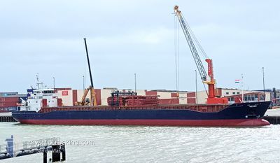
KESSU
General Cargo
Current Trip
| Time Travelled | 22 h, 51 mins |
|---|---|
| Remaining Time | 1 day |
| Distance Travelled | 222.68 nm |
| Remaining Distance | 426.59 nm |
| AVG Speed | 11.1 Noeuds |
| MAX Speed | 11.5 Noeuds |
| AVG Wind | 12.8 knots |
| MAX Wind | 21 knots |
| MIN Temp | 0.4°C / 32.72°F |
| MAX Temp | 5.6°C / 42.08°F |
| Tirant d eau | 3.6 m |
| Position reçue | 9 h, 46 m depuis |
Current Position
| Longitude | 16.61933° |
|---|---|
| Latitude | 55.75283° |
| Etat | Under way using engine |
| Vitesse | 10.4 Noeuds |
| Parcours | 38.6° |
| Zone | Baltic Sea |
| Station | T-AIS |
| Position reçue | 9 h, 46 m depuis |
Info
Information
The current position of KESSU is in Baltic Sea with coordinates 55.75283° / 16.61933° as reported on 2024-04-19 18:04 by AIS to our vessel tracker app. The vessel's current speed is 10.4 Noeuds and is heading at the port of ST PETERSBURG. The estimated time of arrival as calculated by MyShipTracking vessel tracking app is 2024-04-21 18:31 LT
The vessel KESSU (IMO: 9519808, MMSI: 304047000) is a General Cargo that was built in 2012 ( 12 Age ). It's sailing under the flag of [AG] Antigua Barbuda.
In this page you can find informations about the vessels current position, last detected port calls, and current voyage information. If the vessels is not in coverage by AIS you will find the latest position.
The current position of KESSU is detected by our AIS receivers and we are not responsible for the reliability of the data. The last position was recorded while the vessel was in Coverage by the Ais receivers of our vessel tracking app.
The current draught of KESSU as reported by AIS is 3.6 meters
Weather
| Temperature | 1°C / 33.8°F |
|---|---|
| Wind Speed | 11 knots |
| Direction | 342° NNW |
| Pressure | 1008.3 hPa |
| Humidity | 72.1 % |
| Cloud Coverage | 17 % |
Featured Company
Last Port Calls
| Port | Arrival | Departure | Time In Port |
|---|---|---|---|
| 2024-04-17 04:02 | 2024-04-19 04:59 | 2 d | |
| 2024-04-11 14:38 | 2024-04-13 09:35 | 1 d | |
| 2024-04-06 19:54 | 2024-04-08 17:10 | 1 d | |
| 2024-04-01 17:49 | 2024-04-03 17:57 | 2 d | |
| 2024-03-26 15:43 | 2024-03-27 21:43 | 1 d | |
| 2024-03-18 17:18 | 2024-03-19 20:16 | 1 d | |
| 2024-03-12 03:35 | 2024-03-13 02:20 | 22 h | |
| 2024-02-28 15:54 | 2024-03-05 14:11 | 5 d | |
| 2024-02-20 02:26 | 2024-02-23 16:29 | 3 d | |
| 2024-02-14 19:10 | 2024-02-16 12:27 | 1 d |
Most Visited Ports (Last year)
| Port | Arrivals | |
|---|---|---|
| 11 | ||
| 8 | ||
| 5 | ||
| 4 | ||
| 2 | ||
| 2 |
Last Trips
| Origin | Departure | Destination | Arrival | Distance | |
|---|---|---|---|---|---|
| 2024-04-13 12:35 | 2024-04-17 06:02 | 692.52 nm | |||
| 2024-04-08 19:10 | 2024-04-11 17:38 | 703.55 nm | |||
| 2024-04-03 20:57 | 2024-04-06 21:54 | 704.93 nm | |||
| 2024-03-27 22:43 | 2024-04-01 20:49 | 1164.05 nm | |||
| 2024-03-19 23:16 | 2024-03-26 16:43 | 1210.60 nm | |||
| 2024-03-13 03:20 | 2024-03-18 20:18 | 1140.32 nm | |||
| 2024-03-05 15:11 | 2024-03-12 04:35 | 85.74 nm | |||
| 2024-02-23 19:29 | 2024-02-28 16:54 | 1168.25 nm | |||
| 2024-02-16 13:27 | 2024-02-20 05:26 | 723.82 nm | |||
| 2024-02-04 14:20 | 2024-02-14 20:10 | 999.28 nm |
Events
| Heure | Evenement | Détails | Position/ Destination | Info |
|---|---|---|---|---|
| 2024-04-19 18:12 | Etat Changé | Default Under way using engine |
55.77117 / 16.64567
LED
|
Vitesse: 10.4 kn Parcours: 38.6° |
| 2024-04-19 18:04 | Hors de la zone couverte |
55.75283 / 16.61933
Baltic Sea
LED
|
Vitesse: 10.4 kn Parcours: 38.6° |
|
| 2024-04-19 17:25 | Etat Changé | Under way using engine Default |
55.66433 / 16.49350
LED
|
Vitesse: 10.6 kn Parcours: 39° |
| 2024-04-19 17:09 | Dans la zone couverte |
55.66483 / 16.49416
Baltic Sea
LED
|
Vitesse: 10.6 kn Parcours: 38.8° |
|
| 2024-04-19 16:08 | Etat Changé | Default Under way using engine |
55.48909 / 16.23476
LED
|
Vitesse: 10.8 kn Parcours: 41.8° |
| 2024-04-19 15:58 | Hors de la zone couverte |
55.46717 / 16.20000
Baltic Sea
LED
|
Vitesse: 10.8 kn Parcours: 41.8° |
|
| 2024-04-19 15:46 | Changement de zone | Swedish part of the Baltic Sea Danish part of the Kattegat |
55.44100 / 16.15850
Baltic Sea
LED
|
Vitesse: 10.6 kn Parcours: 42° |
| 2024-04-19 08:58 | Changement de zone | Danish part of the Kattegat German part of the Baltic Sea |
54.58464 / 14.56281
Kattegat
LED
|
Vitesse: 11.3 kn Parcours: 58.6° |
| 2024-04-19 08:38 | Changement d'ETA | 2024/04/21 14:00 2024/04/21 18:00 |
54.55027 / 14.47025
LED
|
Vitesse: 11.4 kn Parcours: 57.1° |
| 2024-04-19 07:48 | Tirant d'eau modifié | 3.6 5.4 |
54.46204 / 14.24486
LED
|
Vitesse: 10.9 kn Parcours: 57.6° |