
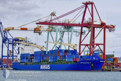
KAPTAN AYTAC A
Container Ship
Current Trip
| Time Travelled | 3 days |
|---|---|
| Remaining Time | 16 h, 30 mins |
| Distance Travelled | 969.77 nm |
| Remaining Distance | 256.62 nm |
| AVG Speed | 12 Noeuds |
| MAX Speed | 15.7 Noeuds |
| AVG Wind | 13.3 knots |
| MAX Wind | 34.8 knots |
| MIN Temp | 12.3°C / 54.14°F |
| MAX Temp | 26.8°C / 80.24°F |
| Tirant d eau | 7.4 m |
| Position reçue | 7 m depuis |
Current Position
| Longitude | 27.94829° |
|---|---|
| Latitude | 34.89695° |
| Etat | Under way using engine |
| Vitesse | 14.8 Noeuds |
| Parcours | 162.5° |
| Zone | Mediterranean Sea - Eastern Basin |
| Station | T-AIS |
| Position reçue | 7 m depuis |
Info
Information
The current position of KAPTAN AYTAC A is in Mediterranean Sea - Eastern Basin with coordinates 34.89695° / 27.94829° as reported on 2024-04-24 17:41 by AIS to our vessel tracker app. The vessel's current speed is 14.8 Noeuds and is heading at the port of EL DEKHEILA. The estimated time of arrival as calculated by MyShipTracking vessel tracking app is 2024-04-25 10:18 LT
The vessel KAPTAN AYTAC A (IMO: 9242302, MMSI: 271044301) is a Container Ship that was built in 2001 ( 23 Age ). It's sailing under the flag of [TR] Turkey.
In this page you can find informations about the vessels current position, last detected port calls, and current voyage information. If the vessels is not in coverage by AIS you will find the latest position.
The current position of KAPTAN AYTAC A is detected by our AIS receivers and we are not responsible for the reliability of the data. The last position was recorded while the vessel was in Coverage by the Ais receivers of our vessel tracking app.
The current draught of KAPTAN AYTAC A as reported by AIS is 7.4 meters
Weather
| Temperature | 19.5°C / 67.1°F |
|---|---|
| Wind Speed | 7 knots |
| Direction | 298° WNW |
| Pressure | 1006 hPa |
| Humidity | 86.9 % |
| Cloud Coverage | 100 % |
Featured Company
Last Port Calls
| Port | Arrival | Departure | Time In Port |
|---|---|---|---|
| 2024-04-19 04:18 | 2024-04-21 09:56 | 2 d | |
| 2024-04-12 12:34 | 2024-04-13 16:44 | 1 d | |
| 2024-04-07 01:50 | 2024-04-07 13:25 | 11 h | |
| 2024-03-26 05:28 | |||
| 2024-03-14 21:13 | |||
| 2024-03-09 00:41 | 2024-03-10 01:49 | 1 d | |
| 2024-03-03 17:32 | 2024-03-04 02:08 | 8 h | |
| 2024-02-28 15:29 | 2024-03-01 05:37 | 1 d | |
| 2024-02-23 22:35 | 2024-02-24 20:01 | 21 h | |
| 2024-02-14 23:54 | 2024-02-17 17:39 | 2 d |
Most Visited Ports (Last year)
| Port | Arrivals | |
|---|---|---|
| 16 | ||
| 12 | ||
| 5 | ||
| 4 | ||
| 4 | ||
| 3 |
Last Trips
| Origin | Departure | Destination | Arrival | Distance | |
|---|---|---|---|---|---|
| 2024-04-13 18:44 | 2024-04-19 07:18 | 1258.09 nm | |||
| 2024-04-07 16:25 | 2024-04-12 14:34 | 562.09 nm | |||
| 2024-03-26 07:28 | 2024-04-07 04:50 | 1747.32 nm | |||
| 2024-03-10 03:49 | 2024-03-15 00:13 | 1221.17 nm | |||
| 2024-03-04 05:08 | 2024-03-09 02:41 | 741.18 nm | |||
| 2024-03-01 08:37 | 2024-03-03 20:32 | 490.12 nm | |||
| 2024-02-24 22:01 | 2024-02-28 18:29 | 1194.13 nm | |||
| 2024-02-17 20:39 | 2024-02-24 00:35 | 1209.98 nm | |||
| 2024-02-10 04:45 | 2024-02-15 02:54 | 1220.25 nm | |||
| 2024-02-05 21:22 | 2024-02-08 21:26 | 526.00 nm |
Events
| Heure | Evenement | Détails | Position/ Destination | Info |
|---|---|---|---|---|
| 2024-04-24 17:32 | Etat Changé | Under way using engine Default |
34.93126 / 27.93251
EGEDK
|
Vitesse: 15.1 kn Parcours: 159° |
| 2024-04-24 17:20 | Etat Changé | Default Under way using engine |
34.97733 / 27.91113
EGEDK
|
Vitesse: 15.1 kn Parcours: 158.9° |
| 2024-04-24 13:56 | Changement de zone | Greek part of the Mediterranean Sea - Eastern Basin Greek part of the Aegean Sea |
35.72170 / 27.45229
Mediterranean Sea - Eastern Basin
EGEDK
|
Vitesse: 13.9 kn Parcours: 153.6° |
| 2024-04-24 09:28 | Etat Changé | Under way using engine Default |
36.61219 / 26.79926
EGEDK
|
Vitesse: 13.9 kn Parcours: 156° |
| 2024-04-24 09:09 | Etat Changé | Default Under way using engine |
36.67683 / 26.76755
EGEDK
|
Vitesse: 13.6 kn Parcours: 159.2° |
| 2024-04-24 03:21 | Etat Changé | Under way using engine Default |
37.61965 / 25.84346
EGEDK
|
Vitesse: 11.2 kn Parcours: 176° |
| 2024-04-24 03:05 | Etat Changé | Default Under way using engine |
37.66904 / 25.83965
EGEDK
|
Vitesse: 11.3 kn Parcours: 175.5° |
| 2024-04-24 03:00 | Etat Changé | Under way using engine Default |
37.68466 / 25.83822
EGEDK
|
Vitesse: 11.2 kn Parcours: 173° |
| 2024-04-24 02:24 | Etat Changé | Default Under way using engine |
37.79539 / 25.82391
EGEDK
|
Vitesse: 11.6 kn Parcours: 171.8° |
| 2024-04-24 01:07 | Etat Changé | Under way using engine Default |
38.03825 / 25.77681
EGEDK
|
Vitesse: 10.8 kn Parcours: 176° |