
K HAK
General Cargo
Current Trip
| Trip Time | --- |
|---|---|
| Trip Distance | --- |
| AVG Speed | --- |
| MAX Speed | --- |
| Tirant d eau | --- |
| AVG Wind | --- |
| MAX Wind | --- |
| MIN Temp | --- |
| MAX Temp | --- |
| Position reçue | 4 d depuis |
Current Position
| Longitude | --- |
|---|---|
| Latitude | --- |
| Etat | Under way using engine |
| Vitesse | 10.5 Noeuds |
| Parcours | 152.3° |
| Zone | Aegean Sea |
| Station | T-AIS |
| Position reçue | 4 d depuis |
Info
Information
The current position of K HAK is in Aegean Sea with coordinates 38.93681° / 26.75734° as reported on 2025-12-04 08:22 by AIS to our vessel tracker app. The vessel's current speed is 10.5 Noeuds and is currently inside the port of NEMRUT.
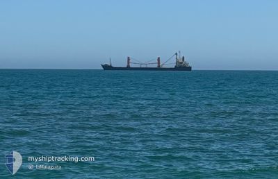
The vessel K HAK (IMO: 9532848, MMSI: 511101041) is a General Cargo that was built in 2009 ( 16 Age ). It's sailing under the flag of [PW] Palau.
In this page you can find informations about the vessels current position, last detected port calls, and current voyage information. If the vessels is not in coverage by AIS you will find the latest position.
The current position of K HAK is detected by our AIS receivers and we are not responsible for the reliability of the data. The last position was recorded while the vessel was in Coverage by the Ais receivers of our vessel tracking app.
The current draught of K HAK as reported by AIS is 8.2 meters
Weather
| Temperature | 7.2°C / 44.96°F |
|---|---|
| Wind Speed | 12 knots |
| Direction | 42° NE |
| Pressure | 1020.4 hPa |
| Humidity | 75.6 % |
| Cloud Coverage | --- |
Featured Company
Last Port Calls
| Port | Arrival | Departure | Time In Port |
|---|---|---|---|
| 2025-12-05 20:54 | |||
| 2025-11-21 08:08 | 2025-11-23 11:32 | 2 d | |
| 2025-11-14 16:16 | 2025-11-16 00:48 | 1 d | |
| 2025-11-11 10:40 | 2025-11-13 17:56 | 2 d | |
| 2025-11-08 12:44 | 2025-11-11 09:32 | 2 d | |
| 2025-10-20 21:49 | 2025-10-24 06:11 | 3 d |
Last Trips
| Origin | Departure | Destination | Arrival | Distance | |
|---|---|---|---|---|---|
| 2025-11-16 00:48 | 2025-11-21 08:08 | 1065.72 nm | |||
| 2025-11-13 17:56 | 2025-11-14 16:16 | 124.32 nm | |||
| 2025-11-11 09:32 | 2025-11-11 10:40 | 6.36 nm | |||
| 2025-10-24 06:11 | 2025-11-08 12:44 | 2224.39 nm | |||
| 2025-09-30 16:47 | 2025-10-20 21:49 | 1742.48 nm |
Events
| Heure | Evenement | Détails | Position/ Destination | Info |
|---|---|---|---|---|
| 2025-12-05 18:26 | Arret |
38.76495 / 26.91937
[TR] NEMRUT
|
Vitesse: Parcours: 203° |
|
| 2025-12-05 17:54 | Port d'arrivée |
|
38.76812 / 26.91946
[TR] NEMRUT
|
Vitesse: 4.9 kn Parcours: 110° |
| 2025-12-05 17:37 | Démarrage | 1.35 nm, West of NEMRUT |
38.77560 / 26.89741
TR NEM
|
Vitesse: 4.1 kn Parcours: 103° |
| 2025-12-04 09:48 | Arret | 1.6 nm, West of NEMRUT |
38.76976 / 26.89064
TR NEM
|
Vitesse: 0.3 kn Parcours: 193° |
| 2025-12-04 08:29 | Etat Changé | Default Under way using engine |
38.92041 / 26.76898
TR NEM
|
Vitesse: 10.5 kn Parcours: 152.3° |
| 2025-12-04 08:22 | Hors de la zone couverte |
38.93681 / 26.75734
Aegean Sea
TR NEM
|
Vitesse: 10.5 kn Parcours: 152.3° |
|
| 2025-12-04 07:55 | Changement de zone | Turkish part of the Aegean Sea Greek part of the Aegean Sea |
39.00546 / 26.70685
Aegean Sea
TR NEM
|
Vitesse: 10.5 kn Parcours: 148.5° |
| 2025-12-04 06:05 | Etat Changé | Under way using engine Default |
39.28590 / 26.50547
TR NEM
|
Vitesse: 11.2 kn Parcours: 143° |
| 2025-12-04 05:54 | Etat Changé | Default Under way using engine |
39.31458 / 26.48349
TR NEM
|
Vitesse: 11.2 kn Parcours: 144.2° |
| 2025-12-04 05:52 | Etat Changé | Under way using engine Default |
39.32005 / 26.47825
TR NEM
|
Vitesse: 11 kn Parcours: 140° |