
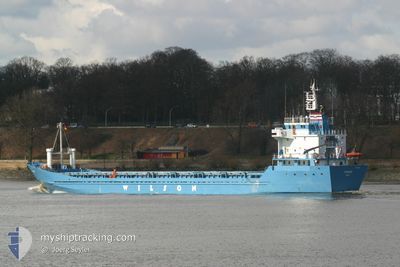
JULIA LS
General Cargo
Current Trip
| Time Travelled | 7 days |
|---|---|
| Remaining Time | --- |
| Distance Travelled | 1045.64 nm |
| Remaining Distance | --- |
| AVG Speed | 8.3 Noeuds |
| MAX Speed | 15.7 Noeuds |
| AVG Wind | 6.8 knots |
| MAX Wind | 19.2 knots |
| MIN Temp | 8.6°C / 47.48°F |
| MAX Temp | 21.5°C / 70.7°F |
| Tirant d eau | 5.8 m |
| Position reçue | 6 h, 20 m depuis |
Current Position
| Longitude | --- |
|---|---|
| Latitude | --- |
| Etat | At anchor |
| Vitesse | 0.4 Noeuds |
| Parcours | 23° |
| Zone | Black Sea |
| Station | T-AIS |
| Position reçue | 6 h, 20 m depuis |
Info
Information
The current position of JULIA LS is in Black Sea with coordinates 43.38374° / 28.37120° as reported on 2025-12-07 07:38 by AIS to our vessel tracker app. The vessel's current speed is 0.4 Noeuds
The vessel JULIA LS (IMO: 7901693, MMSI: 677021400) is a General Cargo that was built in 1980 ( 45 Age ). It's sailing under the flag of [TZ] Tanzania.
In this page you can find informations about the vessels current position, last detected port calls, and current voyage information. If the vessels is not in coverage by AIS you will find the latest position.
The current position of JULIA LS is detected by our AIS receivers and we are not responsible for the reliability of the data. The last position was recorded while the vessel was in Coverage by the Ais receivers of our vessel tracking app.
The current draught of JULIA LS as reported by AIS is 5.8 meters
Weather
| Temperature | 7.2°C / 44.96°F |
|---|---|
| Wind Speed | 18 knots |
| Direction | 349° N |
| Pressure | 1012 hPa |
| Humidity | 83.1 % |
| Cloud Coverage | 100 % |
Featured Company
Last Port Calls
| Port | Arrival | Departure | Time In Port |
|---|---|---|---|
| 2025-11-29 15:05 | 2025-11-30 07:45 | 16 h | |
| 2025-11-23 07:25 | 2025-11-23 18:15 | 10 h | |
| 2025-11-16 08:48 | 2025-11-16 17:06 | 8 h | |
| 2025-11-10 14:38 | 2025-11-11 17:44 | 1 d | |
| 2025-11-04 14:00 | 2025-11-04 23:29 | 9 h | |
| 2025-10-30 10:44 | 2025-10-31 13:52 | 1 d | |
| 2025-10-24 20:20 |
Last Trips
| Origin | Departure | Destination | Arrival | Distance | |
|---|---|---|---|---|---|
| 2025-11-23 18:15 | 2025-11-29 15:05 | 1349.65 nm | |||
| 2025-11-16 17:06 | 2025-11-23 07:25 | 1365.93 nm | |||
| 2025-11-11 17:44 | 2025-11-16 08:48 | 1081.94 nm | |||
| 2025-11-04 23:29 | 2025-11-10 14:38 | 1107.74 nm | |||
| 2025-10-31 13:52 | 2025-11-04 14:00 | 1056.86 nm | |||
| 2025-10-24 20:20 | 2025-10-30 10:44 | 26.42 nm |
Events
| Heure | Evenement | Détails | Position/ Destination | Info |
|---|---|---|---|---|
| 2025-12-07 12:47 | Arret | 1.86 nm, South East of KAVARNA |
43.38376 / 28.37252
MIDIA
|
Vitesse: 0.1 kn Parcours: 318° |
| 2025-12-07 07:38 | Hors de la zone couverte |
43.38374 / 28.37120
Black Sea
|
Vitesse: 0.4 kn Parcours: 66.8° |
|
| 2025-12-07 03:13 | Arret | 1.84 nm, South East of KAVARNA |
43.38390 / 28.37226
MIDIA
|
Vitesse: 0.2 kn Parcours: 335° |
| 2025-12-07 02:52 | Dans la zone couverte |
43.38389 / 28.37158
Black Sea
|
Vitesse: 0.6 kn Parcours: 259.3° |
|
| 2025-12-07 01:31 | Hors de la zone couverte |
43.38380 / 28.37139
Black Sea
|
Vitesse: 0.4 kn Parcours: 58.5° |
|
| 2025-12-05 12:40 | Dans la zone couverte |
43.38500 / 28.36969
Black Sea
|
Vitesse: 0.1 kn Parcours: 175.1° |
|
| 2025-12-05 11:16 | Hors de la zone couverte |
43.38488 / 28.36970
Black Sea
|
Vitesse: 0.5 kn Parcours: 189.7° |
|
| 2025-12-05 06:05 | Etat Changé | At anchor Under way using engine |
43.38564 / 28.36977
MIDIA
|
Vitesse: 0.2 kn Parcours: 93° |
| 2025-12-05 05:49 | Arret | 1.78 nm, South East of KAVARNA |
43.38479 / 28.37116
MIDIA
|
Vitesse: 0.3 kn Parcours: 59° |
| 2025-12-05 05:39 | Etat Changé | Under way using engine Default |
43.37853 / 28.36752
MIDIA
|
Vitesse: 9.5 kn Parcours: 347° |