
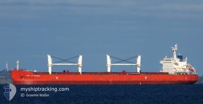
JEWEL OF SHINAS
Bulk Carrier
Current Trip
IDTAB
| Time Travelled | --- |
|---|---|
| Remaining Time | --- |
| Distance Travelled | --- |
| Remaining Distance | --- |
| AVG Speed | --- |
| MAX Speed | --- |
| AVG Wind | --- |
| MAX Wind | --- |
| MIN Temp | --- |
| MAX Temp | --- |
| Tirant d eau | 6.6 m |
| Position reçue | 2 d depuis |
Current Position
| Longitude | 100.84920° |
|---|---|
| Latitude | 12.28191° |
| Etat | Under way using engine |
| Vitesse | 13.4 Noeuds |
| Parcours | 161.6° |
| Zone | Gulf of Thailand |
| Station | T-AIS |
| Position reçue | 2 d depuis |
Info
Information
The current position of JEWEL OF SHINAS is in Gulf of Thailand with coordinates 12.28191° / 100.84920° as reported on 2024-04-16 19:57 by AIS to our vessel tracker app. The vessel's current speed is 13.4 Noeuds
The vessel JEWEL OF SHINAS (IMO: 9473846, MMSI: 355208000) is a Bulk Carrier that was built in 2011 ( 13 Age ). It's sailing under the flag of [PA] Panama.
In this page you can find informations about the vessels current position, last detected port calls, and current voyage information. If the vessels is not in coverage by AIS you will find the latest position.
The current position of JEWEL OF SHINAS is detected by our AIS receivers and we are not responsible for the reliability of the data. The last position was recorded while the vessel was in Coverage by the Ais receivers of our vessel tracking app.
The current draught of JEWEL OF SHINAS as reported by AIS is 6.6 meters
Weather
| Temperature | 28.8°C / 83.84°F |
|---|---|
| Wind Speed | 6 knots |
| Direction | 125° SE |
| Pressure | 1006.4 hPa |
| Humidity | 74.3 % |
| Cloud Coverage | 100 % |
Featured Company
Last Port Calls
Most Visited Ports (Last year)
| Port | Arrivals | |
|---|---|---|
| 3 | ||
| 2 | ||
| 1 | ||
| 1 | ||
| 1 | ||
| 1 |
Last Trips
| Origin | Departure | Destination | Arrival | Distance |
|---|
Events
| Heure | Evenement | Détails | Position/ Destination | Info |
|---|---|---|---|---|
| 2024-04-16 19:59 | Etat Changé | Default Under way using engine |
12.27302 / 100.85221
IDTAB
|
Vitesse: 13.4 kn Parcours: 161.6° |
| 2024-04-16 19:57 | Hors de la zone couverte |
12.28191 / 100.84920
Gulf of Thailand
IDTAB
|
Vitesse: 13.4 kn Parcours: 161.6° |
|
| 2024-04-16 19:49 | Etat Changé | Under way using engine Default |
12.30795 / 100.84031
IDTAB
|
Vitesse: 13.4 kn Parcours: 160° |
| 2024-04-16 19:23 | Etat Changé | Default Under way using engine |
12.39745 / 100.80661
IDTAB
|
Vitesse: 13.3 kn Parcours: 159.7° |
| 2024-04-16 19:19 | Etat Changé | Under way using engine Default |
12.41433 / 100.80027
IDTAB
|
Vitesse: 13.3 kn Parcours: 160° |
| 2024-04-16 19:16 | Etat Changé | Default Under way using engine |
12.42413 / 100.79658
IDTAB
|
Vitesse: 13.3 kn Parcours: 160° |
| 2024-04-16 19:11 | Etat Changé | Under way using engine Default |
12.43919 / 100.79091
IDTAB
|
Vitesse: 13.2 kn Parcours: 160° |
| 2024-04-16 19:07 | Etat Changé | Default Under way using engine |
12.45306 / 100.78567
IDTAB
|
Vitesse: 13.2 kn Parcours: 164.2° |
| 2024-04-16 18:55 | Etat Changé | Under way using engine Default |
12.49828 / 100.77490
IDTAB
|
Vitesse: 13.2 kn Parcours: 164° |
| 2024-04-16 18:51 | Etat Changé | Default Under way using engine |
12.51020 / 100.77168
IDTAB
|
Vitesse: 13.1 kn Parcours: 171.1° |