
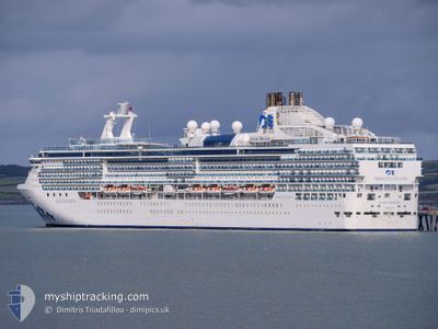
ISLAND PRINCESS
Passengers Ship
Current Trip
BM WE1
| Time Travelled | 7 days |
|---|---|
| Remaining Time | --- |
| Distance Travelled | 2889.63 nm |
| Remaining Distance | --- |
| AVG Speed | 17.2 Noeuds |
| MAX Speed | 20 Noeuds |
| AVG Wind | 12.9 knots |
| MAX Wind | 25.8 knots |
| MIN Temp | 16.3°C / 61.34°F |
| MAX Temp | 24.3°C / 75.74°F |
| Tirant d eau | 8.2 m |
| Position reçue | 1 h, 36 m depuis |
Current Position
| Longitude | -71.64207° |
|---|---|
| Latitude | 28.57508° |
| Etat | Under way using engine |
| Vitesse | 17.6 Noeuds |
| Parcours | 238.5° |
| Zone | North Atlantic Ocean |
| Station | T-AIS |
| Position reçue | 1 h, 36 m depuis |
Info
Information
The current position of ISLAND PRINCESS is in North Atlantic Ocean with coordinates 28.57508° / -71.64207° as reported on 2024-04-23 23:41 by AIS to our vessel tracker app. The vessel's current speed is 17.6 Noeuds
The vessel ISLAND PRINCESS (IMO: 9230402, MMSI: 310384000) is a Passengers Ship that was built in 2003 ( 21 Age ). It's sailing under the flag of [BM] Bermuda.
In this page you can find informations about the vessels current position, last detected port calls, and current voyage information. If the vessels is not in coverage by AIS you will find the latest position.
The current position of ISLAND PRINCESS is detected by our AIS receivers and we are not responsible for the reliability of the data. The last position was recorded while the vessel was in Coverage by the Ais receivers of our vessel tracking app.
The current draught of ISLAND PRINCESS as reported by AIS is 8.2 meters
Weather
| Temperature | 21.1°C / 69.98°F |
|---|---|
| Wind Speed | 14 knots |
| Direction | 19° NNE |
| Pressure | 1020.5 hPa |
| Humidity | 63.8 % |
| Cloud Coverage | 11 % |
Featured Company
Last Port Calls
| Port | Arrival | Departure | Time In Port |
|---|---|---|---|
| 2024-04-16 05:39 | 2024-04-16 16:04 | 10 h | |
| 2024-04-14 04:19 | 2024-04-14 15:00 | 10 h | |
| 2024-04-13 04:38 | 2024-04-13 17:03 | 12 h | |
| 2024-04-09 03:06 | 2024-04-09 15:02 | 11 h | |
| 2024-04-08 03:07 | 2024-04-08 15:24 | 12 h | |
| 2024-04-07 03:39 | 2024-04-07 17:40 | 14 h | |
| 2024-04-06 03:36 | 2024-04-06 18:02 | 14 h | |
| 2024-04-04 07:17 | 2024-04-04 17:56 | 10 h | |
| 2024-04-03 04:18 | 2024-04-03 17:11 | 12 h | |
| 2024-04-01 08:00 | 2024-04-02 18:50 | 1 d |
Most Visited Ports (Last year)
| Port | Arrivals | |
|---|---|---|
| 10 | ||
| 4 | ||
| 4 | ||
| 4 | ||
| 4 | ||
| 4 |
Last Trips
| Origin | Departure | Destination | Arrival | Distance | |
|---|---|---|---|---|---|
| 2024-04-14 17:00 | 2024-04-16 06:39 | 674.94 nm | |||
| 2024-04-13 19:03 | 2024-04-14 06:19 | 130.57 nm | |||
| 2024-04-09 18:02 | 2024-04-13 06:38 | 1508.63 nm | |||
| 2024-04-08 18:24 | 2024-04-09 06:06 | 198.85 nm | |||
| 2024-04-07 20:40 | 2024-04-08 06:07 | 105.07 nm | |||
| 2024-04-06 21:02 | 2024-04-07 06:39 | 128.87 nm | |||
| 2024-04-04 19:56 | 2024-04-06 06:36 | 509.32 nm | |||
| 2024-04-03 19:11 | 2024-04-04 09:17 | 232.39 nm | |||
| 2024-04-02 20:50 | 2024-04-03 06:18 | 169.74 nm | |||
| 2024-03-31 21:08 | 2024-04-01 10:00 | 194.03 nm |
Events
| Heure | Evenement | Détails | Position/ Destination | Info |
|---|---|---|---|---|
| 2024-04-23 23:44 | Etat Changé | Default Under way using engine |
28.56833 / -71.65500
BM WE1
|
Vitesse: 17.6 kn Parcours: 238.5° |
| 2024-04-23 23:41 | Hors de la zone couverte |
28.57508 / -71.64207
North Atlantic Ocean
|
Vitesse: 17.6 kn Parcours: 238.5° |
|
| 2024-04-23 21:04 | Changement de zone | High seas of the North Atlantic Ocean Portuguese (Madeira) part of the North Atlantic Ocean |
28.95620 / -70.91420
North Atlantic Ocean
|
Vitesse: 17.1 kn Parcours: 238.7° |
| 2024-04-23 21:03 | Etat Changé | Under way using engine Default |
28.95858 / -70.90958
BM WE1
|
Vitesse: 17 kn Parcours: 240° |
| 2024-04-23 20:50 | Dans la zone couverte |
28.95620 / -70.91420
North Atlantic Ocean
|
Vitesse: 17.1 kn Parcours: 238.7° |
|
| 2024-04-22 20:10 | Démarrage |
32.33667 / -64.82500
BM WE1
|
Vitesse: 10 kn Parcours: 10° |
|
| 2024-04-22 10:49 | Arret |
32.32799 / -64.82984
BM WE1
|
Vitesse: 0.1 kn Parcours: 27° |
|
| 2024-04-16 23:32 | Etat Changé | Default Under way using engine |
33.03167 / -19.35833
BM WE1
|
Vitesse: 17.6 kn Parcours: 281.7° |
| 2024-04-16 23:28 | Hors de la zone couverte |
33.02679 / -19.33358
North Atlantic Ocean
BM WE1
|
Vitesse: 17.6 kn Parcours: 281.7° |
|
| 2024-04-16 21:34 | Etat Changé | Under way using engine Default |
32.91045 / -18.68452
BM WE1
|
Vitesse: 17.6 kn Parcours: 281° |