
LINDE
General Cargo
Current Trip
| Time Travelled | 1 day |
|---|---|
| Remaining Time | 7 h, 58 mins |
| Distance Travelled | 207.44 nm |
| Remaining Distance | 53.75 nm |
| AVG Speed | 7.6 Noeuds |
| MAX Speed | 10.7 Noeuds |
| AVG Wind | 25 knots |
| MAX Wind | 30 knots |
| MIN Temp | 6.8°C / 44.24°F |
| MAX Temp | 8.6°C / 47.48°F |
| Tirant d eau | 6.4 m |
| Position reçue | Maintenant |
Current Position
| Longitude | 2.78895° |
|---|---|
| Latitude | 51.36363° |
| Etat | Under way using engine |
| Vitesse | 6.1 Noeuds |
| Parcours | 88° |
| Zone | North Sea |
| Station | T-AIS |
| Position reçue | Maintenant |
Info
Information
The current position of LINDE is in North Sea with coordinates 51.36363° / 2.78895° as reported on 2024-04-20 04:07 by AIS to our vessel tracker app. The vessel's current speed is 6.1 Noeuds and is heading at the port of GENT. The estimated time of arrival as calculated by MyShipTracking vessel tracking app is 2024-04-20 12:05 LT
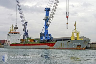
The vessel LINDE (IMO: 9141352, MMSI: 304052000) is a General Cargo that was built in 1998 ( 26 Age ). It's sailing under the flag of [AG] Antigua Barbuda.
In this page you can find informations about the vessels current position, last detected port calls, and current voyage information. If the vessels is not in coverage by AIS you will find the latest position.
The current position of LINDE is detected by our AIS receivers and we are not responsible for the reliability of the data. The last position was recorded while the vessel was in Coverage by the Ais receivers of our vessel tracking app.
The current draught of LINDE as reported by AIS is 6.4 meters
Weather
| Temperature | 7.5°C / 45.5°F |
|---|---|
| Wind Speed | 23 knots |
| Direction | 351° N |
| Pressure | 1021.9 hPa |
| Humidity | 63.5 % |
| Cloud Coverage | 100 % |
Featured Company
Last Port Calls
| Port | Arrival | Departure | Time In Port |
|---|---|---|---|
| 2024-04-17 20:36 | 2024-04-19 03:23 | 1 d | |
| 2024-04-15 01:02 | 2024-04-16 12:04 | 1 d | |
| 2024-04-10 07:22 | 2024-04-12 17:14 | 2 d | |
| 2024-04-05 15:37 | 2024-04-08 17:59 | 3 d | |
| 2024-03-27 20:06 | 2024-03-29 11:32 | 1 d | |
| 2024-03-26 20:12 | |||
| 2024-03-20 19:52 | 2024-03-23 04:10 | 2 d | |
| 2024-03-19 21:33 | |||
| 2024-03-12 23:15 | 2024-03-14 18:18 | 1 d | |
| 2024-03-09 05:01 | 2024-03-11 22:10 | 2 d |
Last Trips
| Origin | Departure | Destination | Arrival | Distance | |
|---|---|---|---|---|---|
| 2024-04-16 13:04 | 2024-04-17 21:36 | 235.30 nm | |||
| 2024-04-12 18:14 | 2024-04-15 02:02 | 468.50 nm | |||
| 2024-04-08 18:59 | 2024-04-10 08:22 | 303.92 nm | |||
| 2024-03-29 12:32 | 2024-04-05 16:37 | 770.23 nm | |||
| 2024-03-26 21:12 | 2024-03-27 21:06 | 199.33 nm | |||
| 2024-03-19 22:33 | 2024-03-20 20:52 | 214.12 nm | |||
| 2024-03-11 23:10 | 2024-03-13 00:15 | 185.59 nm | |||
| 2024-03-06 22:57 | 2024-03-09 06:01 | 235.36 nm | |||
| 2024-02-29 14:46 | 2024-03-01 14:11 | 210.67 nm | |||
| 2024-02-26 22:55 | 2024-02-27 23:22 | 213.67 nm |
Events
| Heure | Evenement | Détails | Position/ Destination | Info |
|---|---|---|---|---|
| 2024-04-19 23:02 | Changement de zone | Belgian part of the North Sea Dutch part of the North Sea |
51.80580 / 2.64055
North Sea
BEGNE
|
Vitesse: 8 kn Parcours: 185° |
| 2024-04-19 21:52 | Changement de zone | Dutch part of the North Sea United Kingdom part of the North Sea |
51.95932 / 2.63613
North Sea
BEGNE
|
Vitesse: 8.3 kn Parcours: 178° |
| 2024-04-19 21:52 | Etat Changé | Under way using engine Default |
51.95932 / 2.63613
BEGNE
|
Vitesse: 8.4 kn Parcours: 177° |
| 2024-04-19 21:36 | Dans la zone couverte |
51.95932 / 2.63613
North Sea
BEGNE
|
Vitesse: 8.3 kn Parcours: 178° |
|
| 2024-04-19 20:01 | Etat Changé | Default Under way using engine |
52.23307 / 2.63042
BEGNE
|
Vitesse: 9.3 kn Parcours: 185° |
| 2024-04-19 19:58 | Hors de la zone couverte |
52.23947 / 2.63042
North Sea
BEGNE
|
Vitesse: 9.3 kn Parcours: 185° |
|
| 2024-04-19 19:11 | Etat Changé | Under way using engine Default |
52.36290 / 2.63663
BEGNE
|
Vitesse: 9.2 kn Parcours: 142° |
| 2024-04-19 18:20 | Etat Changé | Default Under way using engine |
52.46960 / 2.51462
BEGNE
|
Vitesse: 9.2 kn Parcours: 143° |
| 2024-04-19 17:55 | Etat Changé | Under way using engine Default |
52.52435 / 2.45300
BEGNE
|
Vitesse: 9.7 kn Parcours: 146° |
| 2024-04-19 17:52 | Etat Changé | Default Under way using engine |
52.53015 / 2.44655
BEGNE
|
Vitesse: 9.2 kn Parcours: 143° |