
IHMN
Not available
Current Position
| Longitude | 5.91868° |
|---|---|
| Latitude | 43.11673° |
| Etat | Default |
| Vitesse | |
| Parcours | --- |
| Zone | Mediterranean Sea - Western Basin |
| Station | T-AIS |
| Position reçue | 1 m depuis |
Info
Information
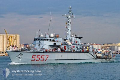
The current position of IHMN is in Mediterranean Sea - Western Basin with coordinates 43.11673° / 5.91868° as reported on 2024-04-19 23:05 by AIS to our vessel tracker app. The vessel's current speed is 0 Noeuds and is currently inside the port of TOULON.
The vessel IHMN (MMSI: 247935000) is a Not available It's sailing under the flag of [IT] Italy.
In this page you can find informations about the vessels current position, last detected port calls, and current voyage information. If the vessels is not in coverage by AIS you will find the latest position.
The current position of IHMN is detected by our AIS receivers and we are not responsible for the reliability of the data. The last position was recorded while the vessel was in Coverage by the Ais receivers of our vessel tracking app.
Weather
| Temperature | 15.2°C / 59.36°F |
|---|---|
| Wind Speed | 21 knots |
| Direction | 283° WNW |
| Pressure | 1012.3 hPa |
| Humidity | 61.5 % |
| Cloud Coverage | --- |
Featured Company
Last Trips
| Origin | Departure | Destination | Arrival | Distance |
|---|
Events
| Heure | Evenement | Détails | Position/ Destination | Info |
|---|---|---|---|---|
| 2024-04-15 16:00 | Dans la zone couverte |
43.11672 / 5.91865
Mediterranean Sea - Western Basin
[FR] TOULON
|
Vitesse: Parcours: 24° |
|
| 2024-04-12 19:41 | Hors de la zone couverte |
42.96218 / 6.27531
Mediterranean Sea - Western Basin
|
Vitesse: 7.6 kn Parcours: 251.7° |
|
| 2024-04-12 18:48 | Dans la zone couverte |
43.05065 / 6.28726
Mediterranean Sea - Western Basin
|
Vitesse: 8.2 kn Parcours: 156° |
|
| 2024-04-12 14:23 | Hors de la zone couverte |
43.08387 / 6.27306
Mediterranean Sea - Western Basin
|
Vitesse: 1.4 kn Parcours: 316.9° |
|
| 2024-04-12 14:23 | Dans la zone couverte |
43.08387 / 6.27306
Mediterranean Sea - Western Basin
|
Vitesse: 1.4 kn Parcours: 316.9° |
|
| 2024-04-12 11:28 | Hors de la zone couverte |
43.08231 / 6.26965
Mediterranean Sea - Western Basin
|
Vitesse: 1.6 kn Parcours: 67° |
|
| 2024-04-12 11:28 | Dans la zone couverte |
43.08231 / 6.26965
Mediterranean Sea - Western Basin
|
Vitesse: 1.6 kn Parcours: 67° |
|
| 2024-04-12 09:59 | Hors de la zone couverte |
43.07947 / 6.26505
Mediterranean Sea - Western Basin
|
Vitesse: 0.1 kn Parcours: 269.7° |
|
| 2024-04-12 09:59 | Detecté en mer | French part of the Mediterranean Sea - Western Basin |
43.07947 / 6.26505
Mediterranean Sea - Western Basin
|
Vitesse: 0.1 kn Parcours: 269.7° |
| 2024-04-12 09:59 | Dans la zone couverte |
43.07947 / 6.26505
Mediterranean Sea - Western Basin
|
Vitesse: 0.1 kn Parcours: 269.7° |