
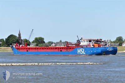
H&S HONESTY
General Cargo
Current Trip
| Time Travelled | 2 days |
|---|---|
| Remaining Time | --- |
| Distance Travelled | 539.06 nm |
| Remaining Distance | --- |
| AVG Speed | 6.6 Noeuds |
| MAX Speed | 10.6 Noeuds |
| AVG Wind | 23.1 knots |
| MAX Wind | 32 knots |
| MIN Temp | 10.8°C / 51.44°F |
| MAX Temp | 16°C / 60.8°F |
| Tirant d eau | 4.4 m |
| Position reçue | 1 h, 20 m depuis |
Current Position
| Longitude | -5.93641° |
|---|---|
| Latitude | 48.32406° |
| Etat | Under way using engine |
| Vitesse | 10.4 Noeuds |
| Parcours | 28° |
| Zone | Celtic Sea |
| Station | T-AIS |
| Position reçue | 1 h, 20 m depuis |
Info
Information
The current position of H&S HONESTY is in Celtic Sea with coordinates 48.32406° / -5.93641° as reported on 2024-04-19 12:57 by AIS to our vessel tracker app. The vessel's current speed is 10.4 Noeuds
The vessel H&S HONESTY (IMO: 9421611, MMSI: 245407000) is a General Cargo that was built in 2007 ( 17 Age ). It's sailing under the flag of [NL] Netherlands.
In this page you can find informations about the vessels current position, last detected port calls, and current voyage information. If the vessels is not in coverage by AIS you will find the latest position.
The current position of H&S HONESTY is detected by our AIS receivers and we are not responsible for the reliability of the data. The last position was recorded while the vessel was in Coverage by the Ais receivers of our vessel tracking app.
The current draught of H&S HONESTY as reported by AIS is 4.4 meters
Weather
| Temperature | 11.6°C / 52.88°F |
|---|---|
| Wind Speed | 11 knots |
| Direction | 343° NNW |
| Pressure | 1024 hPa |
| Humidity | 78.8 % |
| Cloud Coverage | 100 % |
Featured Company
Last Port Calls
| Port | Arrival | Departure | Time In Port |
|---|---|---|---|
| 2024-04-13 06:54 | 2024-04-16 18:20 | 3 d | |
| 2024-04-10 11:37 | 2024-04-10 20:59 | 9 h | |
| 2024-04-02 23:26 | 2024-04-04 21:38 | 1 d | |
| 2024-04-02 11:41 | 2024-04-02 20:25 | 8 h | |
| 2024-03-28 18:53 | 2024-03-29 15:38 | 20 h | |
| 2024-03-27 13:09 | 2024-03-28 00:53 | 11 h | |
| 2024-03-21 07:16 | 2024-03-22 08:23 | 1 d | |
| 2024-03-19 11:47 | 2024-03-19 23:33 | 11 h | |
| 2024-03-14 04:45 | 2024-03-15 13:18 | 1 d | |
| 2024-03-12 19:07 | 2024-03-13 20:28 | 1 d |
Last Trips
| Origin | Departure | Destination | Arrival | Distance | |
|---|---|---|---|---|---|
| 2024-04-10 22:59 | 2024-04-13 07:54 | 573.95 nm | |||
| 2024-04-04 23:38 | 2024-04-10 13:37 | 1078.99 nm | |||
| 2024-04-02 22:25 | 2024-04-03 01:26 | 25.41 nm | |||
| 2024-03-29 16:38 | 2024-04-02 13:41 | 272.93 nm | |||
| 2024-03-28 00:53 | 2024-03-28 19:53 | 139.79 nm | |||
| 2024-03-22 08:23 | 2024-03-27 13:09 | 977.27 nm | |||
| 2024-03-20 00:33 | 2024-03-21 07:16 | 277.54 nm | |||
| 2024-03-15 13:18 | 2024-03-19 12:47 | 861.98 nm | |||
| 2024-03-13 20:28 | 2024-03-14 04:45 | 74.84 nm | |||
| 2024-03-11 22:01 | 2024-03-12 19:07 | 203.69 nm |
Events
| Heure | Evenement | Détails | Position/ Destination | Info |
|---|---|---|---|---|
| 2024-04-19 13:56 | Etat Changé | Default Under way using engine |
48.47500 / -5.81333
GB BLS
|
Vitesse: 10.4 kn Parcours: 28° |
| 2024-04-19 12:57 | Detecté en mer | French part of the Celtic Sea |
48.32406 / -5.93641
Celtic Sea
GB BLS
|
Vitesse: 10.4 kn Parcours: 28° |
| 2024-04-19 12:57 | Dans la zone couverte |
48.32406 / -5.93641
Celtic Sea
GB BLS
|
Vitesse: 10.4 kn Parcours: 28° |
|
| 2024-04-19 12:57 | Hors de la zone couverte |
48.32406 / -5.93641
Celtic Sea
GB BLS
|
Vitesse: 10.4 kn Parcours: 28° |
|
| 2024-04-17 04:38 | Etat Changé | Default Under way using engine |
41.17511 / -9.29211
GB BLS
|
Vitesse: 7.1 kn Parcours: 348.4° |
| 2024-04-17 04:31 | Hors de la zone couverte |
41.16198 / -9.28867
North Atlantic Ocean
GB BLS
|
Vitesse: 7.1 kn Parcours: 348.4° |
|
| 2024-04-16 18:20 | PORT DE DEPART |
|
40.14108 / -8.87908
GB BLS
|
Vitesse: 8.2 kn Parcours: 219° |
| 2024-04-16 18:09 | Etat Changé | Under way using engine Moored |
40.14601 / -8.85348
[PT] FIGUEIRA DA FOZ
|
Vitesse: 3.2 kn Parcours: 266° |
| 2024-04-16 18:09 | Démarrage |
40.14602 / -8.85324
[PT] FIGUEIRA DA FOZ
|
Vitesse: 3.2 kn Parcours: 266° |
|
| 2024-04-16 17:40 | Changement d'ETA | 2024/04/21 08:00 2024/04/21 05:00 |
40.14693 / -8.85242
[PT] FIGUEIRA DA FOZ
|
Vitesse: Parcours: 90° |