
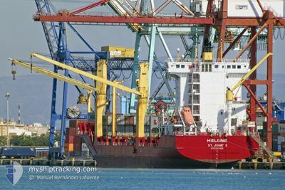
HELENE
Container Ship
Current Trip
| Time Travelled | 8 h, 49 mins |
|---|---|
| Remaining Time | --- |
| Distance Travelled | 72.30 nm |
| Remaining Distance | --- |
| AVG Speed | 10.1 Noeuds |
| MAX Speed | 15.1 Noeuds |
| AVG Wind | 21.4 knots |
| MAX Wind | 28.8 knots |
| MIN Temp | 9.8°C / 49.64°F |
| MAX Temp | 12.8°C / 55.04°F |
| Tirant d eau | 7.8 m |
| Position reçue | 1 m depuis |
Current Position
| Longitude | 27.36410° |
|---|---|
| Latitude | 40.65828° |
| Etat | Under way using engine |
| Vitesse | 10 Noeuds |
| Parcours | 246.5° |
| Zone | Sea of Marmara |
| Station | T-AIS |
| Position reçue | 1 m depuis |
Info
Information
The current position of HELENE is in Sea of Marmara with coordinates 40.65828° / 27.36410° as reported on 2024-04-20 03:31 by AIS to our vessel tracker app. The vessel's current speed is 10 Noeuds and is heading at the port of PORT SAID. The estimated time of arrival as calculated by MyShipTracking vessel tracking app is 2024-04-22 06:00 LT
The vessel HELENE (IMO: 9362956, MMSI: 304157000) is a Container Ship that was built in 2007 ( 17 Age ). It's sailing under the flag of [AG] Antigua Barbuda.
In this page you can find informations about the vessels current position, last detected port calls, and current voyage information. If the vessels is not in coverage by AIS you will find the latest position.
The current position of HELENE is detected by our AIS receivers and we are not responsible for the reliability of the data. The last position was recorded while the vessel was in Coverage by the Ais receivers of our vessel tracking app.
The current draught of HELENE as reported by AIS is 7.8 meters
Weather
| Temperature | 9.7°C / 49.46°F |
|---|---|
| Wind Speed | 24 knots |
| Direction | 39° NE |
| Pressure | 1000.4 hPa |
| Humidity | 94 % |
| Cloud Coverage | 100 % |
Featured Company
Last Port Calls
| Port | Arrival | Departure | Time In Port |
|---|---|---|---|
| 2024-04-18 17:50 | 2024-04-19 18:43 | 1 d | |
| 2024-04-15 22:07 | 2024-04-16 02:55 | 4 h | |
| 2024-04-15 14:06 | 2024-04-15 21:59 | 7 h | |
| 2024-04-12 07:03 | 2024-04-12 17:39 | 10 h | |
| 2024-04-09 13:21 | 2024-04-10 18:25 | 1 d | |
| 2024-04-05 23:16 | 2024-04-06 13:28 | 14 h | |
| 2024-04-03 03:41 | |||
| 2024-03-30 18:30 | 2024-03-31 09:47 | 15 h | |
| 2024-03-28 04:50 | 2024-03-29 11:58 | 1 d | |
| 2024-03-23 01:02 | 2024-03-23 12:53 | 11 h |
Most Visited Ports (Last year)
| Port | Arrivals | |
|---|---|---|
| 21 | ||
| 19 | ||
| 18 | ||
| 7 | ||
| 6 | ||
| 6 |
Last Trips
| Origin | Departure | Destination | Arrival | Distance | |
|---|---|---|---|---|---|
| 2024-04-12 20:39 | 2024-04-18 20:50 | 1695.27 nm | |||
| 2024-04-12 20:39 | 2024-04-16 00:07 | 881.36 nm | |||
| 2024-04-12 20:39 | 2024-04-15 16:06 | 868.96 nm | |||
| 2024-04-10 21:25 | 2024-04-12 10:03 | 370.47 nm | |||
| 2024-04-06 15:28 | 2024-04-09 16:21 | 690.44 nm | |||
| 2024-03-31 12:47 | 2024-04-06 01:16 | 1125.61 nm | |||
| 2024-03-31 12:47 | 2024-04-03 05:41 | 866.21 nm | |||
| 2024-03-29 13:58 | 2024-03-30 21:30 | 373.27 nm | |||
| 2024-03-23 14:53 | 2024-03-28 06:50 | 685.31 nm | |||
| 2024-03-14 23:08 | 2024-03-23 03:02 | 1016.04 nm |
Events
| Heure | Evenement | Détails | Position/ Destination | Info |
|---|---|---|---|---|
| 2024-04-19 23:49 | Démarrage | 8.06 nm, South of SILIVRI |
40.94462 / 28.29768
EGPSD
|
Vitesse: 3.3 kn Parcours: 152° |
| 2024-04-19 23:44 | Arret | 7.94 nm, South of SILIVRI |
40.94662 / 28.29665
EGPSD
|
Vitesse: 0.3 kn Parcours: 125° |
| 2024-04-19 18:43 | PORT DE DEPART |
|
40.95607 / 28.67737
EGPSD
|
Vitesse: 2.2 kn Parcours: 228° |
| 2024-04-19 18:36 | Démarrage |
40.95902 / 28.67393
[TR] AMBARLI
|
Vitesse: 3.2 kn Parcours: 310° |
|
| 2024-04-19 18:25 | Etat Changé | Under way using engine Default |
40.96173 / 28.67256
[TR] AMBARLI
|
Vitesse: Parcours: 356° |
| 2024-04-19 18:15 | Etat Changé | Default Moored |
40.96169 / 28.67256
[TR] AMBARLI
|
Vitesse: Parcours: 355° |
| 2024-04-19 18:11 | Tirant d'eau modifié | 7.8 9.2 |
40.96171 / 28.67254
[TR] AMBARLI
|
Vitesse: Parcours: 355° |
| 2024-04-19 18:03 | Etat Changé | Moored Default |
40.96168 / 28.67252
[TR] AMBARLI
|
Vitesse: Parcours: 355° |
| 2024-04-19 17:51 | Etat Changé | Default Moored |
40.96167 / 28.67255
[TR] AMBARLI
|
Vitesse: Parcours: 355° |
| 2024-04-19 16:54 | Etat Changé | Moored Default |
40.96169 / 28.67251
[TR] AMBARLI
|
Vitesse: Parcours: 355° |