
HOEGH MANILA
Ro-Ro/Passenger Ship
Current Trip
| Time Travelled | 8 days |
|---|---|
| Remaining Time | --- |
| Distance Travelled | 2487.32 nm |
| Remaining Distance | 1532.57 nm |
| AVG Speed | 13.9 Noeuds |
| MAX Speed | 18.3 Noeuds |
| AVG Wind | 11.3 knots |
| MAX Wind | 24 knots |
| MIN Temp | 24.7°C / 76.46°F |
| MAX Temp | 32°C / 89.6°F |
| Tirant d eau | 8.3 m |
| Position reçue | 5 d depuis |
Current Position
| Longitude | -76.06770° |
|---|---|
| Latitude | 10.84065° |
| Etat | Under way using engine |
| Vitesse | 15.3 Noeuds |
| Parcours | 327.3° |
| Zone | Caribbean Sea |
| Station | T-AIS |
| Position reçue | 5 d depuis |
Info
Information
The current position of HOEGH MANILA is in Caribbean Sea with coordinates 10.84065° / -76.06770° as reported on 2024-04-20 03:12 by AIS to our vessel tracker app. The vessel's current speed is 15.3 Noeuds and is heading at the port of CARTAGENA. The estimated time of arrival as calculated by MyShipTracking vessel tracking app is 2024-04-19 13:00 LT
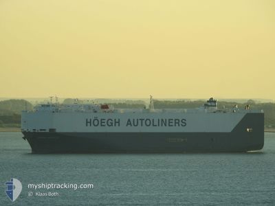
The vessel HOEGH MANILA (IMO: 9368912, MMSI: 259709000) is a Ro-Ro/Passenger Ship that was built in 2007 ( 17 Age ). It's sailing under the flag of [NO] Norway.
In this page you can find informations about the vessels current position, last detected port calls, and current voyage information. If the vessels is not in coverage by AIS you will find the latest position.
The current position of HOEGH MANILA is detected by our AIS receivers and we are not responsible for the reliability of the data. The last position was recorded while the vessel was in Coverage by the Ais receivers of our vessel tracking app.
The current draught of HOEGH MANILA as reported by AIS is 8.3 meters
Weather
| Temperature | 26.8°C / 80.24°F |
|---|---|
| Wind Speed | 6 knots |
| Direction | 94° E |
| Pressure | 1014.7 hPa |
| Humidity | 81.5 % |
| Cloud Coverage | --- |
Featured Company
Last Port Calls
| Port | Arrival | Departure | Time In Port |
|---|---|---|---|
| 2024-04-16 09:15 | 2024-04-17 01:12 | 15 h | |
| 2024-04-15 09:07 | 2024-04-15 19:30 | 10 h | |
| 2024-04-04 18:48 | 2024-04-06 03:13 | 1 d | |
| 2024-03-30 15:36 | 2024-04-01 13:46 | 1 d | |
| 2024-03-28 09:37 | 2024-03-28 22:43 | 13 h | |
| 2024-03-27 02:00 | 2024-03-28 00:06 | 22 h | |
| 2024-03-24 22:28 | 2024-03-26 02:01 | 1 d | |
| 2024-03-14 09:24 | 2024-03-14 19:08 | 9 h | |
| 2024-03-09 03:05 | 2024-03-10 01:23 | 22 h | |
| 2024-03-05 01:16 | 2024-03-05 17:06 | 15 h |
Most Visited Ports (Last year)
| Port | Arrivals | |
|---|---|---|
| 8 | ||
| 7 | ||
| 7 | ||
| 7 | ||
| 7 | ||
| 6 |
Last Trips
| Origin | Departure | Destination | Arrival | Distance | |
|---|---|---|---|---|---|
| 2024-04-15 15:30 | 2024-04-16 05:15 | 137.06 nm | |||
| 2024-04-06 05:13 | 2024-04-15 05:07 | 3303.35 nm | |||
| 2024-04-01 15:46 | 2024-04-04 20:48 | 941.68 nm | |||
| 2024-03-28 23:43 | 2024-03-30 16:36 | 536.04 nm | |||
| 2024-03-28 01:06 | 2024-03-28 10:37 | 116.08 nm | |||
| 2024-03-26 03:01 | 2024-03-27 03:00 | 339.51 nm | |||
| 2024-03-14 15:08 | 2024-03-24 23:28 | 3909.70 nm | |||
| 2024-03-09 20:23 | 2024-03-14 05:24 | 1278.84 nm | |||
| 2024-03-05 11:06 | 2024-03-08 22:05 | 1282.39 nm | |||
| 2024-03-01 23:55 | 2024-03-04 19:16 | 251.52 nm |
Events
| Heure | Evenement | Détails | Position/ Destination | Info |
|---|---|---|---|---|
| 2024-04-25 17:49 | Démarrage | 6.23 nm, East of BOCA DEL RIO |
19.13833 / -96.00166
COCTG
|
Vitesse: 13 kn Parcours: 30° |
| 2024-04-24 12:24 | Arret | 4.88 nm, East of BOCA DEL RIO |
19.12125 / -96.02080
COCTG
|
Vitesse: 0.3 kn Parcours: 9° |
| 2024-04-20 03:17 | Etat Changé | Default Under way using engine |
10.86058 / -76.08048
COCTG
|
Vitesse: 15.3 kn Parcours: 327.3° |
| 2024-04-20 03:12 | Etat Changé | Under way using engine Default |
10.84066 / -76.06770
COCTG
|
Vitesse: 15 kn Parcours: 327° |
| 2024-04-20 03:12 | Hors de la zone couverte |
10.84066 / -76.06770
Caribbean Sea
|
Vitesse: 15.3 kn Parcours: 327.3° |
|
| 2024-04-20 02:48 | Etat Changé | Default Under way using engine |
10.75667 / -76.01334
COCTG
|
Vitesse: 15.2 kn Parcours: 325.6° |
| 2024-04-20 02:42 | Etat Changé | Under way using engine Default |
10.73503 / -75.99775
COCTG
|
Vitesse: 15 kn Parcours: 325° |
| 2024-04-20 01:54 | Etat Changé | Default Under way using engine |
10.56677 / -75.87782
COCTG
|
Vitesse: 15.3 kn Parcours: 322.5° |
| 2024-04-20 01:50 | Etat Changé | Under way using engine Default |
10.55246 / -75.86683
COCTG
|
Vitesse: 15 kn Parcours: 322° |
| 2024-04-20 01:45 | Etat Changé | Default Under way using engine |
10.53667 / -75.85500
COCTG
|
Vitesse: 15.3 kn Parcours: 325.6° |