
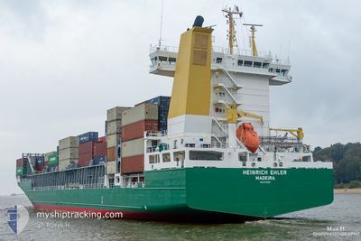
HEINRICH EHLER
Container Ship
Current Trip
| Time Travelled | 2 days |
|---|---|
| Remaining Time | --- |
| Distance Travelled | 722.44 nm |
| Remaining Distance | --- |
| AVG Speed | 13.8 Noeuds |
| MAX Speed | 16.9 Noeuds |
| AVG Wind | 14.6 knots |
| MAX Wind | 28 knots |
| MIN Temp | 7.6°C / 45.68°F |
| MAX Temp | 10.5°C / 50.9°F |
| Tirant d eau | 8.7 m |
| Position reçue | 5 h, 20 m depuis |
Current Position
| Longitude | 3.52633° |
|---|---|
| Latitude | 51.93217° |
| Etat | Under way using engine |
| Vitesse | 9.5 Noeuds |
| Parcours | 71° |
| Zone | North Sea |
| Station | T-AIS |
| Position reçue | 5 h, 20 m depuis |
Info
Information
The current position of HEINRICH EHLER is in North Sea with coordinates 51.93217° / 3.52633° as reported on 2024-04-19 15:10 by AIS to our vessel tracker app. The vessel's current speed is 9.5 Noeuds
The vessel HEINRICH EHLER (IMO: 9372200, MMSI: 255806191) is a Container Ship that was built in 2008 ( 16 Age ). It's sailing under the flag of [PT] Portugal.
In this page you can find informations about the vessels current position, last detected port calls, and current voyage information. If the vessels is not in coverage by AIS you will find the latest position.
The current position of HEINRICH EHLER is detected by our AIS receivers and we are not responsible for the reliability of the data. The last position was recorded while the vessel was in Coverage by the Ais receivers of our vessel tracking app.
The current draught of HEINRICH EHLER as reported by AIS is 8.7 meters
Weather
| Temperature | 7.7°C / 45.86°F |
|---|---|
| Wind Speed | 27 knots |
| Direction | 341° NNW |
| Pressure | 1016.8 hPa |
| Humidity | 67 % |
| Cloud Coverage | 71 % |
Featured Company
Last Port Calls
| Port | Arrival | Departure | Time In Port |
|---|---|---|---|
| 2024-04-16 18:17 | 2024-04-17 12:38 | 18 h | |
| 2024-04-13 13:00 | 2024-04-14 13:09 | 1 d | |
| 2024-04-12 07:13 | 2024-04-12 15:26 | 8 h | |
| 2024-04-10 11:22 | 2024-04-11 15:34 | 1 d | |
| 2024-04-07 23:21 | 2024-04-08 14:05 | 14 h | |
| 2024-04-03 14:49 | 2024-04-07 06:16 | 3 d | |
| 2024-03-31 20:21 | 2024-04-01 10:28 | 14 h | |
| 2024-03-30 03:39 | 2024-03-31 11:27 | 1 d | |
| 2024-03-28 10:33 | 2024-03-29 04:24 | 17 h | |
| 2024-03-26 11:10 | 2024-03-27 23:11 | 1 d |
Most Visited Ports (Last year)
| Port | Arrivals | |
|---|---|---|
| 13 | ||
| 10 | ||
| 10 | ||
| 10 | ||
| 10 | ||
| 9 |
Last Trips
| Origin | Departure | Destination | Arrival | Distance | |
|---|---|---|---|---|---|
| 2024-04-14 14:09 | 2024-04-16 19:17 | 124.25 nm | |||
| 2024-04-12 16:26 | 2024-04-13 14:00 | 191.93 nm | |||
| 2024-04-11 16:34 | 2024-04-12 08:13 | 207.32 nm | |||
| 2024-04-08 16:05 | 2024-04-10 12:22 | 606.23 nm | |||
| 2024-04-07 08:16 | 2024-04-08 01:21 | 145.46 nm | |||
| 2024-04-01 11:28 | 2024-04-03 16:49 | 806.78 nm | |||
| 2024-03-31 12:27 | 2024-03-31 21:21 | 93.19 nm | |||
| 2024-03-29 04:24 | 2024-03-30 03:39 | 116.14 nm | |||
| 2024-03-27 23:11 | 2024-03-28 10:33 | 121.47 nm | |||
| 2024-03-24 20:29 | 2024-03-26 11:10 | 604.73 nm |
Events
| Heure | Evenement | Détails | Position/ Destination | Info |
|---|---|---|---|---|
| 2024-04-19 16:24 | Arret | 10.84 nm, North West of OUDDORP |
51.94700 / 3.77067
ROTTERDAM
|
Vitesse: 0.1 kn Parcours: 351° |
| 2024-04-19 15:49 | Etat Changé | Default Under way using engine |
51.95517 / 3.69267
ROTTERDAM
|
Vitesse: 9.5 kn Parcours: 71° |
| 2024-04-19 15:10 | Hors de la zone couverte |
51.93217 / 3.52633
North Sea
ROTTERDAM
|
Vitesse: 9.5 kn Parcours: 71° |
|
| 2024-04-19 12:19 | Changement de zone | Dutch part of the North Sea Belgian part of the North Sea |
51.77533 / 2.70150
North Sea
ROTTERDAM
|
Vitesse: 12.5 kn Parcours: 51° |
| 2024-04-19 10:55 | Changement de zone | Belgian part of the North Sea French part of the North Sea |
51.55717 / 2.37800
North Sea
ROTTERDAM
|
Vitesse: 12.7 kn Parcours: 42° |
| 2024-04-19 10:54 | Dans la zone couverte |
51.55717 / 2.37800
North Sea
ROTTERDAM
|
Vitesse: 12.7 kn Parcours: 42° |
|
| 2024-04-19 08:40 | Hors de la zone couverte |
51.17300 / 1.91633
North Sea
ROTTERDAM
|
Vitesse: 14 kn Parcours: 58° |
|
| 2024-04-19 07:34 | Changement de zone | French part of the North Sea French part of the English Channel |
51.01933 / 1.58800
North Sea
ROTTERDAM
|
Vitesse: 14 kn Parcours: 48° |
| 2024-04-19 05:42 | Detecté en mer | French part of the English Channel |
50.66700 / 1.29033
English Channel
ROTTERDAM
|
Vitesse: 12.9 kn Parcours: 48° |
| 2024-04-19 05:42 | Dans la zone couverte |
50.66700 / 1.29033
English Channel
ROTTERDAM
|
Vitesse: 12.9 kn Parcours: 48° |