
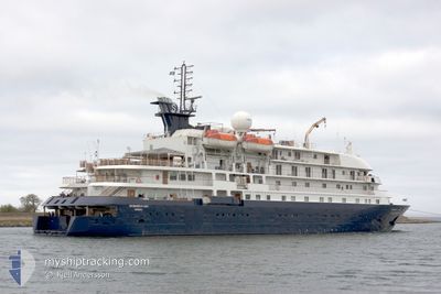
HEBRIDEAN SKY
Passengers Ship
Current Trip
| Trip Time | 12 h, 24 mins |
|---|---|
| Trip Distance | 102.03 nm |
| AVG Speed | 10.2 Noeuds |
| MAX Speed | 12.5 Noeuds |
| Tirant d eau | 4.3 m |
| AVG Wind | 21.4 knots |
| MAX Wind | 25.8 knots |
| MIN Temp | 10°C / 50°F |
| MAX Temp | 14.7°C / 58.46°F |
| Position reçue | 2 d depuis |
Current Position
| Longitude | 13.94807° |
|---|---|
| Latitude | 36.09785° |
| Etat | Under way using engine |
| Vitesse | 12.3 Noeuds |
| Parcours | 262.9° |
| Zone | Mediterranean Sea - Eastern Basin |
| Station | T-AIS |
| Position reçue | 2 d depuis |
Info
Information
The current position of HEBRIDEAN SKY is in Mediterranean Sea - Eastern Basin with coordinates 36.09785° / 13.94807° as reported on 2024-04-22 20:36 by AIS to our vessel tracker app. The vessel's current speed is 12.3 Noeuds and is currently inside the port of RADES.
The vessel HEBRIDEAN SKY (IMO: 8802882, MMSI: 311000253) is a Passengers Ship that was built in 1991 ( 33 Age ). It's sailing under the flag of [BS] Bahamas.
In this page you can find informations about the vessels current position, last detected port calls, and current voyage information. If the vessels is not in coverage by AIS you will find the latest position.
The current position of HEBRIDEAN SKY is detected by our AIS receivers and we are not responsible for the reliability of the data. The last position was recorded while the vessel was in Coverage by the Ais receivers of our vessel tracking app.
The current draught of HEBRIDEAN SKY as reported by AIS is 4.3 meters
Weather
| Temperature | 10.1°C / 50.18°F |
|---|---|
| Wind Speed | 10 knots |
| Direction | 258° WSW |
| Pressure | 1014 hPa |
| Humidity | 72.1 % |
| Cloud Coverage | 55 % |
Featured Company
Last Port Calls
| Port | Arrival | Departure | Time In Port |
|---|---|---|---|
| 2024-04-25 06:15 | |||
| 2024-04-24 17:51 | |||
| 2024-04-22 05:00 | 2024-04-22 17:34 | 12 h | |
| 2024-04-21 04:58 | 2024-04-21 20:16 | 15 h | |
| 2024-04-20 05:36 | 2024-04-20 20:23 | 14 h | |
| 2024-04-19 05:44 | 2024-04-19 20:14 | 14 h | |
| 2024-04-17 06:40 | 2024-04-18 16:53 | 1 d | |
| 2024-04-15 18:07 | 2024-04-16 11:27 | 17 h | |
| 2024-04-15 04:39 | 2024-04-15 16:02 | 11 h | |
| 2024-04-14 05:09 | 2024-04-14 19:06 | 13 h |
Most Visited Ports (Last year)
| Port | Arrivals | |
|---|---|---|
| 5 | ||
| 4 | ||
| 4 | ||
| 4 | ||
| 3 | ||
| 3 |
Last Trips
| Origin | Departure | Destination | Arrival | Distance | |
|---|---|---|---|---|---|
| 2024-04-24 18:51 | 2024-04-25 07:15 | 102.03 nm | |||
| 2024-04-21 22:16 | 2024-04-22 07:00 | 56.54 nm | |||
| 2024-04-20 22:23 | 2024-04-21 06:58 | 60.44 nm | |||
| 2024-04-19 22:14 | 2024-04-20 07:36 | 76.01 nm | |||
| 2024-04-18 18:53 | 2024-04-19 07:44 | 118.03 nm | |||
| 2024-04-16 13:27 | 2024-04-17 08:40 | 180.20 nm | |||
| 2024-04-15 18:02 | 2024-04-15 20:07 | 26.21 nm | |||
| 2024-04-14 21:06 | 2024-04-15 06:39 | 78.07 nm | |||
| 2024-04-13 22:50 | 2024-04-14 07:09 | 87.44 nm | |||
| 2024-04-12 22:18 | 2024-04-13 06:42 | 56.63 nm |
Events
| Heure | Evenement | Détails | Position/ Destination | Info |
|---|---|---|---|---|
| 2024-04-25 06:31 | Arret |
36.81226 / 10.28920
[TN] RADES
|
Vitesse: 0.1 kn Parcours: 91° |
|
| 2024-04-25 06:15 | Port d'arrivée |
|
36.81057 / 10.29501
[TN] RADES
|
Vitesse: 5.8 kn Parcours: 287° |
| 2024-04-24 17:51 | PORT DE DEPART |
|
36.33922 / 11.03496
TN SUS
|
Vitesse: 1.9 kn Parcours: 114° |
| 2024-04-22 20:40 | Etat Changé | Default Under way using engine |
36.09642 / 13.93414
TN SUS
|
Vitesse: 12.3 kn Parcours: 262.9° |
| 2024-04-22 20:36 | Hors de la zone couverte |
36.09785 / 13.94807
Mediterranean Sea - Eastern Basin
TN SUS
|
Vitesse: 12.3 kn Parcours: 262.9° |
|
| 2024-04-22 17:38 | Changement de destination | TN SUS MT MLA |
35.90763 / 14.53359
TN SUS
|
Vitesse: 7.5 kn Parcours: 21.1° |
| 2024-04-22 17:38 | Changement d'ETA | 2024/04/23 11:00 2024/04/22 04:45 |
35.90763 / 14.53359
TN SUS
|
Vitesse: 7.5 kn Parcours: 21.1° |
| 2024-04-22 17:34 | PORT DE DEPART |
|
35.90297 / 14.52891
MT MLA
|
Vitesse: 8 kn Parcours: 62° |
| 2024-04-22 17:33 | Etat Changé | Under way using engine Default |
35.90152 / 14.52631
[MT] VALLETTA
|
Vitesse: 8.1 kn Parcours: 77° |
| 2024-04-22 17:28 | Démarrage |
35.89491 / 14.51773
[MT] VALLETTA
|
Vitesse: 7.7 kn Parcours: 44° |