
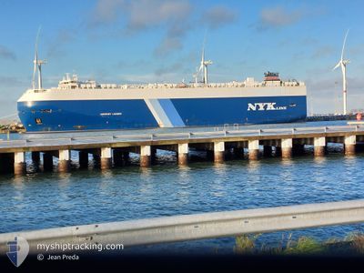
HARMONY LEADER
Ro-Ro/Passenger Ship
Current Trip
| Time Travelled | 8 days |
|---|---|
| Remaining Time | 2 h, 45 mins |
| Distance Travelled | 2638.05 nm |
| Remaining Distance | 82.46 nm |
| AVG Speed | 15.2 Noeuds |
| MAX Speed | 19.4 Noeuds |
| AVG Wind | 9.7 knots |
| MAX Wind | 24.8 knots |
| MIN Temp | 9.4°C / 48.92°F |
| MAX Temp | 27.4°C / 81.32°F |
| Tirant d eau | 8.7 m |
| Position reçue | 6 h, 27 m depuis |
Current Position
| Longitude | 113.79901° |
|---|---|
| Latitude | 22.13661° |
| Etat | Under way using engine |
| Vitesse | 5.7 Noeuds |
| Parcours | 176.9° |
| Zone | South China Sea |
| Station | T-AIS |
| Position reçue | 6 h, 27 m depuis |
Info
Information
The current position of HARMONY LEADER is in South China Sea with coordinates 22.13661° / 113.79901° as reported on 2024-04-25 04:49 by AIS to our vessel tracker app. The vessel's current speed is 5.7 Noeuds and is heading at the port of NANSHA. The estimated time of arrival as calculated by MyShipTracking vessel tracking app is 2024-04-25 14:01 LT
The vessel HARMONY LEADER (IMO: 9441568, MMSI: 311040800) is a Ro-Ro/Passenger Ship that was built in 2011 ( 13 Age ). It's sailing under the flag of [BS] Bahamas.
In this page you can find informations about the vessels current position, last detected port calls, and current voyage information. If the vessels is not in coverage by AIS you will find the latest position.
The current position of HARMONY LEADER is detected by our AIS receivers and we are not responsible for the reliability of the data. The last position was recorded while the vessel was in Coverage by the Ais receivers of our vessel tracking app.
The current draught of HARMONY LEADER as reported by AIS is 8.7 meters
Weather
| Temperature | 27.5°C / 81.5°F |
|---|---|
| Wind Speed | 16 knots |
| Direction | 206° SSW |
| Pressure | 1005.6 hPa |
| Humidity | 90 % |
| Cloud Coverage | 4 % |
Featured Company
Last Port Calls
| Port | Arrival | Departure | Time In Port |
|---|---|---|---|
| 2024-04-15 08:52 | 2024-04-17 07:14 | 1 d | |
| 2024-04-14 21:12 | 2024-04-15 08:18 | 11 h | |
| 2024-04-13 22:05 | 2024-04-14 06:22 | 8 h | |
| 2024-03-19 22:53 | 2024-03-21 04:37 | 1 d | |
| 2024-03-15 08:55 | 2024-03-15 16:04 | 7 h | |
| 2024-03-11 11:45 | 2024-03-12 08:22 | 20 h | |
| 2024-02-27 18:56 | 2024-02-29 05:53 | 1 d | |
| 2024-02-22 07:16 | 2024-02-23 02:36 | 19 h | |
| 2024-02-17 19:59 | 2024-02-18 10:20 | 14 h | |
| 2024-02-07 20:56 | 2024-02-08 11:00 | 14 h |
Most Visited Ports (Last year)
| Port | Arrivals | |
|---|---|---|
| 5 | ||
| 4 | ||
| 4 | ||
| 3 | ||
| 3 | ||
| 3 |
Last Trips
| Origin | Departure | Destination | Arrival | Distance | |
|---|---|---|---|---|---|
| 2024-04-15 17:18 | 2024-04-15 17:52 | 6.36 nm | |||
| 2024-04-14 15:22 | 2024-04-15 06:12 | 215.21 nm | |||
| 2024-03-20 23:37 | 2024-04-14 07:05 | 8518.44 nm | |||
| 2024-03-15 13:04 | 2024-03-19 17:53 | 657.53 nm | |||
| 2024-03-12 05:22 | 2024-03-15 05:55 | 819.44 nm | |||
| 2024-02-29 02:53 | 2024-03-11 08:45 | 2554.04 nm | |||
| 2024-02-22 23:36 | 2024-02-27 15:56 | 1058.70 nm | |||
| 2024-02-18 07:20 | 2024-02-22 04:16 | 1273.94 nm | |||
| 2024-02-08 07:00 | 2024-02-17 16:59 | 2804.91 nm | |||
| 2024-01-29 19:20 | 2024-02-07 16:56 | 2012.91 nm |
Events
| Heure | Evenement | Détails | Position/ Destination | Info |
|---|---|---|---|---|
| 2024-04-25 04:56 | Etat Changé | Default Under way using engine |
22.11901 / 113.80549
CN XSA
|
Vitesse: 5.7 kn Parcours: 176.9° |
| 2024-04-25 04:49 | Hors de la zone couverte |
22.13661 / 113.79901
South China Sea
|
Vitesse: 5.7 kn Parcours: 176.9° |
|
| 2024-04-25 04:47 | Etat Changé | Under way using engine Default |
22.13923 / 113.79836
CN XSA
|
Vitesse: 3.8 kn Parcours: 175° |
| 2024-04-25 04:43 | Etat Changé | Default Under way using engine |
22.14302 / 113.79604
CN XSA
|
Vitesse: 6.9 kn Parcours: 158.9° |
| 2024-04-25 04:34 | Etat Changé | Under way using engine Default |
22.15705 / 113.79043
CN XSA
|
Vitesse: 11.9 kn Parcours: 162° |
| 2024-04-25 04:32 | Etat Changé | Default Under way using engine |
22.16267 / 113.78827
CN XSA
|
Vitesse: 14.5 kn Parcours: 197.6° |
| 2024-04-25 04:26 | Etat Changé | Under way using engine Default |
22.18754 / 113.78931
CN XSA
|
Vitesse: 14.7 kn Parcours: 197° |
| 2024-04-25 04:08 | Etat Changé | Default Under way using engine |
22.26097 / 113.79978
CN XSA
|
Vitesse: 15.3 kn Parcours: 179.3° |
| 2024-04-25 03:30 | Etat Changé | Under way using engine Default |
22.41443 / 113.76072
CN XSA
|
Vitesse: 15 kn Parcours: 166° |
| 2024-04-25 03:28 | Etat Changé | Default Under way using engine |
22.42051 / 113.75953
CN XSA
|
Vitesse: 15 kn Parcours: 173.1° |