
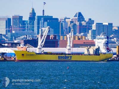
HAPPY RANGER
General Cargo
Current Trip
| Trip Time | 4 days |
|---|---|
| Trip Distance | 885.08 nm |
| AVG Speed | 13.4 Noeuds |
| MAX Speed | 17.2 Noeuds |
| Tirant d eau | 7.1 m |
| AVG Wind | 14.3 knots |
| MAX Wind | 27.6 knots |
| MIN Temp | 8.2°C / 46.76°F |
| MAX Temp | 16.4°C / 61.52°F |
| Position reçue | 5 d depuis |
Current Position
| Longitude | 12.23910° |
|---|---|
| Latitude | 38.57441° |
| Etat | Under way using engine |
| Vitesse | 13.1 Noeuds |
| Parcours | 270.5° |
| Zone | Tyrrhenian Sea |
| Station | T-AIS |
| Position reçue | 5 d depuis |
Info
Information
The current position of HAPPY RANGER is in Tyrrhenian Sea with coordinates 38.57441° / 12.23910° as reported on 2024-04-20 04:17 by AIS to our vessel tracker app. The vessel's current speed is 13.1 Noeuds and is currently inside the port of ORISTANO.
The vessel HAPPY RANGER (IMO: 9139311, MMSI: 245539000) is a General Cargo that was built in 1998 ( 26 Age ). It's sailing under the flag of [NL] Netherlands.
In this page you can find informations about the vessels current position, last detected port calls, and current voyage information. If the vessels is not in coverage by AIS you will find the latest position.
The current position of HAPPY RANGER is detected by our AIS receivers and we are not responsible for the reliability of the data. The last position was recorded while the vessel was in Coverage by the Ais receivers of our vessel tracking app.
The current draught of HAPPY RANGER as reported by AIS is 7.1 meters
Weather
| Temperature | 12°C / 53.6°F |
|---|---|
| Wind Speed | 9 knots |
| Direction | 331° NNW |
| Pressure | 1012.4 hPa |
| Humidity | 67.8 % |
| Cloud Coverage | 28 % |
Featured Company
Last Port Calls
| Port | Arrival | Departure | Time In Port |
|---|---|---|---|
| 2024-04-22 10:21 | |||
| 2024-04-12 10:46 | 2024-04-18 08:39 | 5 d | |
| 2024-04-05 17:28 | 2024-04-06 12:22 | 18 h | |
| 2024-03-31 04:39 | 2024-04-03 15:12 | 3 d | |
| 2024-03-14 05:47 | 2024-03-16 12:33 | 2 d | |
| 2024-03-10 09:39 | 2024-03-11 21:43 | 1 d | |
| 2024-03-01 11:59 | 2024-03-03 17:50 | 2 d | |
| 2024-02-14 12:12 | 2024-02-15 20:52 | 1 d | |
| 2024-02-08 21:17 | 2024-02-14 00:41 | 5 d | |
| 2024-02-05 03:10 | 2024-02-05 21:22 | 18 h |
Most Visited Ports (Last year)
| Port | Arrivals | |
|---|---|---|
| 3 | ||
| 2 | ||
| 2 | ||
| 2 | ||
| 2 | ||
| 2 |
Last Trips
| Origin | Departure | Destination | Arrival | Distance | |
|---|---|---|---|---|---|
| 2024-04-18 10:39 | 2024-04-22 12:21 | 885.08 nm | |||
| 2024-04-06 15:22 | 2024-04-12 12:46 | 1432.28 nm | |||
| 2024-04-03 18:12 | 2024-04-05 20:28 | 221.37 nm | |||
| 2024-03-16 13:33 | 2024-03-31 07:39 | 4138.05 nm | |||
| 2024-03-11 22:43 | 2024-03-14 06:47 | 790.40 nm | |||
| 2024-03-03 18:50 | 2024-03-10 10:39 | 389.97 nm | |||
| 2024-02-15 15:52 | 2024-03-01 12:59 | 4574.73 nm | |||
| 2024-02-13 19:41 | 2024-02-14 07:12 | 155.99 nm | |||
| 2024-02-05 16:22 | 2024-02-08 16:17 | 588.83 nm | |||
| 2024-02-03 22:05 | 2024-02-04 22:10 | 376.78 nm |
Events
| Heure | Evenement | Détails | Position/ Destination | Info |
|---|---|---|---|---|
| 2024-04-22 10:21 | Port d'arrivée |
|
39.86643 / 8.55062
[IT] ORISTANO
|
Vitesse: Parcours: 301° |
| 2024-04-20 05:08 | Etat Changé | Default Under way using engine |
38.57548 / 12.00250
ORISTANO
|
Vitesse: 13.1 kn Parcours: 270.5° |
| 2024-04-20 04:17 | Hors de la zone couverte |
38.57441 / 12.23910
Tyrrhenian Sea
ORISTANO
|
Vitesse: 13.1 kn Parcours: 270.5° |
|
| 2024-04-20 02:43 | Etat Changé | Under way using engine Default |
38.56207 / 12.67492
ORISTANO
|
Vitesse: 12.8 kn Parcours: 273° |
| 2024-04-20 02:01 | Etat Changé | Default Under way using engine |
38.55389 / 12.86655
ORISTANO
|
Vitesse: 12.8 kn Parcours: 273.3° |
| 2024-04-19 15:29 | Changement de zone | Italian part of the Tyrrhenian Sea Italian part of the Ionian Sea |
38.25283 / 15.66742
Tyrrhenian Sea
ORISTANO
|
Vitesse: 15 kn Parcours: 76.1° |
| 2024-04-19 12:56 | Dans la zone couverte |
37.86963 / 15.87525
Ionian Sea
ORISTANO
|
Vitesse: 14.1 kn Parcours: 271.2° |
|
| 2024-04-19 10:42 | Hors de la zone couverte |
38.13322 / 16.46093
Ionian Sea
ORISTANO
|
Vitesse: 15 kn Parcours: 227.7° |
|
| 2024-04-19 10:22 | Dans la zone couverte |
38.18750 / 16.53515
Ionian Sea
ORISTANO
|
Vitesse: 14.5 kn Parcours: 225.9° |
|
| 2024-04-19 07:50 | Hors de la zone couverte |
38.63846 / 17.08556
Ionian Sea
ORISTANO
|
Vitesse: 14.5 kn Parcours: 222.3° |