
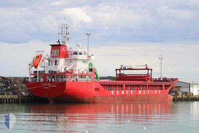
GUNERLER
General Cargo
Current Trip
| Time Travelled | 6 days |
|---|---|
| Remaining Time | --- |
| Distance Travelled | 1207.16 nm |
| Remaining Distance | --- |
| AVG Speed | 9.3 Noeuds |
| MAX Speed | 12.7 Noeuds |
| AVG Wind | 7.3 knots |
| MAX Wind | 26 knots |
| MIN Temp | 13.1°C / 55.58°F |
| MAX Temp | 27.4°C / 81.32°F |
| Tirant d eau | 7.1 m |
| Position reçue | 1 d depuis |
Current Position
| Longitude | 14.00117° |
|---|---|
| Latitude | 36.68535° |
| Etat | Under way using engine |
| Vitesse | 7.2 Noeuds |
| Parcours | 283.2° |
| Zone | Mediterranean Sea - Eastern Basin |
| Station | T-AIS |
| Position reçue | 1 d depuis |
Info
Information
The current position of GUNERLER is in Mediterranean Sea - Eastern Basin with coordinates 36.68535° / 14.00117° as reported on 2024-04-18 20:33 by AIS to our vessel tracker app. The vessel's current speed is 7.2 Noeuds and is heading at the port of CORUNA. The estimated time of arrival as calculated by MyShipTracking vessel tracking app is 2024-04-25 23:00 LT
The vessel GUNERLER (IMO: 9598684, MMSI: 314686000) is a General Cargo that was built in 2011 ( 13 Age ). It's sailing under the flag of [BB] Barbados.
In this page you can find informations about the vessels current position, last detected port calls, and current voyage information. If the vessels is not in coverage by AIS you will find the latest position.
The current position of GUNERLER is detected by our AIS receivers and we are not responsible for the reliability of the data. The last position was recorded while the vessel was in Coverage by the Ais receivers of our vessel tracking app.
The current draught of GUNERLER as reported by AIS is 7.1 meters
Weather
| Temperature | 14.3°C / 57.74°F |
|---|---|
| Wind Speed | 19 knots |
| Direction | 287° WNW |
| Pressure | 1015.5 hPa |
| Humidity | 63.6 % |
| Cloud Coverage | --- |
Featured Company
Last Port Calls
| Port | Arrival | Departure | Time In Port |
|---|---|---|---|
| 2024-04-10 13:54 | 2024-04-13 20:02 | 3 d | |
| 2024-04-08 07:04 | 2024-04-08 17:52 | 10 h | |
| 2024-04-03 10:27 | 2024-04-04 14:44 | 1 d | |
| 2024-04-02 09:42 | 2024-04-03 03:37 | 17 h | |
| 2024-04-01 06:36 | 2024-04-01 23:13 | 16 h | |
| 2024-03-27 20:53 | 2024-03-28 18:55 | 22 h | |
| 2024-03-16 07:32 | 2024-03-16 12:19 | 4 h | |
| 2024-03-12 20:19 | |||
| 2024-02-21 19:26 | 2024-02-26 19:29 | 5 d |
Last Trips
| Origin | Departure | Destination | Arrival | Distance | |
|---|---|---|---|---|---|
| 2024-04-08 20:52 | 2024-04-10 16:54 | 207.67 nm | |||
| 2024-04-04 17:44 | 2024-04-08 10:04 | 164.06 nm | |||
| 2024-04-03 06:37 | 2024-04-03 13:27 | 60.52 nm | |||
| 2024-04-02 02:13 | 2024-04-02 12:42 | 45.20 nm | |||
| 2024-03-28 21:55 | 2024-04-01 09:36 | 839.44 nm | |||
| 2024-03-16 13:19 | 2024-03-27 23:53 | 2055.88 nm | |||
| 2024-03-12 21:19 | 2024-03-16 08:32 | 798.46 nm | |||
| 2024-01-31 07:05 | 2024-02-21 20:26 | 2398.44 nm |
Events
| Heure | Evenement | Détails | Position/ Destination | Info |
|---|---|---|---|---|
| 2024-04-18 20:33 | Hors de la zone couverte |
36.68535 / 14.00117
Mediterranean Sea - Eastern Basin
ESLCG
|
Vitesse: 7.2 kn Parcours: 283.2° |
|
| 2024-04-18 14:45 | Detecté en mer | Italian part of the Mediterranean Sea - Eastern Basin |
36.46765 / 14.74648
Mediterranean Sea - Eastern Basin
ESLCG
|
Vitesse: 6.4 kn Parcours: 280.5° |
| 2024-04-18 14:45 | Dans la zone couverte |
36.46765 / 14.74648
Mediterranean Sea - Eastern Basin
ESLCG
|
Vitesse: 6.4 kn Parcours: 280.5° |
|
| 2024-04-17 09:02 | Etat Changé | Default Under way using engine |
36.40595 / 19.74868
ESLCG
|
Vitesse: 10.1 kn Parcours: 266.3° |
| 2024-04-17 09:02 | Hors de la zone couverte |
36.40596 / 19.74932
Mediterranean Sea - Eastern Basin
ESLCG
|
Vitesse: 10.1 kn Parcours: 266.3° |
|
| 2024-04-17 07:44 | Etat Changé | Under way using engine Default |
36.40266 / 20.02219
ESLCG
|
Vitesse: 10.2 kn Parcours: 273° |
| 2024-04-17 07:16 | Etat Changé | Default Under way using engine |
36.39849 / 20.11782
ESLCG
|
Vitesse: 10.2 kn Parcours: 273.7° |
| 2024-04-17 07:08 | Etat Changé | Under way using engine Default |
36.39705 / 20.14707
ESLCG
|
Vitesse: 10.1 kn Parcours: 272° |
| 2024-04-17 06:52 | Etat Changé | Default Under way using engine |
36.39427 / 20.20331
ESLCG
|
Vitesse: 10.1 kn Parcours: 271.2° |
| 2024-04-17 06:36 | Detecté en mer | Greek part of the Mediterranean Sea - Eastern Basin |
36.39199 / 20.25912
Mediterranean Sea - Eastern Basin
ESLCG
|
Vitesse: 10.3 kn Parcours: 272.5° |