
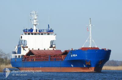
GT VELA
General Cargo
Current Trip
| Time Travelled | 54 mins |
|---|---|
| Remaining Time | --- |
| Distance Travelled | 6.02 nm |
| Remaining Distance | --- |
| AVG Speed | 7.3 Noeuds |
| MAX Speed | 10.7 Noeuds |
| AVG Wind | 10 knots |
| MAX Wind | 10.4 knots |
| MIN Temp | 5.6°C / 42.08°F |
| MAX Temp | 6.1°C / 42.98°F |
| Tirant d eau | 3.2 m |
| Position reçue | 1 m depuis |
Current Position
| Longitude | -6.11704° |
|---|---|
| Latitude | 53.68300° |
| Etat | Under way using engine |
| Vitesse | 10.6 Noeuds |
| Parcours | 129.1° |
| Zone | Irish Sea and St. George's Channel |
| Station | T-AIS |
| Position reçue | 1 m depuis |
Info
Information
The current position of GT VELA is in Irish Sea and St. George's Channel with coordinates 53.68300° / -6.11704° as reported on 2024-04-23 22:43 by AIS to our vessel tracker app. The vessel's current speed is 10.6 Noeuds and is heading at the port of WATERFORD. The estimated time of arrival as calculated by MyShipTracking vessel tracking app is 2024-04-24 13:30 LT
The vessel GT VELA (IMO: 8912027, MMSI: 305970000) is a General Cargo that was built in 1991 ( 33 Age ). It's sailing under the flag of [AG] Antigua Barbuda.
In this page you can find informations about the vessels current position, last detected port calls, and current voyage information. If the vessels is not in coverage by AIS you will find the latest position.
The current position of GT VELA is detected by our AIS receivers and we are not responsible for the reliability of the data. The last position was recorded while the vessel was in Coverage by the Ais receivers of our vessel tracking app.
The current draught of GT VELA as reported by AIS is 3.2 meters
Weather
| Temperature | 8.1°C / 46.58°F |
|---|---|
| Wind Speed | 14 knots |
| Direction | 328° NNW |
| Pressure | 1024.3 hPa |
| Humidity | 76.8 % |
| Cloud Coverage | 14 % |
Featured Company
Last Port Calls
| Port | Arrival | Departure | Time In Port |
|---|---|---|---|
| 2024-04-22 22:48 | 2024-04-23 21:50 | 23 h | |
| 2024-04-17 11:37 | 2024-04-17 12:27 | 50 m | |
| 2024-04-13 13:54 | 2024-04-15 18:11 | 2 d | |
| 2024-04-11 12:26 | 2024-04-13 01:44 | 1 d | |
| 2024-04-05 14:38 | 2024-04-08 03:46 | 2 d | |
| 2024-04-03 09:26 | 2024-04-05 13:12 | 2 d | |
| 2024-03-28 10:25 | 2024-04-02 21:55 | 5 d | |
| 2024-03-21 03:32 | 2024-03-24 09:53 | 3 d | |
| 2024-03-19 19:18 | 2024-03-20 13:51 | 18 h | |
| 2024-03-15 05:06 | 2024-03-15 12:08 | 7 h |
Last Trips
| Origin | Departure | Destination | Arrival | Distance | |
|---|---|---|---|---|---|
| 2024-04-17 14:27 | 2024-04-22 23:48 | 946.53 nm | |||
| 2024-04-15 20:11 | 2024-04-17 13:37 | 368.11 nm | |||
| 2024-04-13 04:44 | 2024-04-13 15:54 | 106.52 nm | |||
| 2024-04-08 05:46 | 2024-04-11 15:26 | 730.25 nm | |||
| 2024-04-05 15:12 | 2024-04-05 16:38 | 13.75 nm | |||
| 2024-04-02 23:55 | 2024-04-03 11:26 | 98.90 nm | |||
| 2024-03-24 11:53 | 2024-03-28 11:25 | 765.24 nm | |||
| 2024-03-20 14:51 | 2024-03-21 05:32 | 72.14 nm | |||
| 2024-03-15 13:08 | 2024-03-19 20:18 | 481.19 nm | |||
| 2024-03-15 06:00 | 2024-03-15 06:06 | 0.18 nm |
Events
| Heure | Evenement | Détails | Position/ Destination | Info |
|---|---|---|---|---|
| 2024-04-23 21:53 | Tirant d'eau modifié | 3.2 5.2 |
53.72346 / -6.28835
IE WAT
|
Vitesse: 8.1 kn Parcours: 53.7° |
| 2024-04-23 21:53 | Changement de destination | IE WAT IE DRO |
53.72346 / -6.28835
IE WAT
|
Vitesse: 8.1 kn Parcours: 53.7° |
| 2024-04-23 21:53 | Changement d'ETA | 2024/04/24 13:30 2024/04/21 20:30 |
53.72346 / -6.28835
IE WAT
|
Vitesse: 8.1 kn Parcours: 53.7° |
| 2024-04-23 21:50 | PORT DE DEPART |
|
53.72107 / -6.29464
IE DRO
|
Vitesse: 7.5 kn Parcours: 80° |
| 2024-04-23 21:41 | Dans la zone couverte |
53.71994 / -6.31984
Irish Sea and St. George's Channel
[IE] DROGHEDA
|
Vitesse: 6.8 kn Parcours: 74.9° |
|
| 2024-04-22 22:52 | Hors de la zone couverte |
53.71937 / -6.32261
Irish Sea and St. George's Channel
[IE] DROGHEDA
|
Vitesse: 4.3 kn Parcours: 252.7° |
|
| 2024-04-22 22:48 | Port d'arrivée |
|
53.72030 / -6.31612
[IE] DROGHEDA
|
Vitesse: 4.7 kn Parcours: 246° |
| 2024-04-22 21:43 | Démarrage | 4.08 nm, South of CLOGHERHEAD |
53.73477 / -6.18293
IE DRO
|
Vitesse: 3.1 kn Parcours: 226° |
| 2024-04-22 21:27 | Etat Changé | Under way using engine At anchor |
53.73601 / -6.18166
IE DRO
|
Vitesse: 0.1 kn Parcours: 355° |
| 2024-04-22 20:47 | Etat Changé | At anchor Default |
53.73600 / -6.18185
IE DRO
|
Vitesse: Parcours: 5° |