
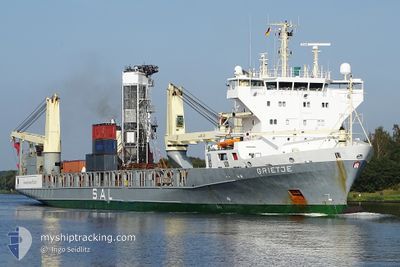
GRIETJE
General Cargo
Current Trip
| Time Travelled | 6 days |
|---|---|
| Remaining Time | 21 days |
| Distance Travelled | 2419.54 nm |
| Remaining Distance | 9313.42 nm |
| AVG Speed | 16.8 Noeuds |
| MAX Speed | 19.1 Noeuds |
| AVG Wind | 8.4 knots |
| MAX Wind | 22.4 knots |
| MIN Temp | 16.2°C / 61.16°F |
| MAX Temp | 25.6°C / 78.08°F |
| Tirant d eau | 6.3 m |
| Position reçue | 22 m depuis |
Current Position
| Longitude | -18.20060° |
|---|---|
| Latitude | 15.02889° |
| Etat | Under way using engine |
| Vitesse | 18 Noeuds |
| Parcours | 180.6° |
| Zone | North Atlantic Ocean |
| Station | T-AIS |
| Position reçue | 22 m depuis |
Info
Information
The current position of GRIETJE is in North Atlantic Ocean with coordinates 15.02889° / -18.20060° as reported on 2024-04-20 04:45 by AIS to our vessel tracker app. The vessel's current speed is 18 Noeuds and is heading at the port of SINGAPORE. The estimated time of arrival as calculated by MyShipTracking vessel tracking app is 2024-05-11 11:21 LT
The vessel GRIETJE (IMO: 9147708, MMSI: 304081008) is a General Cargo that was built in 2000 ( 24 Age ). It's sailing under the flag of [AG] Antigua Barbuda.
In this page you can find informations about the vessels current position, last detected port calls, and current voyage information. If the vessels is not in coverage by AIS you will find the latest position.
The current position of GRIETJE is detected by our AIS receivers and we are not responsible for the reliability of the data. The last position was recorded while the vessel was in Coverage by the Ais receivers of our vessel tracking app.
The current draught of GRIETJE as reported by AIS is 6.3 meters
Weather
| Temperature | 22.7°C / 72.86°F |
|---|---|
| Wind Speed | 18 knots |
| Direction | 11° N |
| Pressure | 1009.5 hPa |
| Humidity | 79.5 % |
| Cloud Coverage | 10 % |
Featured Company
Last Port Calls
| Port | Arrival | Departure | Time In Port |
|---|---|---|---|
| 2024-04-12 11:15 | 2024-04-13 15:20 | 1 d | |
| 2024-04-06 19:25 | 2024-04-07 13:23 | 17 h | |
| 2024-04-05 13:29 | 2024-04-06 19:24 | 1 d | |
| 2024-03-24 15:00 | 2024-03-26 03:56 | 1 d | |
| 2024-03-20 04:13 | 2024-03-22 06:07 | 2 d | |
| 2024-03-17 17:14 | 2024-03-19 14:56 | 1 d | |
| 2024-03-05 04:48 | 2024-03-17 04:34 | 11 d | |
| 2024-03-02 12:33 | 2024-03-03 13:45 | 1 d | |
| 2024-02-08 06:49 | 2024-02-09 05:21 | 22 h |
Last Trips
| Origin | Departure | Destination | Arrival | Distance | |
|---|---|---|---|---|---|
| 2024-04-07 16:23 | 2024-04-12 13:15 | 1511.18 nm | |||
| 2024-04-06 22:24 | 2024-04-06 22:25 | 0.39 nm | |||
| 2024-03-26 04:56 | 2024-04-05 16:29 | 3186.98 nm | |||
| 2024-03-22 07:07 | 2024-03-24 16:00 | 909.29 nm | |||
| 2024-03-19 15:56 | 2024-03-20 05:13 | 182.02 nm | |||
| 2024-03-17 05:34 | 2024-03-17 18:14 | 209.94 nm | |||
| 2024-03-03 14:45 | 2024-03-05 05:48 | 510.72 nm | |||
| 2024-02-09 07:21 | 2024-03-02 13:33 | 7815.14 nm | |||
| 2024-01-25 07:56 | 2024-02-08 08:49 | 5560.76 nm |
Events
| Heure | Evenement | Détails | Position/ Destination | Info |
|---|---|---|---|---|
| 2024-04-20 04:50 | Etat Changé | Default Under way using engine |
15.00208 / -18.20116
SGSIN
|
Vitesse: 18 kn Parcours: 180.6° |
| 2024-04-20 04:45 | Etat Changé | Under way using engine Default |
15.02889 / -18.20060
SGSIN
|
Vitesse: 18.1 kn Parcours: 182° |
| 2024-04-20 04:30 | Etat Changé | Default Under way using engine |
15.10257 / -18.19778
SGSIN
|
Vitesse: 17.8 kn Parcours: 183.2° |
| 2024-04-20 03:12 | Etat Changé | Under way using engine Default |
15.49470 / -18.18542
SGSIN
|
Vitesse: 18.2 kn Parcours: 180° |
| 2024-04-20 02:18 | Etat Changé | Default Under way using engine |
15.77193 / -18.18492
SGSIN
|
Vitesse: 18.8 kn Parcours: 179° |
| 2024-04-20 02:11 | Etat Changé | Under way using engine Default |
15.81087 / -18.18505
SGSIN
|
Vitesse: 18.8 kn Parcours: 180° |
| 2024-04-20 02:08 | Etat Changé | Default Under way using engine |
15.82545 / -18.18511
SGSIN
|
Vitesse: 18.8 kn Parcours: 180.3° |
| 2024-04-20 02:03 | Changement de zone | Senegalese part of the North Atlantic Ocean Mauritanian part of the North Atlantic Ocean |
15.85004 / -18.18520
North Atlantic Ocean
SGSIN
|
Vitesse: 18.8 kn Parcours: 180.3° |
| 2024-04-20 02:03 | Etat Changé | Under way using engine Default |
15.85004 / -18.18520
SGSIN
|
Vitesse: 18.8 kn Parcours: 181° |
| 2024-04-20 01:26 | Etat Changé | Default Under way using engine |
16.04329 / -18.18999
SGSIN
|
Vitesse: 19 kn Parcours: 176.6° |