
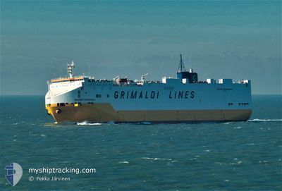
GRANDE SCANDINAVIA
Vehicles Carrier
Current Trip
| Time Travelled | 17 h, 12 mins |
|---|---|
| Remaining Time | --- |
| Distance Travelled | 142.55 nm |
| Remaining Distance | --- |
| AVG Speed | 16 Noeuds |
| MAX Speed | 16.7 Noeuds |
| AVG Wind | 7.8 knots |
| MAX Wind | 10 knots |
| MIN Temp | 18.6°C / 65.48°F |
| MAX Temp | 20.4°C / 68.72°F |
| Tirant d eau | 8.2 m |
| Position reçue | 8 h, 9 m depuis |
Current Position
| Longitude | 32.32595° |
|---|---|
| Latitude | 33.24071° |
| Etat | Under way using engine |
| Vitesse | 15.5 Noeuds |
| Parcours | 304° |
| Zone | Mediterranean Sea - Eastern Basin |
| Station | T-AIS |
| Position reçue | 8 h, 9 m depuis |
Info
Information
The current position of GRANDE SCANDINAVIA is in Mediterranean Sea - Eastern Basin with coordinates 33.24071° / 32.32595° as reported on 2024-04-19 00:39 by AIS to our vessel tracker app. The vessel's current speed is 15.5 Noeuds and is heading at the port of IZMIT. The estimated time of arrival as calculated by MyShipTracking vessel tracking app is 2024-04-20 23:00 LT
The vessel GRANDE SCANDINAVIA (IMO: 9220615, MMSI: 247018700) is a Vehicles Carrier that was built in 2001 ( 23 Age ). It's sailing under the flag of [IT] Italy.
In this page you can find informations about the vessels current position, last detected port calls, and current voyage information. If the vessels is not in coverage by AIS you will find the latest position.
The current position of GRANDE SCANDINAVIA is detected by our AIS receivers and we are not responsible for the reliability of the data. The last position was recorded while the vessel was in Coverage by the Ais receivers of our vessel tracking app.
The current draught of GRANDE SCANDINAVIA as reported by AIS is 8.2 meters
Weather
| Temperature | 18.6°C / 65.48°F |
|---|---|
| Wind Speed | 10 knots |
| Direction | 291° WNW |
| Pressure | 1012.8 hPa |
| Humidity | 81.5 % |
| Cloud Coverage | --- |
Featured Company
Last Port Calls
| Port | Arrival | Departure | Time In Port |
|---|---|---|---|
| 2024-04-17 21:12 | 2024-04-18 15:37 | 18 h | |
| 2024-04-13 15:32 | 2024-04-14 20:05 | 1 d | |
| 2024-04-04 09:56 | 2024-04-05 11:56 | 1 d | |
| 2024-03-30 08:15 | 2024-03-31 15:09 | 1 d | |
| 2024-03-28 14:12 | 2024-03-29 02:49 | 12 h | |
| 2024-03-26 19:48 | 2024-03-27 15:10 | 19 h | |
| 2024-03-25 03:08 | 2024-03-26 04:07 | 1 d | |
| 2024-03-19 02:01 | 2024-03-20 19:59 | 1 d | |
| 2024-03-18 11:45 | 2024-03-19 00:45 | 12 h | |
| 2024-03-13 11:01 | 2024-03-14 06:16 | 19 h |
Last Trips
| Origin | Departure | Destination | Arrival | Distance | |
|---|---|---|---|---|---|
| 2024-04-14 22:05 | 2024-04-18 00:12 | 1245.20 nm | |||
| 2024-04-05 12:56 | 2024-04-13 17:32 | 1542.25 nm | |||
| 2024-03-31 17:09 | 2024-04-04 10:56 | 1231.48 nm | |||
| 2024-03-29 03:49 | 2024-03-30 09:15 | 381.38 nm | |||
| 2024-03-27 16:10 | 2024-03-28 15:12 | 344.92 nm | |||
| 2024-03-26 05:07 | 2024-03-26 20:48 | 221.85 nm | |||
| 2024-03-20 20:59 | 2024-03-25 04:08 | 1631.41 nm | |||
| 2024-03-19 01:45 | 2024-03-19 03:01 | 17.26 nm | |||
| 2024-03-14 09:16 | 2024-03-18 12:45 | 1590.62 nm | |||
| 2024-03-13 00:58 | 2024-03-13 14:01 | 82.34 nm |
Events
| Heure | Evenement | Détails | Position/ Destination | Info |
|---|---|---|---|---|
| 2024-04-19 00:39 | Hors de la zone couverte |
33.24071 / 32.32595
Mediterranean Sea - Eastern Basin
ILASH>TRIZT
|
Vitesse: 15.5 kn Parcours: 304° |
|
| 2024-04-18 22:59 | Changement de zone | Cypriote part of the Mediterranean Sea - Eastern Basin Israeli part of the Mediterranean Sea - Eastern Basin |
32.97284 / 32.73283
Mediterranean Sea - Eastern Basin
ILASH>TRIZT
|
Vitesse: 15.4 kn Parcours: 311° |
| 2024-04-18 22:59 | Dans la zone couverte |
32.97284 / 32.73283
Mediterranean Sea - Eastern Basin
ILASH>TRIZT
|
Vitesse: 15.4 kn Parcours: 311° |
|
| 2024-04-18 16:21 | Hors de la zone couverte |
31.92186 / 34.44213
Mediterranean Sea - Eastern Basin
ILASH>TRIZT
|
Vitesse: 16.7 kn Parcours: 305° |
|
| 2024-04-18 16:07 | Changement d'ETA | 2024/04/20 23:00 2024/04/20 20:00 |
31.88610 / 34.50375
ILASH>TRIZT
|
Vitesse: 16.7 kn Parcours: 300° |
| 2024-04-18 16:07 | Etat Changé | Under way using engine Moored |
31.88490 / 34.50629
ILASH>TRIZT
|
Vitesse: 16.6 kn Parcours: 299° |
| 2024-04-18 15:37 | PORT DE DEPART |
|
31.85067 / 34.63979
ILASH>TRIZT
|
Vitesse: 9.1 kn Parcours: 351° |
| 2024-04-18 15:26 | Démarrage |
31.83055 / 34.63929
[IL] ASHDOD
|
Vitesse: 3.7 kn Parcours: 312° |
|
| 2024-04-18 14:20 | Tirant d'eau modifié | 8.2 8.3 |
31.83012 / 34.64137
[IL] ASHDOD
|
Vitesse: Parcours: 297° |
| 2024-04-18 14:20 | Changement d'ETA | 2024/04/20 20:00 2024/04/17 15:00 |
31.83012 / 34.64137
[IL] ASHDOD
|
Vitesse: Parcours: 297° |