
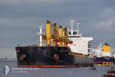
GOOD HEART
Cargo
Current Trip
| Time Travelled | 18 days |
|---|---|
| Remaining Time | --- |
| Distance Travelled | 4587.29 nm |
| Remaining Distance | --- |
| AVG Speed | 11 Noeuds |
| MAX Speed | 13.8 Noeuds |
| AVG Wind | 8.8 knots |
| MAX Wind | 19 knots |
| MIN Temp | 12.2°C / 53.96°F |
| MAX Temp | 30.1°C / 86.18°F |
| Tirant d eau | 11.4 m |
| Position reçue | 7 d depuis |
Current Position
| Longitude | 103.59187° |
|---|---|
| Latitude | 1.19734° |
| Etat | Under way using engine |
| Vitesse | 13.8 Noeuds |
| Parcours | 286.8° |
| Zone | Singapore Strait |
| Station | T-AIS |
| Position reçue | 7 d depuis |
Info
Information
The current position of GOOD HEART is in Singapore Strait with coordinates 1.19734° / 103.59187° as reported on 2024-04-11 11:19 by AIS to our vessel tracker app. The vessel's current speed is 13.8 Noeuds and is heading at the port of KLAIPEDA. The estimated time of arrival as calculated by MyShipTracking vessel tracking app is 2024-05-27 09:00 LT
The vessel GOOD HEART (IMO: 9669380, MMSI: 636021148) is a Cargo It's sailing under the flag of [LR] Liberia.
In this page you can find informations about the vessels current position, last detected port calls, and current voyage information. If the vessels is not in coverage by AIS you will find the latest position.
The current position of GOOD HEART is detected by our AIS receivers and we are not responsible for the reliability of the data. The last position was recorded while the vessel was in Coverage by the Ais receivers of our vessel tracking app.
The current draught of GOOD HEART as reported by AIS is 11.4 meters
Weather
| Temperature | 28°C / 82.4°F |
|---|---|
| Wind Speed | 14 knots |
| Direction | 128° SE |
| Pressure | 1008.9 hPa |
| Humidity | 79 % |
| Cloud Coverage | 27 % |
Featured Company
Most Visited Ports (Last year)
| Port | Arrivals | |
|---|---|---|
| 2 | ||
| 2 | ||
| 2 | ||
| 1 | ||
| 1 | ||
| 1 |
Events
| Heure | Evenement | Détails | Position/ Destination | Info |
|---|---|---|---|---|
| 2024-04-18 15:59 | Démarrage |
-6.95277 / 76.61832
LT KLJ
|
Vitesse: 4 kn Parcours: 231° |
|
| 2024-04-18 15:17 | Arret |
-6.94833 / 76.63333
LT KLJ
|
Vitesse: Parcours: -1° |
|
| 2024-04-11 11:26 | Etat Changé | Default Under way using engine |
1.20399 / 103.56731
LT KLJ
|
Vitesse: 13.8 kn Parcours: 286.8° |
| 2024-04-11 11:19 | Hors de la zone couverte |
1.19734 / 103.59187
Singapore Strait
|
Vitesse: 13.8 kn Parcours: 286.8° |
|
| 2024-04-11 11:05 | Etat Changé | Under way using engine Default |
1.18266 / 103.64397
LT KLJ
|
Vitesse: 13.2 kn Parcours: 288° |
| 2024-04-11 11:02 | Etat Changé | Default Under way using engine |
1.17975 / 103.65345
LT KLJ
|
Vitesse: 12.8 kn Parcours: 293° |
| 2024-04-11 10:50 | Changement de zone | Indonesian part of the Singapore Strait Singaporean part of the Singapore Strait |
1.16300 / 103.69308
Singapore Strait
|
Vitesse: 13 kn Parcours: 298.3° |
| 2024-04-11 09:55 | Changement d'ETA | 2024/05/27 09:00 2024/05/26 15:30 |
1.20611 / 103.87327
LT KLJ
|
Vitesse: 12.8 kn Parcours: 244.4° |
| 2024-04-11 09:01 | Etat Changé | Under way using engine At anchor |
1.28710 / 103.97695
LT KLJ
|
Vitesse: 5.3 kn Parcours: 147.5° |
| 2024-04-11 08:56 | Démarrage | 3.06 nm, South West of TANAH MERAH |
1.28958 / 103.97210
LT KLJ
|
Vitesse: 3.1 kn Parcours: 94° |