
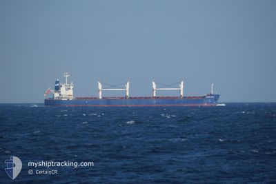
GLOBAL BRAVE
Bulk Carrier
Current Trip
| Time Travelled | 3 days |
|---|---|
| Remaining Time | --- |
| Distance Travelled | 715.25 nm |
| Remaining Distance | --- |
| AVG Speed | 12 Noeuds |
| MAX Speed | 14.6 Noeuds |
| AVG Wind | 15 knots |
| MAX Wind | 21 knots |
| MIN Temp | 22.7°C / 72.86°F |
| MAX Temp | 26.5°C / 79.7°F |
| Tirant d eau | 6.1 m |
| Position reçue | 5 m depuis |
Current Position
| Longitude | -93.60463° |
|---|---|
| Latitude | 29.37695° |
| Etat | At anchor |
| Vitesse | 0.1 Noeuds |
| Parcours | 102° |
| Zone | Gulf of Mexico |
| Station | T-AIS |
| Position reçue | 5 m depuis |
Info
Information
The current position of GLOBAL BRAVE is in Gulf of Mexico with coordinates 29.37695° / -93.60463° as reported on 2024-04-20 00:39 by AIS to our vessel tracker app. The vessel's current speed is 0.1 Noeuds and is heading at the port of PORT ARTHUR. The estimated time of arrival as calculated by MyShipTracking vessel tracking app is 2024-04-19 12:00 LT
The vessel GLOBAL BRAVE (IMO: 9434606, MMSI: 354440000) is a Bulk Carrier that was built in 2010 ( 14 Age ). It's sailing under the flag of [PA] Panama.
In this page you can find informations about the vessels current position, last detected port calls, and current voyage information. If the vessels is not in coverage by AIS you will find the latest position.
The current position of GLOBAL BRAVE is detected by our AIS receivers and we are not responsible for the reliability of the data. The last position was recorded while the vessel was in Coverage by the Ais receivers of our vessel tracking app.
The current draught of GLOBAL BRAVE as reported by AIS is 6.1 meters
Weather
| Temperature | 23.4°C / 74.12°F |
|---|---|
| Wind Speed | 9 knots |
| Direction | 141° SE |
| Pressure | 1015.4 hPa |
| Humidity | 90.8 % |
| Cloud Coverage | 57 % |
Featured Company
Last Port Calls
| Port | Arrival | Departure | Time In Port |
|---|---|---|---|
| 2024-04-13 23:54 | 2024-04-16 01:03 | 2 d | |
| 2024-04-07 13:16 | 2024-04-11 22:00 | 4 d | |
| 2024-04-02 01:51 | 2024-04-05 02:07 | 3 d | |
| 2024-02-10 02:26 | 2024-02-15 19:26 | 5 d |
Last Trips
| Origin | Departure | Destination | Arrival | Distance | |
|---|---|---|---|---|---|
| 2024-04-11 17:00 | 2024-04-13 18:54 | 248.49 nm | |||
| 2024-04-04 21:07 | 2024-04-07 08:16 | 728.08 nm | |||
| 2024-02-16 02:26 | 2024-04-01 20:51 | 9873.00 nm | |||
| 2024-01-26 20:59 | 2024-02-10 09:26 | 881.09 nm |
Events
| Heure | Evenement | Détails | Position/ Destination | Info |
|---|---|---|---|---|
| 2024-04-19 21:39 | Etat Changé | At anchor Default |
29.37715 / -93.60450
PORT ARTHUR,USA
|
Vitesse: 0.1 kn Parcours: 106° |
| 2024-04-19 21:36 | Etat Changé | Default At anchor |
29.37713 / -93.60455
PORT ARTHUR,USA
|
Vitesse: 0.1 kn Parcours: 106° |
| 2024-04-19 21:03 | Etat Changé | At anchor Default |
29.37715 / -93.60452
PORT ARTHUR,USA
|
Vitesse: Parcours: -1° |
| 2024-04-19 21:00 | Etat Changé | Default At anchor |
29.37667 / -93.60333
PORT ARTHUR,USA
|
Vitesse: Parcours: 105° |
| 2024-04-19 20:27 | Etat Changé | At anchor Default |
29.37708 / -93.60455
PORT ARTHUR,USA
|
Vitesse: Parcours: -1° |
| 2024-04-19 20:24 | Etat Changé | Default At anchor |
29.37667 / -93.60333
PORT ARTHUR,USA
|
Vitesse: 0.1 kn Parcours: 104° |
| 2024-04-19 19:15 | Etat Changé | At anchor Default |
29.37695 / -93.60458
PORT ARTHUR,USA
|
Vitesse: 0.1 kn Parcours: 108° |
| 2024-04-19 19:09 | Etat Changé | Default At anchor |
29.37710 / -93.60453
PORT ARTHUR,USA
|
Vitesse: 0.1 kn Parcours: 108° |
| 2024-04-19 18:27 | Etat Changé | At anchor Default |
29.37715 / -93.60450
PORT ARTHUR,USA
|
Vitesse: Parcours: -1° |
| 2024-04-19 18:24 | Etat Changé | Default At anchor |
29.37667 / -93.60333
PORT ARTHUR,USA
|
Vitesse: 0.1 kn Parcours: 113° |