
NQ MILLA
Oil/Chemical Tanker
Current Trip
| Time Travelled | 5 days |
|---|---|
| Remaining Time | --- |
| Distance Travelled | 1642.62 nm |
| Remaining Distance | 139.86 nm |
| AVG Speed | 12.4 Noeuds |
| MAX Speed | 17 Noeuds |
| AVG Wind | 15.2 knots |
| MAX Wind | 33 knots |
| MIN Temp | 9.5°C / 49.1°F |
| MAX Temp | 19.5°C / 67.1°F |
| Tirant d eau | 6.9 m |
| Position reçue | 1 d depuis |
Current Position
| Longitude | -12.79490° |
|---|---|
| Latitude | 36.48740° |
| Etat | Under way using engine |
| Vitesse | 12.2 Noeuds |
| Parcours | 194.5° |
| Zone | North Atlantic Ocean |
| Station | T-AIS |
| Position reçue | 1 d depuis |
Info
Information
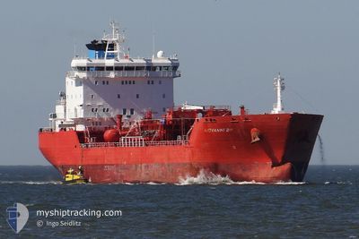
The current position of NQ MILLA is in North Atlantic Ocean with coordinates 36.48740° / -12.79490° as reported on 2024-04-18 12:06 by AIS to our vessel tracker app. The vessel's current speed is 12.2 Noeuds and is heading at the port of LAS PALMAS. The estimated time of arrival as calculated by MyShipTracking vessel tracking app is 2024-04-20 11:00 LT
The vessel NQ MILLA (IMO: 9261516, MMSI: 229545000) is a Oil/Chemical Tanker that was built in 2003 ( 21 Age ). It's sailing under the flag of [MT] Malta.
In this page you can find informations about the vessels current position, last detected port calls, and current voyage information. If the vessels is not in coverage by AIS you will find the latest position.
The current position of NQ MILLA is detected by our AIS receivers and we are not responsible for the reliability of the data. The last position was recorded while the vessel was in Coverage by the Ais receivers of our vessel tracking app.
The current draught of NQ MILLA as reported by AIS is 6.9 meters
Weather
| Temperature | 19.5°C / 67.1°F |
|---|---|
| Wind Speed | 10 knots |
| Direction | 349° N |
| Pressure | 1018.3 hPa |
| Humidity | 76.3 % |
| Cloud Coverage | 8 % |
Featured Company
Last Port Calls
| Port | Arrival | Departure | Time In Port |
|---|---|---|---|
| 2024-04-12 20:16 | 2024-04-14 02:42 | 1 d | |
| 2024-04-07 09:56 | 2024-04-08 22:43 | 1 d | |
| 2024-04-02 20:00 | 2024-04-03 18:48 | 22 h | |
| 2024-04-01 15:36 | 2024-04-02 08:54 | 17 h | |
| 2024-03-30 13:03 | 2024-03-31 18:27 | 1 d | |
| 2024-03-21 14:26 | 2024-03-21 15:04 | 37 m | |
| 2024-03-14 15:04 | 2024-03-16 20:02 | 2 d | |
| 2024-02-28 22:58 | 2024-03-01 00:42 | 1 d | |
| 2024-02-21 08:59 | 2024-02-24 10:19 | 3 d | |
| 2024-02-09 15:46 | 2024-02-09 21:52 | 6 h |
Last Trips
| Origin | Departure | Destination | Arrival | Distance | |
|---|---|---|---|---|---|
| 2024-04-08 23:43 | 2024-04-12 22:16 | 1164.19 nm | |||
| 2024-04-03 20:48 | 2024-04-07 10:56 | 1010.73 nm | |||
| 2024-04-02 10:54 | 2024-04-02 22:00 | 74.52 nm | |||
| 2024-03-31 20:27 | 2024-04-01 17:36 | 255.27 nm | |||
| 2024-03-21 16:04 | 2024-03-30 14:03 | 659.62 nm | |||
| 2024-03-16 21:02 | 2024-03-21 15:26 | 828.84 nm | |||
| 2024-03-01 00:42 | 2024-03-14 16:04 | 3707.49 nm | |||
| 2024-02-24 11:19 | 2024-02-28 22:58 | 1003.55 nm | |||
| 2024-02-09 21:52 | 2024-02-21 09:59 | 3299.64 nm | |||
| 2024-02-05 14:20 | 2024-02-09 15:46 | 916.43 nm |
Events
| Heure | Evenement | Détails | Position/ Destination | Info |
|---|---|---|---|---|
| 2024-04-18 12:25 | Etat Changé | Default Under way using engine |
36.42578 / -12.81639
ESLPA
|
Vitesse: 12.2 kn Parcours: 194.5° |
| 2024-04-18 12:06 | Hors de la zone couverte |
36.48740 / -12.79490
North Atlantic Ocean
ESLPA
|
Vitesse: 12.2 kn Parcours: 194.5° |
|
| 2024-04-18 12:00 | Etat Changé | Under way using engine Default |
36.50872 / -12.78782
ESLPA
|
Vitesse: 12.1 kn Parcours: 194° |
| 2024-04-18 11:49 | Dans la zone couverte |
36.50708 / -12.78837
North Atlantic Ocean
ESLPA
|
Vitesse: 12.3 kn Parcours: 195.2° |
|
| 2024-04-18 10:28 | Etat Changé | Default Under way using engine |
36.81094 / -12.69482
ESLPA
|
Vitesse: 12.2 kn Parcours: 193.2° |
| 2024-04-18 10:27 | Hors de la zone couverte |
36.81488 / -12.69369
North Atlantic Ocean
ESLPA
|
Vitesse: 12.2 kn Parcours: 193.2° |
|
| 2024-04-18 10:24 | Etat Changé | Under way using engine Default |
36.82478 / -12.69084
ESLPA
|
Vitesse: 12.4 kn Parcours: 196° |
| 2024-04-18 10:24 | Dans la zone couverte |
36.81758 / -12.69290
North Atlantic Ocean
ESLPA
|
Vitesse: 12.2 kn Parcours: 192.5° |
|
| 2024-04-18 07:11 | Etat Changé | Default Under way using engine |
37.45150 / -12.49571
ESLPA
|
Vitesse: 12.4 kn Parcours: 192.5° |
| 2024-04-18 07:08 | Hors de la zone couverte |
37.46160 / -12.49320
North Atlantic Ocean
ESLPA
|
Vitesse: 12.4 kn Parcours: 192.5° |