
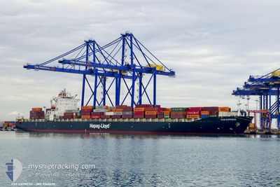
FOS EXPRESS
Container Ship
Current Trip
| Time Travelled | 13 days |
|---|---|
| Remaining Time | 3 days |
| Distance Travelled | 4127.33 nm |
| Remaining Distance | 1136.18 nm |
| AVG Speed | 12.6 Noeuds |
| MAX Speed | 19.4 Noeuds |
| AVG Wind | 14.4 knots |
| MAX Wind | 30.3 knots |
| MIN Temp | 12°C / 53.6°F |
| MAX Temp | 22.4°C / 72.32°F |
| Tirant d eau | 11.8 m |
| Position reçue | 1 h, 42 m depuis |
Current Position
| Longitude | -77.87092° |
|---|---|
| Latitude | 26.03317° |
| Etat | Under way using engine |
| Vitesse | 12.7 Noeuds |
| Parcours | 300.7° |
| Zone | North Atlantic Ocean |
| Station | T-AIS |
| Position reçue | 1 h, 42 m depuis |
Info
Information
The current position of FOS EXPRESS is in North Atlantic Ocean with coordinates 26.03317° / -77.87092° as reported on 2024-04-25 17:17 by AIS to our vessel tracker app. The vessel's current speed is 12.7 Noeuds and is heading at the port of VERACRUZ. The estimated time of arrival as calculated by MyShipTracking vessel tracking app is 2024-04-29 11:58 LT
The vessel FOS EXPRESS (IMO: 9348699, MMSI: 636020258) is a Container Ship that was built in 2008 ( 16 Age ). It's sailing under the flag of [LR] Liberia.
In this page you can find informations about the vessels current position, last detected port calls, and current voyage information. If the vessels is not in coverage by AIS you will find the latest position.
The current position of FOS EXPRESS is detected by our AIS receivers and we are not responsible for the reliability of the data. The last position was recorded while the vessel was in Coverage by the Ais receivers of our vessel tracking app.
The current draught of FOS EXPRESS as reported by AIS is 11.8 meters
Weather
| Temperature | 22.5°C / 72.5°F |
|---|---|
| Wind Speed | 12 knots |
| Direction | 82° E |
| Pressure | 1020.7 hPa |
| Humidity | 68.2 % |
| Cloud Coverage | 93 % |
Featured Company
Last Port Calls
| Port | Arrival | Departure | Time In Port |
|---|---|---|---|
| 2024-04-10 14:01 | 2024-04-11 23:57 | 1 d | |
| 2024-04-09 04:33 | 2024-04-10 01:05 | 20 h | |
| 2024-04-04 16:53 | 2024-04-07 11:50 | 2 d | |
| 2024-04-02 11:28 | 2024-04-03 21:39 | 1 d | |
| 2024-03-30 01:25 | 2024-03-31 01:44 | 1 d | |
| 2024-03-11 03:36 | 2024-03-13 11:49 | 2 d | |
| 2024-03-07 14:53 | 2024-03-08 19:43 | 1 d | |
| 2024-02-19 09:15 | 2024-02-20 13:34 | 1 d | |
| 2024-02-18 03:09 | 2024-02-18 18:30 | 15 h | |
| 2024-02-15 06:41 | 2024-02-17 07:15 | 2 d |
Last Trips
| Origin | Departure | Destination | Arrival | Distance | |
|---|---|---|---|---|---|
| 2024-04-10 03:05 | 2024-04-10 16:01 | 165.79 nm | |||
| 2024-04-07 13:50 | 2024-04-09 06:33 | 366.62 nm | |||
| 2024-04-03 23:39 | 2024-04-04 18:53 | 103.51 nm | |||
| 2024-03-31 03:44 | 2024-04-02 13:28 | 574.77 nm | |||
| 2024-03-13 06:49 | 2024-03-30 02:25 | 5228.43 nm | |||
| 2024-03-08 13:43 | 2024-03-10 22:36 | 503.42 nm | |||
| 2024-02-20 14:34 | 2024-03-07 08:53 | 5376.07 nm | |||
| 2024-02-18 19:30 | 2024-02-19 10:15 | 163.36 nm | |||
| 2024-02-17 08:15 | 2024-02-18 04:09 | 362.42 nm | |||
| 2024-02-14 17:23 | 2024-02-15 07:41 | 94.23 nm |
Events
| Heure | Evenement | Détails | Position/ Destination | Info |
|---|---|---|---|---|
| 2024-04-25 17:17 | Hors de la zone couverte |
26.03317 / -77.87092
North Atlantic Ocean
MXVER
|
Vitesse: 12.7 kn Parcours: 300.7° |
|
| 2024-04-25 15:30 | Dans la zone couverte |
25.85743 / -77.50183
North Atlantic Ocean
MXVER
|
Vitesse: 13 kn Parcours: 288.9° |
|
| 2024-04-25 12:55 | Hors de la zone couverte |
25.77228 / -76.90383
North Atlantic Ocean
MXVER
|
Vitesse: 18.7 kn Parcours: 252.7° |
|
| 2024-04-25 12:55 | Detecté en mer | Bahamas part of the North Atlantic Ocean |
25.77228 / -76.90383
North Atlantic Ocean
MXVER
|
Vitesse: 18.7 kn Parcours: 252.7° |
| 2024-04-25 12:55 | Dans la zone couverte |
25.77228 / -76.90383
North Atlantic Ocean
MXVER
|
Vitesse: 18.7 kn Parcours: 252.7° |
|
| 2024-04-16 16:26 | Etat Changé | Default Under way using engine |
36.68777 / -26.67274
MXVER
|
Vitesse: 12.4 kn Parcours: 265.6° |
| 2024-04-16 15:38 | Etat Changé | Under way using engine Default |
36.69776 / -26.46934
MXVER
|
Vitesse: 12.1 kn Parcours: 263° |
| 2024-04-16 15:38 | Dans la zone couverte |
36.69776 / -26.46934
North Atlantic Ocean
MXVER
|
Vitesse: 12.4 kn Parcours: 265.6° |
|
| 2024-04-16 15:38 | Hors de la zone couverte |
36.69776 / -26.46934
North Atlantic Ocean
MXVER
|
Vitesse: 12.4 kn Parcours: 265.6° |
|
| 2024-04-16 14:04 | Hors de la zone couverte |
36.71945 / -26.07340
North Atlantic Ocean
MXVER
|
Vitesse: 12.2 kn Parcours: 266.4° |