
FLOTTANT
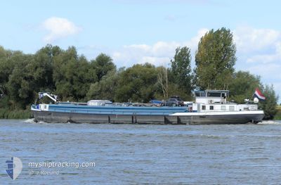
Tanker
Current Trip
| Trip Time | 1 day |
|---|---|
| Trip Distance | 78.46 nm |
| AVG Speed | 8.8 Noeuds |
| MAX Speed | 10.8 Noeuds |
| Tirant d eau | 0.3 m |
| AVG Wind | 8.5 knots |
| MAX Wind | 17.8 knots |
| MIN Temp | 3°C / 37.4°F |
| MAX Temp | 7.6°C / 45.68°F |
| Position reçue | 2 m depuis |
Current Position
| Longitude | 5.82307° |
|---|---|
| Latitude | 51.84882° |
| Etat | Moored |
| Vitesse | |
| Parcours | --- |
| Zone | North Sea |
| Station | T-AIS |
| Position reçue | 2 m depuis |
Info
Information
The current position of FLOTTANT is in North Sea with coordinates 51.84882° / 5.82307° as reported on 2024-04-18 00:35 by AIS to our vessel tracker app. The vessel's current speed is 0 Noeuds and is currently inside the port of NIJMEGEN.
The vessel FLOTTANT (MMSI: 244008902) is a Tanker It's sailing under the flag of [NL] Netherlands.
In this page you can find informations about the vessels current position, last detected port calls, and current voyage information. If the vessels is not in coverage by AIS you will find the latest position.
The current position of FLOTTANT is detected by our AIS receivers and we are not responsible for the reliability of the data. The last position was recorded while the vessel was in Coverage by the Ais receivers of our vessel tracking app.
The current draught of FLOTTANT as reported by AIS is 0.3 meters
Weather
| Temperature | 4.3°C / 39.74°F |
|---|---|
| Wind Speed | 6 knots |
| Direction | 21° NNE |
| Pressure | 1014.6 hPa |
| Humidity | 93.5 % |
| Cloud Coverage | 100 % |
Featured Company
Last Port Calls
| Port | Arrival | Departure | Time In Port |
|---|---|---|---|
| 2024-04-17 08:04 | |||
| 2024-04-15 16:30 | 2024-04-16 05:05 | 12 h | |
| 2024-04-15 12:13 | 2024-04-15 12:21 | 7 m | |
| 2024-04-12 23:12 | 2024-04-14 08:58 | 1 d | |
| 2024-04-11 16:08 | 2024-04-12 05:02 | 12 h | |
| 2024-04-10 09:18 | 2024-04-10 14:48 | 5 h | |
| 2024-04-08 17:12 | 2024-04-09 04:28 | 11 h | |
| 2024-04-08 08:43 | 2024-04-08 09:04 | 20 m | |
| 2024-04-06 12:55 | 2024-04-07 09:15 | 20 h | |
| 2024-04-04 20:49 | 2024-04-05 05:10 | 8 h |
Most Visited Ports (Last year)
| Port | Arrivals | |
|---|---|---|
| 32 | ||
| 29 | ||
| 28 | ||
| 23 | ||
| 22 | ||
| 20 |
Last Trips
| Origin | Departure | Destination | Arrival | Distance | |
|---|---|---|---|---|---|
| 2024-04-16 07:05 | 2024-04-17 10:04 | 78.46 nm | |||
| 2024-04-15 14:21 | 2024-04-15 18:30 | 0.58 nm | |||
| 2024-04-14 10:58 | 2024-04-15 14:13 | 75.70 nm | |||
| 2024-04-12 07:02 | 2024-04-13 01:12 | 76.16 nm | |||
| 2024-04-10 16:48 | 2024-04-11 18:08 | 75.55 nm | |||
| 2024-04-09 06:28 | 2024-04-10 11:18 | 76.27 nm | |||
| 2024-04-08 11:04 | 2024-04-08 19:12 | 0.60 nm | |||
| 2024-04-07 11:15 | 2024-04-08 10:43 | 37.42 nm | |||
| 2024-04-05 07:10 | 2024-04-06 14:55 | 76.81 nm | |||
| 2024-04-04 13:15 | 2024-04-04 22:49 | 37.41 nm |
Events
| Heure | Evenement | Détails | Position/ Destination | Info |
|---|---|---|---|---|
| 2024-04-17 08:21 | Etat Changé | Moored Under way using engine |
51.84875 / 5.82317
[NL] NIJMEGEN
|
Vitesse: Parcours: 511° |
| 2024-04-17 08:12 | Arret |
51.84880 / 5.82312
[NL] NIJMEGEN
|
Vitesse: 0.2 kn Parcours: 511° |
|
| 2024-04-17 08:04 | Port d'arrivée |
|
51.84497 / 5.81649
[NL] NIJMEGEN
|
Vitesse: 3.4 kn Parcours: 143.2° |
| 2024-04-17 07:59 | Démarrage | 0.29 nm, North of NIJMEGEN |
51.85166 / 5.82112
2E KANAALHAVEN TE NI
|
Vitesse: 4.4 kn Parcours: 209.6° |
| 2024-04-17 07:48 | Arret | 0.38 nm, North of NIJMEGEN |
51.85335 / 5.82261
2E KANAALHAVEN TE NI
|
Vitesse: 0.3 kn Parcours: 511° |
| 2024-04-17 05:55 | Dans la zone couverte |
51.83157 / 6.19300
North Sea
2E KANAALHAVEN TE NI
|
Vitesse: 10.7 kn Parcours: 292.7° |
|
| 2024-04-17 03:50 | Hors de la zone couverte |
51.65868 / 6.58959
North Sea
2E KANAALHAVEN TE NI
|
Vitesse: 10.2 kn Parcours: 296.8° |
|
| 2024-04-17 03:49 | Dans la zone couverte |
51.65626 / 6.59535
North Sea
2E KANAALHAVEN TE NI
|
Vitesse: 10.3 kn Parcours: 310.7° |
|
| 2024-04-16 05:22 | Hors de la zone couverte |
51.66831 / 7.72009
North Sea
2E KANAALHAVEN TE NI
|
Vitesse: 4.9 kn Parcours: 238.4° |
|
| 2024-04-16 05:05 | PORT DE DEPART |
|
51.67559 / 7.75345
2E KANAALHAVEN TE NI
|
Vitesse: 4.1 kn Parcours: 252° |