
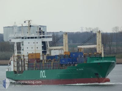
NCL SALTEN
Container Ship
Current Trip
| Time Travelled | 1 day |
|---|---|
| Remaining Time | 13 h, 43 mins |
| Distance Travelled | 495.02 nm |
| Remaining Distance | 263.61 nm |
| AVG Speed | 18.7 Noeuds |
| MAX Speed | 19.9 Noeuds |
| AVG Wind | 19.9 knots |
| MAX Wind | 28.3 knots |
| MIN Temp | 4.3°C / 39.74°F |
| MAX Temp | 6.6°C / 43.88°F |
| Tirant d eau | 5.9 m |
| Position reçue | 15 m depuis |
Current Position
| Longitude | 4.70417° |
|---|---|
| Latitude | 55.04383° |
| Etat | Under way using engine |
| Vitesse | 18.6 Noeuds |
| Parcours | 171° |
| Zone | North Sea |
| Station | T-AIS |
| Position reçue | 15 m depuis |
Info
Information
The current position of NCL SALTEN is in North Sea with coordinates 55.04383° / 4.70417° as reported on 2024-04-24 17:27 by AIS to our vessel tracker app. The vessel's current speed is 18.6 Noeuds and is heading at the port of ANTWERP. The estimated time of arrival as calculated by MyShipTracking vessel tracking app is 2024-04-25 07:26 LT
The vessel NCL SALTEN (IMO: 9252773, MMSI: 209762000) is a Container Ship that was built in 2002 ( 22 Age ). It's sailing under the flag of [CY] Cyprus.
In this page you can find informations about the vessels current position, last detected port calls, and current voyage information. If the vessels is not in coverage by AIS you will find the latest position.
The current position of NCL SALTEN is detected by our AIS receivers and we are not responsible for the reliability of the data. The last position was recorded while the vessel was in Coverage by the Ais receivers of our vessel tracking app.
The current draught of NCL SALTEN as reported by AIS is 5.9 meters
Weather
| Temperature | 6.6°C / 43.88°F |
|---|---|
| Wind Speed | 18 knots |
| Direction | 354° N |
| Pressure | 1008.7 hPa |
| Humidity | 70.7 % |
| Cloud Coverage | 48 % |
Featured Company
Last Port Calls
| Port | Arrival | Departure | Time In Port |
|---|---|---|---|
| 2024-04-13 07:41 | 2024-04-23 14:05 | 10 d | |
| 2024-04-12 22:55 | 2024-04-13 02:15 | 3 h | |
| 2024-04-12 15:01 | 2024-04-12 16:23 | 1 h | |
| 2024-04-12 03:21 | 2024-04-12 10:20 | 6 h | |
| 2024-04-11 23:41 | 2024-04-12 01:42 | 2 h | |
| 2024-04-10 16:01 | 2024-04-10 21:31 | 5 h | |
| 2024-04-10 04:27 | 2024-04-10 15:58 | 11 h | |
| 2024-04-09 02:09 | 2024-04-10 01:17 | 23 h | |
| 2024-04-08 11:06 | 2024-04-08 23:32 | 12 h | |
| 2024-04-07 14:03 | 2024-04-08 09:23 | 19 h |
Last Trips
| Origin | Departure | Destination | Arrival | Distance | |
|---|---|---|---|---|---|
| 2024-04-13 04:15 | 2024-04-13 09:41 | 92.41 nm | |||
| 2024-04-12 18:23 | 2024-04-13 00:55 | 112.75 nm | |||
| 2024-04-12 12:20 | 2024-04-12 17:01 | 77.17 nm | |||
| 2024-04-12 03:42 | 2024-04-12 05:21 | 27.44 nm | |||
| 2024-04-10 23:31 | 2024-04-12 01:41 | 437.55 nm | |||
| 2024-04-10 17:58 | 2024-04-10 18:01 | 0.78 nm | |||
| 2024-04-10 03:17 | 2024-04-10 06:27 | 33.20 nm | |||
| 2024-04-09 01:32 | 2024-04-09 04:09 | 23.85 nm | |||
| 2024-04-08 11:23 | 2024-04-08 13:06 | 16.48 nm | |||
| 2024-04-06 11:44 | 2024-04-07 16:03 | 441.95 nm |
Events
| Heure | Evenement | Détails | Position/ Destination | Info |
|---|---|---|---|---|
| 2024-04-24 17:05 | Changement de zone | Dutch part of the North Sea German part of the North Sea |
55.16083 / 4.67283
North Sea
BEANR
|
Vitesse: 19.2 kn Parcours: 175° |
| 2024-04-24 15:56 | Changement de zone | German part of the North Sea Danish part of the North Sea |
55.51900 / 4.58400
North Sea
BEANR
|
Vitesse: 19 kn Parcours: 168° |
| 2024-04-24 14:28 | Changement de zone | Danish part of the North Sea Norwegian part of the North Sea |
55.97767 / 4.48717
North Sea
BEANR
|
Vitesse: 19.1 kn Parcours: 176° |
| 2024-04-24 14:28 | Etat Changé | Under way using engine Default |
55.97767 / 4.48717
BEANR
|
Vitesse: 19.4 kn Parcours: 177° |
| 2024-04-24 14:19 | Dans la zone couverte |
55.97767 / 4.48717
North Sea
BEANR
|
Vitesse: 19.1 kn Parcours: 176° |
|
| 2024-04-24 09:16 | Etat Changé | Default Under way using engine |
57.63867 / 4.26200
BEANR
|
Vitesse: 19.2 kn Parcours: 175° |
| 2024-04-24 09:00 | Hors de la zone couverte |
57.71850 / 4.25250
North Sea
BEANR
|
Vitesse: 19.2 kn Parcours: 175° |
|
| 2024-04-23 22:27 | Changement de zone | Norwegian part of the North Sea Norwegian part of the Norwegian Sea |
60.99533 / 4.06233
North Sea
BEANR
|
Vitesse: 18.3 kn Parcours: 173° |
| 2024-04-23 15:27 | Démarrage | 1.75 nm, North East of ALESUND |
62.48550 / 6.19650
BEANR
|
Vitesse: 9 kn Parcours: 317° |
| 2024-04-23 15:16 | Tirant d'eau modifié | 5.9 6 |
62.48117 / 6.19317
BEANR
|
Vitesse: Parcours: 27° |