
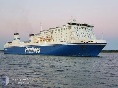
FINNSTAR
Ro-Ro/Passenger Ship
Current Trip
| Time Travelled | 1 day |
|---|---|
| Remaining Time | 1 h, 4 mins |
| Distance Travelled | 593.53 nm |
| Remaining Distance | 25.55 nm |
| AVG Speed | 21.7 Noeuds |
| MAX Speed | 23.3 Noeuds |
| AVG Wind | 14.9 knots |
| MAX Wind | 25.1 knots |
| MIN Temp | --- |
| MAX Temp | 7.7°C / 45.86°F |
| Tirant d eau | 7.1 m |
| Position reçue | Maintenant |
Current Position
| Longitude | 11.37786° |
|---|---|
| Latitude | 54.20468° |
| Etat | Under way using engine |
| Vitesse | 20.1 Noeuds |
| Parcours | 238.1° |
| Zone | Baltic Sea |
| Station | T-AIS |
| Position reçue | Maintenant |
Info
Information
The current position of FINNSTAR is in Baltic Sea with coordinates 54.20468° / 11.37786° as reported on 2024-04-23 18:35 by AIS to our vessel tracker app. The vessel's current speed is 20.1 Noeuds and is heading at the port of TRAVEMUNDE. The estimated time of arrival as calculated by MyShipTracking vessel tracking app is 2024-04-23 19:40 LT
The vessel FINNSTAR (IMO: 9319442, MMSI: 230981000) is a Ro-Ro/Passenger Ship that was built in 2006 ( 18 Age ). It's sailing under the flag of [FI] Finland.
In this page you can find informations about the vessels current position, last detected port calls, and current voyage information. If the vessels is not in coverage by AIS you will find the latest position.
The current position of FINNSTAR is detected by our AIS receivers and we are not responsible for the reliability of the data. The last position was recorded while the vessel was in Coverage by the Ais receivers of our vessel tracking app.
The current draught of FINNSTAR as reported by AIS is 7.1 meters
Weather
| Temperature | 7.7°C / 45.86°F |
|---|---|
| Wind Speed | 15 knots |
| Direction | 210° SSW |
| Pressure | 1011.2 hPa |
| Humidity | 65.3 % |
| Cloud Coverage | 100 % |
Featured Company
Last Port Calls
| Port | Arrival | Departure | Time In Port |
|---|---|---|---|
| 2024-04-22 08:27 | 2024-04-22 15:31 | 7 h | |
| 2024-04-20 18:43 | 2024-04-21 03:04 | 8 h | |
| 2024-04-19 06:50 | 2024-04-19 13:06 | 6 h | |
| 2024-04-17 18:24 | 2024-04-18 01:58 | 7 h | |
| 2024-04-16 06:50 | 2024-04-16 12:14 | 5 h | |
| 2024-04-14 18:28 | 2024-04-15 01:25 | 6 h | |
| 2024-04-13 06:50 | 2024-04-13 12:58 | 6 h | |
| 2024-04-11 18:29 | 2024-04-12 01:38 | 7 h | |
| 2024-04-10 06:48 | 2024-04-10 12:22 | 5 h | |
| 2024-04-08 18:25 | 2024-04-09 00:44 | 6 h |
Most Visited Ports (Last year)
| Port | Arrivals | |
|---|---|---|
| 109 | ||
| 108 | ||
| 1 | ||
| 1 |
Last Trips
| Origin | Departure | Destination | Arrival | Distance | |
|---|---|---|---|---|---|
| 2024-04-21 05:04 | 2024-04-22 11:27 | 617.75 nm | |||
| 2024-04-19 16:06 | 2024-04-20 20:43 | 618.42 nm | |||
| 2024-04-18 03:58 | 2024-04-19 09:50 | 614.94 nm | |||
| 2024-04-16 15:14 | 2024-04-17 20:24 | 618.12 nm | |||
| 2024-04-15 03:25 | 2024-04-16 09:50 | 618.19 nm | |||
| 2024-04-13 15:58 | 2024-04-14 20:28 | 618.58 nm | |||
| 2024-04-12 03:38 | 2024-04-13 09:50 | 617.81 nm | |||
| 2024-04-10 15:22 | 2024-04-11 20:29 | 618.43 nm | |||
| 2024-04-09 02:44 | 2024-04-10 09:48 | 618.41 nm | |||
| 2024-04-07 15:10 | 2024-04-08 20:25 | 618.05 nm |
Events
| Heure | Evenement | Détails | Position/ Destination | Info |
|---|---|---|---|---|
| 2024-04-23 17:43 | Changement de zone | German part of the Baltic Sea Danish part of the Baltic Sea |
54.36209 / 11.81479
Baltic Sea
DE TRV
|
Vitesse: 21.3 kn Parcours: 238.7° |
| 2024-04-23 17:07 | Changement de zone | Danish part of the Baltic Sea German part of the Baltic Sea |
54.44066 / 12.14303
Baltic Sea
DE TRV
|
Vitesse: 20.9 kn Parcours: 261.2° |
| 2024-04-23 16:55 | Changement de zone | German part of the Baltic Sea Danish part of the Baltic Sea |
54.49404 / 12.21349
Baltic Sea
DE TRV
|
Vitesse: 21.3 kn Parcours: 196.7° |
| 2024-04-23 16:19 | Changement de zone | Danish part of the Baltic Sea German part of the Baltic Sea |
54.65955 / 12.40501
Baltic Sea
DE TRV
|
Vitesse: 20.5 kn Parcours: 241.1° |
| 2024-04-23 15:58 | Changement de zone | German part of the Baltic Sea Danish part of the Baltic Sea |
54.72119 / 12.58018
Baltic Sea
DE TRV
|
Vitesse: 20.2 kn Parcours: 236.4° |
| 2024-04-23 15:16 | Changement de zone | Danish part of the Baltic Sea German part of the Baltic Sea |
54.83727 / 12.93808
Baltic Sea
DE TRV
|
Vitesse: 21.1 kn Parcours: 245.4° |
| 2024-04-23 13:55 | Changement de zone | German part of the Baltic Sea Swedish part of the Baltic Sea |
55.01598 / 13.73789
Baltic Sea
DE TRV
|
Vitesse: 22.2 kn Parcours: 250.5° |
| 2024-04-23 12:02 | Changement de zone | Swedish part of the Baltic Sea Danish part of the Kattegat |
55.44512 / 14.65516
Baltic Sea
DE TRV
|
Vitesse: 22.1 kn Parcours: 237.2° |
| 2024-04-23 11:02 | Changement de zone | Danish part of the Kattegat Swedish part of the Baltic Sea |
55.64917 / 15.20672
Kattegat
DE TRV
|
Vitesse: 22.5 kn Parcours: 238.3° |
| 2024-04-23 08:01 | Etat Changé | Under way using engine Default |
56.23931 / 16.90046
DE TRV
|
Vitesse: 22.1 kn Parcours: 233° |