
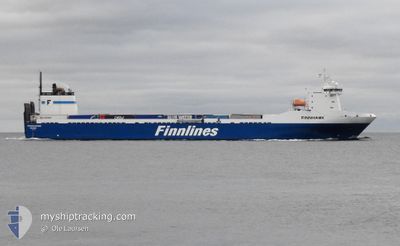
FINNHAWK
Ro-Ro Cargo
Current Trip
| Time Travelled | 1 day |
|---|---|
| Remaining Time | 1 day |
| Distance Travelled | 510.02 nm |
| Remaining Distance | 651.77 nm |
| AVG Speed | 18.1 Noeuds |
| MAX Speed | 19.7 Noeuds |
| AVG Wind | 13.2 knots |
| MAX Wind | 24 knots |
| MIN Temp | -0.4°C / 31.28°F |
| MAX Temp | 3.6°C / 38.48°F |
| Tirant d eau | 7 m |
| Position reçue | 1 m depuis |
Current Position
| Longitude | 13.14740° |
|---|---|
| Latitude | 55.25154° |
| Etat | Under way using engine |
| Vitesse | 16.8 Noeuds |
| Parcours | 275.5° |
| Zone | Baltic Sea |
| Station | T-AIS |
| Position reçue | 1 m depuis |
Info
Information
The current position of FINNHAWK is in Baltic Sea with coordinates 55.25154° / 13.14740° as reported on 2024-04-19 19:10 by AIS to our vessel tracker app. The vessel's current speed is 16.8 Noeuds and is heading at the port of HULL. The estimated time of arrival as calculated by MyShipTracking vessel tracking app is 2024-04-21 08:52 LT
The vessel FINNHAWK (IMO: 9207895, MMSI: 230007000) is a Ro-Ro Cargo that was built in 2001 ( 23 Age ). It's sailing under the flag of [FI] Finland.
In this page you can find informations about the vessels current position, last detected port calls, and current voyage information. If the vessels is not in coverage by AIS you will find the latest position.
The current position of FINNHAWK is detected by our AIS receivers and we are not responsible for the reliability of the data. The last position was recorded while the vessel was in Coverage by the Ais receivers of our vessel tracking app.
The current draught of FINNHAWK as reported by AIS is 7 meters
Weather
| Temperature | 3.4°C / 38.12°F |
|---|---|
| Wind Speed | 23 knots |
| Direction | 64° ENE |
| Pressure | 1004.9 hPa |
| Humidity | 88.3 % |
| Cloud Coverage | 100 % |
Featured Company
Last Port Calls
| Port | Arrival | Departure | Time In Port |
|---|---|---|---|
| 2024-04-17 12:11 | 2024-04-18 15:32 | 1 d | |
| 2024-04-14 09:35 | 2024-04-14 20:36 | 11 h | |
| 2024-04-09 03:02 | 2024-04-11 11:08 | 2 d | |
| 2024-03-14 08:20 | 2024-04-06 06:06 | 22 d | |
| 2024-03-10 08:20 | 2024-03-11 09:16 | 1 d | |
| 2024-03-07 03:03 | 2024-03-07 16:49 | 13 h | |
| 2024-03-02 15:08 | 2024-03-03 20:10 | 1 d | |
| 2024-02-28 10:48 | 2024-02-28 23:18 | 12 h | |
| 2024-02-24 17:45 | 2024-02-25 10:23 | 16 h | |
| 2024-02-21 11:54 | 2024-02-22 02:06 | 14 h |
Most Visited Ports (Last year)
| Port | Arrivals | |
|---|---|---|
| 44 | ||
| 43 | ||
| 1 | ||
| 1 | ||
| 1 |
Last Trips
| Origin | Departure | Destination | Arrival | Distance | |
|---|---|---|---|---|---|
| 2024-04-14 21:36 | 2024-04-17 15:11 | 1172.54 nm | |||
| 2024-04-11 14:08 | 2024-04-14 10:35 | 1189.57 nm | |||
| 2024-04-06 07:06 | 2024-04-09 06:02 | 1182.01 nm | |||
| 2024-03-11 11:16 | 2024-03-14 08:20 | 1174.71 nm | |||
| 2024-03-07 16:49 | 2024-03-10 10:20 | 1173.53 nm | |||
| 2024-03-03 22:10 | 2024-03-07 03:03 | 1184.69 nm | |||
| 2024-02-28 23:18 | 2024-03-02 17:08 | 1175.73 nm | |||
| 2024-02-25 12:23 | 2024-02-28 10:48 | 1174.92 nm | |||
| 2024-02-22 02:06 | 2024-02-24 19:45 | 1173.38 nm | |||
| 2024-02-18 13:29 | 2024-02-21 11:54 | 1173.31 nm |
Events
| Heure | Evenement | Détails | Position/ Destination | Info |
|---|---|---|---|---|
| 2024-04-19 15:50 | Changement de zone | Swedish part of the Baltic Sea Danish part of the Kattegat |
55.45526 / 14.67873
Baltic Sea
HULL
|
Vitesse: 17.5 kn Parcours: 245.9° |
| 2024-04-19 14:35 | Changement de zone | Danish part of the Kattegat Swedish part of the Baltic Sea |
55.63826 / 15.23222
Kattegat
HULL
|
Vitesse: 17.7 kn Parcours: 237.7° |
| 2024-04-19 11:22 | Changement de zone | Swedish part of the Baltic Sea Estonian part of the Baltic Sea |
56.12360 / 16.65631
Baltic Sea
HULL
|
Vitesse: 17.5 kn Parcours: 237.9° |
| 2024-04-19 11:21 | Dans la zone couverte |
56.12360 / 16.65631
Baltic Sea
HULL
|
Vitesse: 17.5 kn Parcours: 237.9° |
|
| 2024-04-18 21:52 | Hors de la zone couverte |
59.28000 / 21.92073
Baltic Sea
HULL
|
Vitesse: 19.5 kn Parcours: 230.8° |
|
| 2024-04-18 21:25 | Changement de zone | Estonian part of the Baltic Sea Finnish part of the Baltic Sea |
59.37466 / 22.14475
Baltic Sea
HULL
|
Vitesse: 19.5 kn Parcours: 229.7° |
| 2024-04-18 19:47 | Changement de zone | Finnish part of the Baltic Sea Finnish part of the Gulf of Finland |
59.59494 / 23.08537
Baltic Sea
HULL
|
Vitesse: 19.5 kn Parcours: 250.9° |
| 2024-04-18 19:19 | Changement d'ETA | 2024/04/21 08:00 2024/04/21 10:00 |
59.64425 / 23.36779
HULL
|
Vitesse: 19.6 kn Parcours: 251.2° |
| 2024-04-18 15:42 | Etat Changé | Under way using engine Moored |
60.18821 / 25.21944
HULL
|
Vitesse: 11.9 kn Parcours: 192.4° |
| 2024-04-18 15:32 | PORT DE DEPART |
|
60.21081 / 25.20975
HULL
|
Vitesse: 8.5 kn Parcours: 154° |