
FIAT VOLUNTAS
Cargo
Current Trip
000000
| Time Travelled | 11 h, 37 mins |
|---|---|
| Remaining Time | --- |
| Distance Travelled | 60.78 nm |
| Remaining Distance | --- |
| AVG Speed | 6.9 Noeuds |
| MAX Speed | 9.6 Noeuds |
| AVG Wind | 10.2 knots |
| MAX Wind | 13 knots |
| MIN Temp | 5.2°C / 41.36°F |
| MAX Temp | 10.6°C / 51.08°F |
| Tirant d eau | 0.3 m |
| Position reçue | 1 m depuis |
Current Position
| Longitude | 5.13425° |
|---|---|
| Latitude | 51.99282° |
| Etat | Under way using engine |
| Vitesse | |
| Parcours | --- |
| Zone | North Sea |
| Station | T-AIS |
| Position reçue | 1 m depuis |
Info
Information
The current position of FIAT VOLUNTAS is in North Sea with coordinates 51.99282° / 5.13425° as reported on 2024-04-25 18:13 by AIS to our vessel tracker app. The vessel's current speed is 0 Noeuds
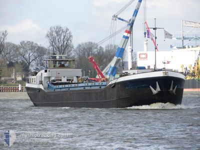
The vessel FIAT VOLUNTAS (MMSI: 244710341) is a Cargo It's sailing under the flag of [NL] Netherlands.
In this page you can find informations about the vessels current position, last detected port calls, and current voyage information. If the vessels is not in coverage by AIS you will find the latest position.
The current position of FIAT VOLUNTAS is detected by our AIS receivers and we are not responsible for the reliability of the data. The last position was recorded while the vessel was in Coverage by the Ais receivers of our vessel tracking app.
The current draught of FIAT VOLUNTAS as reported by AIS is 0.3 meters
Weather
| Temperature | 6.2°C / 43.16°F |
|---|---|
| Wind Speed | 13 knots |
| Direction | 212° SSW |
| Pressure | 1001.2 hPa |
| Humidity | 93.1 % |
| Cloud Coverage | 100 % |
Featured Company
Last Port Calls
| Port | Arrival | Departure | Time In Port |
|---|---|---|---|
| 2024-04-24 19:23 | 2024-04-25 06:37 | 11 h | |
| 2024-04-19 12:22 | 2024-04-19 12:42 | 19 m | |
| 2024-04-16 19:31 | 2024-04-17 06:15 | 10 h | |
| 2024-02-27 13:19 | 2024-04-16 18:25 | ||
| 2024-02-27 08:12 | 2024-02-27 09:03 | 50 m | |
| 2024-02-21 08:42 | 2024-02-21 09:02 | 20 m | |
| 2024-02-20 21:36 | 2024-02-21 05:36 | 7 h | |
| 2024-02-20 09:30 | 2024-02-20 09:38 | 8 m | |
| 2024-02-19 15:33 | 2024-02-19 16:05 | 32 m | |
| 2024-02-16 13:34 | 2024-02-19 05:43 | 2 d |
Most Visited Ports (Last year)
| Port | Arrivals | |
|---|---|---|
| 23 | ||
| 16 | ||
| 15 | ||
| 13 | ||
| 12 | ||
| 10 |
Last Trips
| Origin | Departure | Destination | Arrival | Distance | |
|---|---|---|---|---|---|
| 2024-04-19 14:42 | 2024-04-24 21:23 | 186.26 nm | |||
| 2024-04-17 08:15 | 2024-04-19 14:22 | 139.30 nm | |||
| 2024-04-16 20:25 | 2024-04-16 21:31 | 7.83 nm | |||
| 2024-02-27 10:03 | 2024-02-27 14:19 | 49.68 nm | |||
| 2024-02-21 10:02 | 2024-02-27 09:12 | 157.13 nm | |||
| 2024-02-21 06:36 | 2024-02-21 09:42 | 1.17 nm | |||
| 2024-02-20 10:38 | 2024-02-20 22:36 | 52.36 nm | |||
| 2024-02-19 17:05 | 2024-02-20 10:30 | 1.57 nm | |||
| 2024-02-19 06:43 | 2024-02-19 16:33 | 52.60 nm | |||
| 2024-02-16 09:22 | 2024-02-16 14:34 | 31.94 nm |
Events
| Heure | Evenement | Détails | Position/ Destination | Info |
|---|---|---|---|---|
| 2024-04-25 18:08 | Arret | 1.36 nm, East of VIANEN |
51.99280 / 5.13427
000000
|
Vitesse: 0.2 kn Parcours: 511° |
| 2024-04-25 15:52 | Démarrage | 0.98 nm, North East of TIEL |
51.90196 / 5.45357
000000
|
Vitesse: 4 kn Parcours: 339° |
| 2024-04-25 15:34 | Arret | 0.9 nm, North East of TIEL |
51.90010 / 5.45479
000000
|
Vitesse: 0.2 kn Parcours: 511° |
| 2024-04-25 13:23 | Démarrage | 3.43 nm, North East of NIJMEGEN |
51.87387 / 5.90527
000000
|
Vitesse: 5 kn Parcours: 223.4° |
| 2024-04-25 13:21 | Etat Changé | Under way using engine Moored |
51.87569 / 5.90578
000000
|
Vitesse: 0.2 kn Parcours: 511° |
| 2024-04-25 11:44 | Etat Changé | Moored Under way using engine |
51.87587 / 5.90577
000000
|
Vitesse: Parcours: 511° |
| 2024-04-25 11:24 | Arret | 3.5 nm, North East of NIJMEGEN |
51.87574 / 5.90574
000000
|
Vitesse: 0.3 kn Parcours: 511° |
| 2024-04-25 07:14 | Démarrage | 0.61 nm, North East of ROSSUM |
51.79928 / 5.35595
000000
|
Vitesse: 6 kn Parcours: 320.4° |
| 2024-04-25 07:06 | Arret | 0.64 nm, East of ROSSUM |
51.79756 / 5.35820
000000
|
Vitesse: Parcours: 511° |
| 2024-04-25 06:37 | PORT DE DEPART |
|
51.77160 / 5.36102
000000
|
Vitesse: 4.4 kn Parcours: 69.7° |