
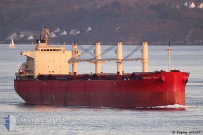
FEDERAL TIBER
Bulk Carrier
Current Trip
| Time Travelled | 23 days |
|---|---|
| Remaining Time | --- |
| Distance Travelled | 4635.67 nm |
| Remaining Distance | --- |
| AVG Speed | 12 Noeuds |
| MAX Speed | 15.3 Noeuds |
| AVG Wind | 8.8 knots |
| MAX Wind | 19 knots |
| MIN Temp | 11.8°C / 53.24°F |
| MAX Temp | 29.3°C / 84.74°F |
| Tirant d eau | 10.5 m |
| Position reçue | 5 h, 0 m depuis |
Current Position
| Longitude | -0.61115° |
|---|---|
| Latitude | 35.75783° |
| Etat | At anchor |
| Vitesse | |
| Parcours | 310° |
| Zone | Mediterranean Sea - Western Basin |
| Station | T-AIS |
| Position reçue | 5 h, 0 m depuis |
Info
Information
The current position of FEDERAL TIBER is in Mediterranean Sea - Western Basin with coordinates 35.75783° / -0.61115° as reported on 2024-04-25 12:17 by AIS to our vessel tracker app. The vessel's current speed is 0 Noeuds
The vessel FEDERAL TIBER (IMO: 9644483, MMSI: 538004747) is a Bulk Carrier that was built in 2013 ( 11 Age ). It's sailing under the flag of [MH] Marshall Is.
In this page you can find informations about the vessels current position, last detected port calls, and current voyage information. If the vessels is not in coverage by AIS you will find the latest position.
The current position of FEDERAL TIBER is detected by our AIS receivers and we are not responsible for the reliability of the data. The last position was recorded while the vessel was in Coverage by the Ais receivers of our vessel tracking app.
The current draught of FEDERAL TIBER as reported by AIS is 10.5 meters
Weather
| Temperature | 18°C / 64.4°F |
|---|---|
| Wind Speed | 6 knots |
| Direction | 312° NW |
| Pressure | 1008.1 hPa |
| Humidity | 50.5 % |
| Cloud Coverage | 100 % |
Featured Company
Events
| Heure | Evenement | Détails | Position/ Destination | Info |
|---|---|---|---|---|
| 2024-04-25 12:20 | Etat Changé | Default At anchor |
35.75784 / -.61118
DZORN
|
Vitesse: Parcours: 310° |
| 2024-04-25 12:17 | Hors de la zone couverte |
35.75783 / -.61115
Mediterranean Sea - Western Basin
|
Vitesse: Parcours: 213.8° |
|
| 2024-04-25 12:11 | Etat Changé | At anchor Default |
35.75786 / -.61115
DZORN
|
Vitesse: Parcours: 310° |
| 2024-04-25 11:50 | Etat Changé | Default At anchor |
35.75786 / -.61115
DZORN
|
Vitesse: 0.1 kn Parcours: 311° |
| 2024-04-25 11:41 | Etat Changé | At anchor Default |
35.75782 / -.61112
DZORN
|
Vitesse: 0.1 kn Parcours: 311° |
| 2024-04-25 11:35 | Etat Changé | Default At anchor |
35.75778 / -.61115
DZORN
|
Vitesse: Parcours: 310° |
| 2024-04-25 11:29 | Etat Changé | At anchor Default |
35.75781 / -.61125
DZORN
|
Vitesse: Parcours: 312° |
| 2024-04-25 11:08 | Etat Changé | Default At anchor |
35.75763 / -.61151
DZORN
|
Vitesse: 0.1 kn Parcours: 322° |
| 2024-04-25 10:59 | Etat Changé | At anchor Default |
35.75751 / -.61150
DZORN
|
Vitesse: 0.1 kn Parcours: 318° |
| 2024-04-25 10:44 | Etat Changé | Default At anchor |
35.75747 / -.61195
DZORN
|
Vitesse: Parcours: 334° |