
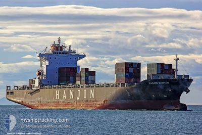
EXPRESS BRAZIL
Container Ship
Current Trip
| Time Travelled | 6 days |
|---|---|
| Remaining Time | --- |
| Distance Travelled | 2344.76 nm |
| Remaining Distance | --- |
| AVG Speed | 15.2 Noeuds |
| MAX Speed | 18.8 Noeuds |
| AVG Wind | 10.8 knots |
| MAX Wind | 20 knots |
| MIN Temp | 23.4°C / 74.12°F |
| MAX Temp | 28.9°C / 84.02°F |
| Tirant d eau | 10.9 m |
| Position reçue | 2 h, 12 m depuis |
Current Position
| Longitude | -51.13918° |
|---|---|
| Latitude | -0.36805° |
| Etat | Under way using engine |
| Vitesse | 14 Noeuds |
| Parcours | 230° |
| Zone | South Atlantic Ocean |
| Station | T-AIS |
| Position reçue | 2 h, 12 m depuis |
Info
Information
The current position of EXPRESS BRAZIL is in South Atlantic Ocean with coordinates -0.36805° / -51.13918° as reported on 2024-04-23 13:59 by AIS to our vessel tracker app. The vessel's current speed is 14 Noeuds and is heading at the port of MACAPA. The estimated time of arrival as calculated by MyShipTracking vessel tracking app is 2024-04-23 12:00 LT
The vessel EXPRESS BRAZIL (IMO: 9443023, MMSI: 248574000) is a Container Ship that was built in 2010 ( 14 Age ). It's sailing under the flag of [MT] Malta.
In this page you can find informations about the vessels current position, last detected port calls, and current voyage information. If the vessels is not in coverage by AIS you will find the latest position.
The current position of EXPRESS BRAZIL is detected by our AIS receivers and we are not responsible for the reliability of the data. The last position was recorded while the vessel was in Coverage by the Ais receivers of our vessel tracking app.
The current draught of EXPRESS BRAZIL as reported by AIS is 10.9 meters
Weather
| Temperature | 28°C / 82.4°F |
|---|---|
| Wind Speed | 5 knots |
| Direction | 93° E |
| Pressure | 1011.2 hPa |
| Humidity | 78.4 % |
| Cloud Coverage | 100 % |
Featured Company
Last Port Calls
| Port | Arrival | Departure | Time In Port |
|---|---|---|---|
| 2024-04-16 13:36 | 2024-04-17 12:59 | 23 h | |
| 2024-04-13 11:56 | 2024-04-14 04:36 | 16 h | |
| 2024-04-11 00:17 | 2024-04-11 16:24 | 16 h | |
| 2024-03-23 14:45 | 2024-03-26 10:34 | 2 d | |
| 2024-03-13 22:39 | 2024-03-14 19:11 | 20 h | |
| 2024-03-12 07:44 | 2024-03-12 22:56 | 15 h | |
| 2024-03-07 04:48 | 2024-03-07 12:43 | 7 h | |
| 2024-02-27 09:38 | 2024-02-27 20:32 | 10 h | |
| 2024-02-22 02:30 | 2024-02-23 14:03 | 1 d | |
| 2024-02-12 21:43 | 2024-02-13 12:35 | 14 h |
Most Visited Ports (Last year)
| Port | Arrivals | |
|---|---|---|
| 12 | ||
| 12 | ||
| 11 | ||
| 10 | ||
| 9 | ||
| 5 |
Last Trips
| Origin | Departure | Destination | Arrival | Distance | |
|---|---|---|---|---|---|
| 2024-04-13 23:36 | 2024-04-16 08:36 | 555.28 nm | |||
| 2024-04-11 11:24 | 2024-04-13 06:56 | 482.79 nm | |||
| 2024-03-26 06:34 | 2024-04-10 19:17 | 3351.29 nm | |||
| 2024-03-14 14:11 | 2024-03-23 10:45 | 2955.97 nm | |||
| 2024-03-12 17:56 | 2024-03-13 17:39 | 282.36 nm | |||
| 2024-03-07 07:43 | 2024-03-12 02:44 | 964.92 nm | |||
| 2024-02-27 17:32 | 2024-03-06 23:48 | 2175.00 nm | |||
| 2024-02-23 10:03 | 2024-02-27 06:38 | 1126.76 nm | |||
| 2024-02-13 07:35 | 2024-02-21 22:30 | 3003.67 nm | |||
| 2024-02-10 17:37 | 2024-02-12 16:43 | 555.58 nm |
Events
| Heure | Evenement | Détails | Position/ Destination | Info |
|---|---|---|---|---|
| 2024-04-23 14:05 | Etat Changé | Default Under way using engine |
-.38471 / -51.15539
MACAPA
|
Vitesse: 14 kn Parcours: 230° |
| 2024-04-23 13:59 | Hors de la zone couverte |
-.36805 / -51.13918
South Atlantic Ocean
MACAPA
|
Vitesse: 14 kn Parcours: 230° |
|
| 2024-04-23 13:58 | Etat Changé | Under way using engine Default |
-.36568 / -51.13623
MACAPA
|
Vitesse: 14.3 kn Parcours: 235° |
| 2024-04-23 13:56 | Etat Changé | Default Under way using engine |
-.36108 / -51.13013
MACAPA
|
Vitesse: 14.2 kn Parcours: 233.7° |
| 2024-04-23 12:19 | Changement de zone | Brazilian part of the South Atlantic Ocean Brazilian part of the North Atlantic Ocean |
-.00595 / -51.01347
South Atlantic Ocean
MACAPA
|
Vitesse: 15.4 kn Parcours: 188.4° |
| 2024-04-23 10:53 | Tirant d'eau modifié | 10.9 11 |
.16504 / -50.85334
MACAPA
|
Vitesse: 14.4 kn Parcours: 266.9° |
| 2024-04-23 10:53 | Changement d'ETA | 2024/04/23 12:00 2024/04/23 00:00 |
.16504 / -50.85334
MACAPA
|
Vitesse: 14.4 kn Parcours: 266.9° |
| 2024-04-23 10:36 | Etat Changé | Under way using engine Default |
.17657 / -50.78633
MACAPA
|
Vitesse: 13 kn Parcours: 264° |
| 2024-04-23 10:29 | Etat Changé | Default Under way using engine |
.17833 / -50.76167
MACAPA
|
Vitesse: 13 kn Parcours: 249.1° |
| 2024-04-23 10:14 | Changement de zone | Brazilian part of the North Atlantic Ocean Panamanian part of the Caribbean Sea |
.19936 / -50.71003
North Atlantic Ocean
|
Vitesse: 14.5 kn Parcours: 251.7° |