
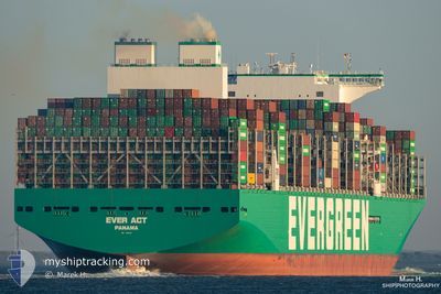
EVER ACT
Cargo D
Current Trip
| Time Travelled | 14 days |
|---|---|
| Remaining Time | --- |
| Distance Travelled | 6593.55 nm |
| Remaining Distance | --- |
| AVG Speed | 18.5 Noeuds |
| MAX Speed | 22.6 Noeuds |
| AVG Wind | 10.8 knots |
| MAX Wind | 23.6 knots |
| MIN Temp | 15.8°C / 60.44°F |
| MAX Temp | 30.6°C / 87.08°F |
| Tirant d eau | 16.6 m |
| Position reçue | 2 d depuis |
Current Position
| Longitude | 17.18025° |
|---|---|
| Latitude | -33.27266° |
| Etat | Under way using engine |
| Vitesse | 17.7 Noeuds |
| Parcours | 324.2° |
| Zone | South Atlantic Ocean |
| Station | T-AIS |
| Position reçue | 2 d depuis |
Info
Information
The current position of EVER ACT is in South Atlantic Ocean with coordinates -33.27266° / 17.18025° as reported on 2024-04-21 11:51 by AIS to our vessel tracker app. The vessel's current speed is 17.7 Noeuds and is heading at the port of ROTTERDAM. The estimated time of arrival as calculated by MyShipTracking vessel tracking app is 2024-05-06 08:00 LT
The vessel EVER ACT (IMO: 9893905, MMSI: 352978199) is a Cargo D It's sailing under the flag of [PA] Panama.
In this page you can find informations about the vessels current position, last detected port calls, and current voyage information. If the vessels is not in coverage by AIS you will find the latest position.
The current position of EVER ACT is detected by our AIS receivers and we are not responsible for the reliability of the data. The last position was recorded while the vessel was in Coverage by the Ais receivers of our vessel tracking app.
The current draught of EVER ACT as reported by AIS is 16.6 meters
Weather
| Temperature | 21.1°C / 69.98°F |
|---|---|
| Wind Speed | 16 knots |
| Direction | 149° SSE |
| Pressure | 1015.6 hPa |
| Humidity | 81.1 % |
| Cloud Coverage | 6 % |
Featured Company
Last Port Calls
| Port | Arrival | Departure | Time In Port |
|---|---|---|---|
| 2024-04-07 23:52 | 2024-04-08 22:57 | 23 h | |
| 2024-04-02 04:33 | 2024-04-03 09:08 | 1 d | |
| 2024-03-30 23:29 | 2024-03-31 23:28 | 23 h | |
| 2024-03-26 03:37 | 2024-03-27 12:33 | 1 d | |
| 2024-03-23 05:11 | 2024-03-24 16:25 | 1 d | |
| 2024-03-19 17:12 | 2024-03-20 19:23 | 1 d | |
| 2024-03-14 17:33 | 2024-03-15 19:32 | 1 d | |
| 2024-03-10 07:51 | 2024-03-11 01:28 | 17 h | |
| 2024-02-11 20:22 | 2024-02-14 15:59 | 2 d | |
| 2024-02-08 14:21 | 2024-02-10 22:37 | 2 d |
Most Visited Ports (Last year)
| Port | Arrivals | |
|---|---|---|
| 6 | ||
| 5 | ||
| 4 | ||
| 4 | ||
| 4 | ||
| 4 |
Last Trips
| Origin | Departure | Destination | Arrival | Distance | |
|---|---|---|---|---|---|
| 2024-04-03 17:08 | 2024-04-08 07:52 | 1494.81 nm | |||
| 2024-04-01 07:28 | 2024-04-02 12:33 | 506.97 nm | |||
| 2024-03-27 20:33 | 2024-03-31 07:29 | 492.70 nm | |||
| 2024-03-25 00:25 | 2024-03-26 11:37 | 436.09 nm | |||
| 2024-03-21 03:23 | 2024-03-23 13:11 | 975.81 nm | |||
| 2024-03-16 03:32 | 2024-03-20 01:12 | 1649.09 nm | |||
| 2024-03-11 06:58 | 2024-03-15 01:33 | 1577.13 nm | |||
| 2024-02-14 16:59 | 2024-03-10 13:21 | 10625.61 nm | |||
| 2024-02-10 23:37 | 2024-02-11 21:22 | 312.59 nm | |||
| 2024-02-02 07:38 | 2024-02-08 15:21 | 587.81 nm |
Events
| Heure | Evenement | Détails | Position/ Destination | Info |
|---|---|---|---|---|
| 2024-04-21 11:59 | Etat Changé | Default Under way using engine |
-33.24059 / 17.15200
SGSIN PWBGB>> NLRTM
|
Vitesse: 17.7 kn Parcours: 324.2° |
| 2024-04-21 11:51 | Hors de la zone couverte |
-33.27266 / 17.18025
South Atlantic Ocean
SGSIN PWBGB>> NLRTM
|
Vitesse: 17.7 kn Parcours: 324.2° |
|
| 2024-04-21 11:47 | Etat Changé | Under way using engine Default |
-33.28865 / 17.19328
SGSIN PWBGB>> NLRTM
|
Vitesse: 17.8 kn Parcours: 327° |
| 2024-04-21 11:44 | Dans la zone couverte |
-33.28865 / 17.19328
South Atlantic Ocean
SGSIN PWBGB>> NLRTM
|
Vitesse: 17.8 kn Parcours: 326.4° |
|
| 2024-04-21 10:51 | Etat Changé | Default Under way using engine |
-33.52172 / 17.37028
SGSIN PWBGB>> NLRTM
|
Vitesse: 17.1 kn Parcours: 324.4° |
| 2024-04-21 10:44 | Hors de la zone couverte |
-33.55258 / 17.39568
South Atlantic Ocean
SGSIN PWBGB>> NLRTM
|
Vitesse: 17.1 kn Parcours: 324.4° |
|
| 2024-04-21 10:18 | Etat Changé | Under way using engine Default |
-33.64618 / 17.48558
SGSIN PWBGB>> NLRTM
|
Vitesse: 17.5 kn Parcours: 307° |
| 2024-04-21 10:07 | Etat Changé | Default Under way using engine |
-33.67854 / 17.53640
SGSIN PWBGB>> NLRTM
|
Vitesse: 17.4 kn Parcours: 314.3° |
| 2024-04-21 08:44 | Etat Changé | Under way using engine Default |
-33.99459 / 17.82774
SGSIN PWBGB>> NLRTM
|
Vitesse: 17.4 kn Parcours: 323° |
| 2024-04-21 08:34 | Etat Changé | Default Under way using engine |
-34.03507 / 17.86334
SGSIN PWBGB>> NLRTM
|
Vitesse: 17.4 kn Parcours: 323.8° |