
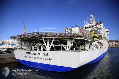
ESPERANZA DEL MAR
Hospital Ship
Current Trip
| Time Travelled | 14 days |
|---|---|
| Remaining Time | 2 days |
| Distance Travelled | 2097.99 nm |
| Remaining Distance | 511.68 nm |
| AVG Speed | 6.9 Noeuds |
| MAX Speed | 13.3 Noeuds |
| AVG Wind | 18.4 knots |
| MAX Wind | 35 knots |
| MIN Temp | 7.5°C / 45.5°F |
| MAX Temp | 20.9°C / 69.62°F |
| Tirant d eau | 4.5 m |
| Position reçue | 20 h, 41 m depuis |
Current Position
| Longitude | -10.82693° |
|---|---|
| Latitude | 51.50023° |
| Etat | Under way using engine |
| Vitesse | 7.4 Noeuds |
| Parcours | 214.6° |
| Zone | North Atlantic Ocean |
| Station | T-AIS |
| Position reçue | 20 h, 41 m depuis |
Info
Information
The current position of ESPERANZA DEL MAR is in North Atlantic Ocean with coordinates 51.50023° / -10.82693° as reported on 2024-04-19 18:19 by AIS to our vessel tracker app. The vessel's current speed is 7.4 Noeuds and is heading at the port of VIGO. The estimated time of arrival as calculated by MyShipTracking vessel tracking app is 2024-04-23 12:02 LT
The vessel ESPERANZA DEL MAR (IMO: 9220536, MMSI: 224731000) is a Hospital Ship that was built in 2001 ( 23 Age ). It's sailing under the flag of [ES] Spain.
In this page you can find informations about the vessels current position, last detected port calls, and current voyage information. If the vessels is not in coverage by AIS you will find the latest position.
The current position of ESPERANZA DEL MAR is detected by our AIS receivers and we are not responsible for the reliability of the data. The last position was recorded while the vessel was in Coverage by the Ais receivers of our vessel tracking app.
The current draught of ESPERANZA DEL MAR as reported by AIS is 4.5 meters
Weather
| Temperature | 12.6°C / 54.68°F |
|---|---|
| Wind Speed | 10 knots |
| Direction | 112° ESE |
| Pressure | 1028.5 hPa |
| Humidity | 70.2 % |
| Cloud Coverage | 66 % |
Featured Company
Most Visited Ports (Last year)
| Port | Arrivals | |
|---|---|---|
| 13 | ||
| 2 | ||
| 1 |
Events
| Heure | Evenement | Détails | Position/ Destination | Info |
|---|---|---|---|---|
| 2024-04-19 18:27 | Etat Changé | Default Under way using engine |
51.48672 / -10.84232
ESVGO
|
Vitesse: 7.4 kn Parcours: 214.6° |
| 2024-04-19 18:19 | Etat Changé | Under way using engine Default |
51.50023 / -10.82693
ESVGO
|
Vitesse: 7.5 kn Parcours: 214° |
| 2024-04-19 18:19 | Hors de la zone couverte |
51.50023 / -10.82693
North Atlantic Ocean
ESVGO
|
Vitesse: 7.4 kn Parcours: 214.6° |
|
| 2024-04-19 18:02 | Etat Changé | Default Under way using engine |
51.52913 / -10.79353
ESVGO
|
Vitesse: 7.6 kn Parcours: 213.9° |
| 2024-04-19 18:02 | Dans la zone couverte |
51.50023 / -10.82693
North Atlantic Ocean
ESVGO
|
Vitesse: 7.4 kn Parcours: 214.6° |
|
| 2024-04-19 17:08 | Hors de la zone couverte |
51.62041 / -10.68600
North Atlantic Ocean
ESVGO
|
Vitesse: 7.6 kn Parcours: 213.9° |
|
| 2024-04-19 14:45 | Etat Changé | Under way using engine Default |
51.48036 / -10.38673
ESVGO
|
Vitesse: 4.9 kn Parcours: 298° |
| 2024-04-19 14:21 | Etat Changé | Default Under way using engine |
51.46607 / -10.33634
ESVGO
|
Vitesse: 5.2 kn Parcours: 294.4° |
| 2024-04-19 11:29 | Démarrage | 3.45 nm, South of CASTLETOWN BEARHAVEN |
51.59759 / -9.94158
ESVGO
|
Vitesse: 3.1 kn Parcours: 276° |
| 2024-04-19 10:19 | Arret | 3.51 nm, South of CASTLETOWN BEARHAVEN |
51.59551 / -9.93728
ESVGO
|
Vitesse: 0.3 kn Parcours: 281° |