
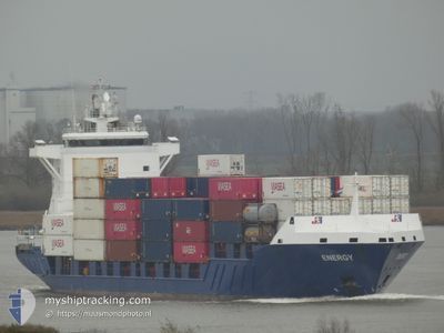
ENERGY
Container Ship
Current Trip
| Trip Time | 15 h, 14 mins |
|---|---|
| Trip Distance | 203.80 nm |
| AVG Speed | 10.5 Noeuds |
| MAX Speed | 17 Noeuds |
| Tirant d eau | 6.5 m |
| AVG Wind | 19.8 knots |
| MAX Wind | 27.9 knots |
| MIN Temp | 7.8°C / 46.04°F |
| MAX Temp | 10.4°C / 50.72°F |
| Position reçue | 2 m depuis |
Current Position
| Longitude | 4.39813° |
|---|---|
| Latitude | 51.88113° |
| Etat | Moored |
| Vitesse | |
| Parcours | 262° |
| Zone | North Sea |
| Station | T-AIS |
| Position reçue | 2 m depuis |
Info
Information
The current position of ENERGY is in North Sea with coordinates 51.88113° / 4.39813° as reported on 2024-04-19 09:38 by AIS to our vessel tracker app. The vessel's current speed is 0 Noeuds and is currently inside the port of ROTTERDAM PERNIS.
The vessel ENERGY (IMO: 9255787, MMSI: 255806300) is a Container Ship that was built in 2004 ( 20 Age ). It's sailing under the flag of [PT] Portugal.
In this page you can find informations about the vessels current position, last detected port calls, and current voyage information. If the vessels is not in coverage by AIS you will find the latest position.
The current position of ENERGY is detected by our AIS receivers and we are not responsible for the reliability of the data. The last position was recorded while the vessel was in Coverage by the Ais receivers of our vessel tracking app.
The current draught of ENERGY as reported by AIS is 6.5 meters
Weather
| Temperature | 10.2°C / 50.36°F |
|---|---|
| Wind Speed | 16 knots |
| Direction | 303° WNW |
| Pressure | 1008.7 hPa |
| Humidity | 83 % |
| Cloud Coverage | 100 % |
Featured Company
Last Port Calls
| Port | Arrival | Departure | Time In Port |
|---|---|---|---|
| 2024-04-19 04:38 | |||
| 2024-04-17 22:21 | 2024-04-18 13:24 | 15 h | |
| 2024-04-15 09:51 | 2024-04-15 14:07 | 4 h | |
| 2024-04-15 01:10 | 2024-04-15 07:18 | 6 h | |
| 2024-04-12 12:41 | 2024-04-13 02:50 | 14 h | |
| 2024-04-11 06:25 | 2024-04-11 18:18 | 11 h | |
| 2024-04-08 15:05 | 2024-04-09 12:32 | 21 h | |
| 2024-04-07 20:51 | 2024-04-08 12:16 | 15 h | |
| 2024-04-05 07:53 | 2024-04-06 02:59 | 19 h | |
| 2024-04-04 01:35 | 2024-04-04 14:10 | 12 h |
Last Trips
| Origin | Departure | Destination | Arrival | Distance | |
|---|---|---|---|---|---|
| 2024-04-18 14:24 | 2024-04-19 06:38 | 203.80 nm | |||
| 2024-04-15 16:07 | 2024-04-17 23:21 | 552.03 nm | |||
| 2024-04-15 09:18 | 2024-04-15 11:51 | 35.91 nm | |||
| 2024-04-13 04:50 | 2024-04-15 03:10 | 558.47 nm | |||
| 2024-04-11 21:18 | 2024-04-12 14:41 | 144.26 nm | |||
| 2024-04-09 14:32 | 2024-04-11 09:25 | 563.73 nm | |||
| 2024-04-08 14:16 | 2024-04-08 17:05 | 35.91 nm | |||
| 2024-04-06 04:59 | 2024-04-07 22:51 | 558.34 nm | |||
| 2024-04-04 15:10 | 2024-04-05 09:53 | 204.35 nm | |||
| 2024-04-02 15:05 | 2024-04-04 02:35 | 545.11 nm |
Events
| Heure | Evenement | Détails | Position/ Destination | Info |
|---|---|---|---|---|
| 2024-04-19 04:47 | Etat Changé | Moored Under way using engine |
51.88108 / 4.39815
[NL] ROTTERDAM PERNIS
|
Vitesse: Parcours: 262° |
| 2024-04-19 04:39 | Arret |
51.88101 / 4.39830
[NL] ROTTERDAM PERNIS
|
Vitesse: 0.3 kn Parcours: 264° |
|
| 2024-04-19 04:38 | Port d'arrivée |
|
51.88104 / 4.39837
[NL] ROTTERDAM PERNIS
|
Vitesse: 0.6 kn Parcours: 263° |
| 2024-04-18 23:43 | Detecté en mer | Dutch part of the North Sea |
52.23555 / 3.21103
North Sea
NLRTM
|
Vitesse: 13.5 kn Parcours: 123.1° |
| 2024-04-18 23:43 | Dans la zone couverte |
52.23555 / 3.21103
North Sea
NLRTM
|
Vitesse: 13.5 kn Parcours: 123.1° |
|
| 2024-04-18 21:35 | Hors de la zone couverte |
52.52900 / 2.54571
North Sea
NLRTM
|
Vitesse: 15.1 kn Parcours: 126.7° |
|
| 2024-04-18 16:44 | Dans la zone couverte |
53.22610 / .74642
North Sea
NLRTM
|
Vitesse: 16.6 kn Parcours: 134.3° |
|
| 2024-04-18 15:03 | Hors de la zone couverte |
53.53812 / .29171
North Sea
NLRTM
|
Vitesse: 13.3 kn Parcours: 96.8° |
|
| 2024-04-18 13:24 | PORT DE DEPART |
|
53.63531 / -.17752
NLRTM
|
Vitesse: 7 kn Parcours: 99° |
| 2024-04-18 13:19 | Démarrage |
53.63117 / -.18725
[GB] IMMINGHAM
|
Vitesse: 3.3 kn Parcours: 36° |