
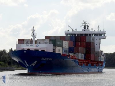
ELBTEAM
Cargo
Current Trip
| Time Travelled | 1 day |
|---|---|
| Remaining Time | 2 days |
| Distance Travelled | 276.11 nm |
| Remaining Distance | 672.30 nm |
| AVG Speed | 9.9 Noeuds |
| MAX Speed | 15.3 Noeuds |
| AVG Wind | 13.7 knots |
| MAX Wind | 26.1 knots |
| MIN Temp | 8°C / 46.4°F |
| MAX Temp | 16.7°C / 62.06°F |
| Tirant d eau | 8 m |
| Position reçue | 3 m depuis |
Current Position
| Longitude | -7.96296° |
|---|---|
| Latitude | 44.47586° |
| Etat | Under way using engine |
| Vitesse | 13.1 Noeuds |
| Parcours | 18° |
| Zone | North Atlantic Ocean |
| Station | T-AIS |
| Position reçue | 3 m depuis |
Info
Information
The current position of ELBTEAM is in North Atlantic Ocean with coordinates 44.47586° / -7.96296° as reported on 2024-04-24 16:48 by AIS to our vessel tracker app. The vessel's current speed is 13.1 Noeuds and is heading at the port of TILBURY. The estimated time of arrival as calculated by MyShipTracking vessel tracking app is 2024-04-26 18:26 LT
The vessel ELBTEAM (MMSI: 255806267) is a Cargo It's sailing under the flag of [PT] Portugal.
In this page you can find informations about the vessels current position, last detected port calls, and current voyage information. If the vessels is not in coverage by AIS you will find the latest position.
The current position of ELBTEAM is detected by our AIS receivers and we are not responsible for the reliability of the data. The last position was recorded while the vessel was in Coverage by the Ais receivers of our vessel tracking app.
The current draught of ELBTEAM as reported by AIS is 8 meters
Weather
| Temperature | 12.5°C / 54.5°F |
|---|---|
| Wind Speed | 11 knots |
| Direction | 308° NW |
| Pressure | 1020.2 hPa |
| Humidity | 80.3 % |
| Cloud Coverage | 100 % |
Featured Company
Last Port Calls
| Port | Arrival | Departure | Time In Port |
|---|---|---|---|
| 2024-04-22 13:00 | 2024-04-23 00:09 | 11 h | |
| 2024-04-20 09:45 | 2024-04-21 20:19 | 1 d | |
| 2024-04-15 13:38 | 2024-04-16 13:27 | 23 h | |
| 2024-04-15 00:45 | 2024-04-15 07:02 | 6 h | |
| 2024-04-14 10:33 | 2024-04-14 22:42 | 12 h | |
| 2024-04-13 06:50 | 2024-04-13 20:22 | 13 h | |
| 2024-04-12 16:09 | 2024-04-12 23:40 | 7 h | |
| 2024-04-08 05:20 | 2024-04-08 17:27 | 12 h | |
| 2024-04-03 20:08 | 2024-04-05 00:17 | 1 d | |
| 2024-03-29 13:41 | 2024-03-30 19:58 | 1 d |
Last Trips
| Origin | Departure | Destination | Arrival | Distance | |
|---|---|---|---|---|---|
| 2024-04-21 21:19 | 2024-04-22 14:00 | 214.16 nm | |||
| 2024-04-16 15:27 | 2024-04-20 10:45 | 1186.27 nm | |||
| 2024-04-15 09:02 | 2024-04-15 15:38 | 78.65 nm | |||
| 2024-04-15 00:42 | 2024-04-15 02:45 | 31.45 nm | |||
| 2024-04-13 22:22 | 2024-04-14 12:33 | 132.12 nm | |||
| 2024-04-13 00:40 | 2024-04-13 08:50 | 86.54 nm | |||
| 2024-04-08 18:27 | 2024-04-12 17:09 | 950.29 nm | |||
| 2024-04-05 01:17 | 2024-04-08 06:20 | 216.96 nm | |||
| 2024-03-30 20:58 | 2024-04-03 21:08 | 1180.29 nm | |||
| 2024-03-29 02:46 | 2024-03-29 14:41 | 108.73 nm |
Events
| Heure | Evenement | Détails | Position/ Destination | Info |
|---|---|---|---|---|
| 2024-04-24 15:31 | Dans la zone couverte |
44.20728 / -8.10079
North Atlantic Ocean
|
Vitesse: 13.5 kn Parcours: 19° |
|
| 2024-04-24 14:19 | Hors de la zone couverte |
43.95693 / -8.25567
North Atlantic Ocean
|
Vitesse: 13.8 kn Parcours: 24.5° |
|
| 2024-04-24 13:42 | Tirant d'eau modifié | 8 8.7 |
43.81809 / -8.28795
GBTIL
|
Vitesse: 13.4 kn Parcours: 17° |
| 2024-04-24 12:30 | Changement d'ETA | 2024/04/26 17:00 2024/04/26 11:00 |
43.56157 / -8.40634
GBTIL
|
Vitesse: 13.2 kn Parcours: 6.8° |
| 2024-04-24 11:43 | Démarrage | 3.37 nm, West of MUGARDOS |
43.46296 / -8.32211
GBTIL
|
Vitesse: 3.3 kn Parcours: 161° |
| 2024-04-24 11:30 | Etat Changé | Under way using engine Moored |
43.46349 / -8.32447
GBTIL
|
Vitesse: Parcours: 56° |
| 2024-04-24 11:22 | Changement d'ETA | 2024/04/26 11:00 2024/04/26 11:30 |
43.46350 / -8.32448
GBTIL
|
Vitesse: Parcours: 56° |
| 2024-04-24 10:49 | Tirant d'eau modifié | 8.7 8.8 |
43.46350 / -8.32448
GBTIL
|
Vitesse: Parcours: 56° |
| 2024-04-24 10:02 | Tirant d'eau modifié | 8.8 8.4 |
43.46349 / -8.32447
GBTIL
|
Vitesse: Parcours: 56° |
| 2024-04-24 10:02 | Changement de destination | GBTIL ESFRO |
43.46349 / -8.32447
GBTIL
|
Vitesse: Parcours: 56° |