
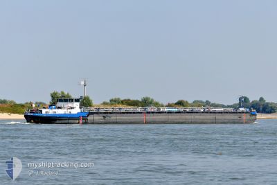
EILTANK 18
Tanker D
Current Trip
LEVERKUSEN
| Time Travelled | 6 h, 1 mins |
|---|---|
| Remaining Time | --- |
| Distance Travelled | 5.45 nm |
| Remaining Distance | --- |
| AVG Speed | 5.5 Noeuds |
| MAX Speed | 6 Noeuds |
| AVG Wind | 5.2 knots |
| MAX Wind | 7 knots |
| MIN Temp | 12.1°C / 53.78°F |
| MAX Temp | 12.6°C / 54.68°F |
| Tirant d eau | 1.3 m |
| Position reçue | 3 h, 46 m depuis |
Current Position
| Longitude | --- |
|---|---|
| Latitude | --- |
| Etat | At anchor |
| Vitesse | 5.9 Noeuds |
| Parcours | 217.8° |
| Zone | North Sea |
| Station | T-AIS |
| Position reçue | 3 h, 46 m depuis |
Info
Information
The current position of EILTANK 18 is in North Sea with coordinates 50.86292° / 7.01682° as reported on 2025-12-09 00:54 by AIS to our vessel tracker app. The vessel's current speed is 5.9 Noeuds
The vessel EILTANK 18 (MMSI: 211494220) is a Tanker D It's sailing under the flag of [DE] Germany.
In this page you can find informations about the vessels current position, last detected port calls, and current voyage information. If the vessels is not in coverage by AIS you will find the latest position.
The current position of EILTANK 18 is detected by our AIS receivers and we are not responsible for the reliability of the data. The last position was recorded while the vessel was in Coverage by the Ais receivers of our vessel tracking app.
The current draught of EILTANK 18 as reported by AIS is 1.3 meters
Weather
| Temperature | 12.9°C / 55.22°F |
|---|---|
| Wind Speed | 7 knots |
| Direction | 209° SSW |
| Pressure | 1016.5 hPa |
| Humidity | 81 % |
| Cloud Coverage | 100 % |
Featured Company
Last Port Calls
| Port | Arrival | Departure | Time In Port |
|---|---|---|---|
| 2025-12-08 00:07 | 2025-12-08 23:40 | 23 h | |
| 2025-12-07 23:06 | |||
| 2025-12-07 22:03 | |||
| 2025-12-07 22:03 | |||
| 2025-12-03 05:35 | 2025-12-03 18:45 | 13 h | |
| 2025-12-03 18:45 | |||
| 2025-12-02 23:30 | 2025-12-03 04:15 | 4 h | |
| 2025-12-01 14:27 | 2025-12-02 20:05 | 1 d | |
| 2025-12-01 07:48 | 2025-12-01 13:05 | 5 h | |
| 2025-12-01 06:33 |
Most Visited Ports (Last year)
| Port | Arrivals | |
|---|---|---|
| 79 | ||
| 63 | ||
| 44 | ||
| 41 | ||
| 20 | ||
| 18 |
Last Trips
| Origin | Departure | Destination | Arrival | Distance | |
|---|---|---|---|---|---|
| 2025-12-07 23:06 | 2025-12-08 00:07 | 1.34 nm | |||
| 2025-12-07 22:03 | 2025-12-07 22:03 | --- | |||
| 2025-12-03 04:15 | 2025-12-03 18:45 | 19.52 nm | |||
| 2025-12-03 04:15 | 2025-12-03 05:35 | 11.04 nm | |||
| 2025-12-02 20:05 | 2025-12-02 23:30 | 10.58 nm | |||
| 2025-12-01 13:05 | 2025-12-01 14:27 | 11.14 nm | |||
| 2025-12-01 06:33 | 2025-12-01 07:48 | 4.78 nm | |||
| 2025-11-23 07:22 | 2025-11-23 09:09 | 15.16 nm | |||
| 2025-11-22 21:01 | 2025-11-22 23:44 | 16.36 nm | |||
| 2025-11-22 03:39 | 2025-11-22 05:36 | 17.04 nm |
Events
| Heure | Evenement | Détails | Position/ Destination | Info |
|---|---|---|---|---|
| 2025-12-09 00:54 | Hors de la zone couverte |
50.86292 / 7.01682
North Sea
|
Vitesse: 5.9 kn Parcours: 217.8° |
|
| 2025-12-09 00:50 | Etat Changé | At anchor Default |
50.86758 / 7.02270
LEVERKUSEN
|
Vitesse: 5 kn Parcours: 243° |
| 2025-12-09 00:46 | Etat Changé | Default At anchor |
50.87167 / 7.03167
LEVERKUSEN
|
Vitesse: 5 kn Parcours: 105.3° |
| 2025-12-08 23:46 | Etat Changé | At anchor Default |
50.91783 / 6.97318
LEVERKUSEN
|
Vitesse: 6 kn Parcours: -1° |
| 2025-12-08 23:38 | Dans la zone couverte |
50.91783 / 6.97318
North Sea
|
Vitesse: 5.6 kn Parcours: 160.2° |
|
| 2025-12-08 22:40 | PORT DE DEPART |
|
50.93114 / 6.96832
LEVERKUSEN
|
Vitesse: Parcours: -1° |
| 2025-12-07 23:07 | Port d'arrivée |
|
51.02667 / 6.97333
[DE] LEVERKUSEN
|
Vitesse: 5.3 kn Parcours: 133.2° |
| 2025-12-07 22:59 | Hors de la zone couverte |
51.03501 / 6.96012
North Sea
|
Vitesse: 5.3 kn Parcours: 133.2° |
|
| 2025-12-07 22:52 | Dans la zone couverte |
51.04158 / 6.94707
North Sea
|
Vitesse: 5.3 kn Parcours: 126.5° |
|
| 2025-12-07 22:06 | PORT DE DEPART |
|
51.04158 / 6.94707
LEVERKUSEN
|
Vitesse: Parcours: -1° |