
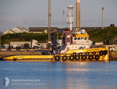
KOOLE 32
Pusher Tug
Current Trip
| Time Travelled | 5 days |
|---|---|
| Remaining Time | --- |
| Distance Travelled | 935.01 nm |
| Remaining Distance | --- |
| AVG Speed | 6.7 Noeuds |
| MAX Speed | 8 Noeuds |
| AVG Wind | 17.1 knots |
| MAX Wind | 33 knots |
| MIN Temp | 12.9°C / 55.22°F |
| MAX Temp | 19.8°C / 67.64°F |
| Tirant d eau | 2.8 m |
| Position reçue | 2 h, 57 m depuis |
Current Position
| Longitude | -12.96218° |
|---|---|
| Latitude | 29.52677° |
| Etat | Restricted manoeuverability |
| Vitesse | 5.8 Noeuds |
| Parcours | 193° |
| Zone | North Atlantic Ocean |
| Station | T-AIS |
| Position reçue | 2 h, 57 m depuis |
Info
Information
The current position of KOOLE 32 is in North Atlantic Ocean with coordinates 29.52677° / -12.96218° as reported on 2024-04-24 09:12 by AIS to our vessel tracker app. The vessel's current speed is 5.8 Noeuds and is heading at the port of TARFAYA. The estimated time of arrival as calculated by MyShipTracking vessel tracking app is 2024-04-26 08:00 LT
The vessel KOOLE 32 (IMO: 9547881, MMSI: 246376000) is a Pusher Tug that was built in 2010 ( 14 Age ). It's sailing under the flag of [NL] Netherlands.
In this page you can find informations about the vessels current position, last detected port calls, and current voyage information. If the vessels is not in coverage by AIS you will find the latest position.
The current position of KOOLE 32 is detected by our AIS receivers and we are not responsible for the reliability of the data. The last position was recorded while the vessel was in Coverage by the Ais receivers of our vessel tracking app.
The current draught of KOOLE 32 as reported by AIS is 2.8 meters
Weather
| Temperature | 19.5°C / 67.1°F |
|---|---|
| Wind Speed | 16 knots |
| Direction | 8° N |
| Pressure | 1015.9 hPa |
| Humidity | 78.3 % |
| Cloud Coverage | 5 % |
Featured Company
Last Port Calls
| Port | Arrival | Departure | Time In Port |
|---|---|---|---|
| 2024-04-15 08:51 | 2024-04-18 16:51 | 3 d | |
| 2024-03-13 13:48 | 2024-04-08 09:37 | 25 d | |
| 2024-03-10 12:51 | 2024-03-13 13:22 | 3 d | |
| 2024-03-07 12:50 | 2024-03-10 12:27 | 2 d | |
| 2024-03-03 18:19 | 2024-03-05 13:56 | 1 d | |
| 2024-03-03 16:38 | 2024-03-03 17:40 | 1 h | |
| 2024-03-02 16:11 | 2024-03-03 06:23 | 14 h | |
| 2024-02-26 23:56 | 2024-03-02 15:44 | 4 d | |
| 2024-02-26 18:39 | 2024-02-26 19:20 | 40 m | |
| 2024-02-25 15:16 | 2024-02-26 18:03 | 1 d |
Most Visited Ports (Last year)
| Port | Arrivals | |
|---|---|---|
| 45 | ||
| 12 | ||
| 9 | ||
| 8 | ||
| 7 | ||
| 6 |
Last Trips
| Origin | Departure | Destination | Arrival | Distance | |
|---|---|---|---|---|---|
| 2024-04-08 11:37 | 2024-04-15 10:51 | 827.00 nm | |||
| 2024-03-13 14:22 | 2024-03-13 14:48 | 2.68 nm | |||
| 2024-03-10 13:27 | 2024-03-10 13:51 | 2.48 nm | |||
| 2024-03-05 14:56 | 2024-03-07 13:50 | 249.51 nm | |||
| 2024-03-03 18:40 | 2024-03-03 19:19 | 5.08 nm | |||
| 2024-03-03 07:23 | 2024-03-03 17:38 | 75.16 nm | |||
| 2024-03-02 16:44 | 2024-03-02 17:11 | 4.69 nm | |||
| 2024-02-26 20:20 | 2024-02-27 00:56 | 47.48 nm | |||
| 2024-02-26 19:03 | 2024-02-26 19:39 | 4.74 nm | |||
| 2024-02-24 17:22 | 2024-02-25 16:16 | 144.01 nm |
Events
| Heure | Evenement | Détails | Position/ Destination | Info |
|---|---|---|---|---|
| 2024-04-24 09:17 | Etat Changé | Default Restricted manoeuverability |
29.51902 / -12.96440
TOWING TO TARFAYA
|
Vitesse: 5.8 kn Parcours: 193° |
| 2024-04-24 09:12 | Hors de la zone couverte |
29.52677 / -12.96218
North Atlantic Ocean
TOWING TO TARFAYA
|
Vitesse: 5.8 kn Parcours: 193° |
|
| 2024-04-24 08:45 | Etat Changé | Restricted manoeuverability Default |
29.56782 / -12.95068
TOWING TO TARFAYA
|
Vitesse: 5.8 kn Parcours: 190° |
| 2024-04-24 08:25 | Etat Changé | Default Restricted manoeuverability |
29.60033 / -12.94337
TOWING TO TARFAYA
|
Vitesse: 5.9 kn Parcours: 192° |
| 2024-04-24 08:10 | Etat Changé | Restricted manoeuverability Default |
29.62438 / -12.93773
TOWING TO TARFAYA
|
Vitesse: 6 kn Parcours: 193° |
| 2024-04-24 08:10 | Dans la zone couverte |
29.62438 / -12.93773
North Atlantic Ocean
TOWING TO TARFAYA
|
Vitesse: 6 kn Parcours: 192° |
|
| 2024-04-24 05:09 | Etat Changé | Default Restricted manoeuverability |
29.92090 / -12.85287
TOWING TO TARFAYA
|
Vitesse: 6 kn Parcours: 191° |
| 2024-04-24 05:01 | Hors de la zone couverte |
29.93505 / -12.84937
North Atlantic Ocean
TOWING TO TARFAYA
|
Vitesse: 6 kn Parcours: 191° |
|
| 2024-04-24 04:36 | Etat Changé | Restricted manoeuverability Default |
29.97552 / -12.84033
TOWING TO TARFAYA
|
Vitesse: 6 kn Parcours: 192° |
| 2024-04-24 04:32 | Dans la zone couverte |
29.97390 / -12.84073
North Atlantic Ocean
TOWING TO TARFAYA
|
Vitesse: 6 kn Parcours: 191° |