
DONG-A METIS
Vehicles Carrier
Current Trip
| Time Travelled | 18 h, 16 mins |
|---|---|
| Remaining Time | --- |
| Distance Travelled | 244.65 nm |
| Remaining Distance | --- |
| AVG Speed | 13.5 Noeuds |
| MAX Speed | 18.1 Noeuds |
| AVG Wind | 18.2 knots |
| MAX Wind | 26.7 knots |
| MIN Temp | 7.8°C / 46.04°F |
| MAX Temp | 11°C / 51.8°F |
| Tirant d eau | 9.1 m |
| Position reçue | 3 h, 5 m depuis |
Current Position
| Longitude | --- |
|---|---|
| Latitude | --- |
| Etat | Under way using engine |
| Vitesse | 14.2 Noeuds |
| Parcours | 211.3° |
| Zone | North Pacific Ocean |
| Station | T-AIS |
| Position reçue | 3 h, 5 m depuis |
Info
Information
The current position of DONG-A METIS is in North Pacific Ocean with coordinates 47.76416° / -125.70782° as reported on 2025-12-07 01:30 by AIS to our vessel tracker app. The vessel's current speed is 14.2 Noeuds and is heading at the port of PYEONGTAEK. The estimated time of arrival as calculated by MyShipTracking vessel tracking app is 2025-12-25 18:30 LT
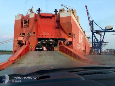
The vessel DONG-A METIS (IMO: 9419747, MMSI: 372997000) is a Vehicles Carrier that was built in 2010 ( 15 Age ). It's sailing under the flag of [PA] Panama.
In this page you can find informations about the vessels current position, last detected port calls, and current voyage information. If the vessels is not in coverage by AIS you will find the latest position.
The current position of DONG-A METIS is detected by our AIS receivers and we are not responsible for the reliability of the data. The last position was recorded while the vessel was in Coverage by the Ais receivers of our vessel tracking app.
The current draught of DONG-A METIS as reported by AIS is 9.1 meters
Weather
| Temperature | 11°C / 51.8°F |
|---|---|
| Wind Speed | 11 knots |
| Direction | 198° SSW |
| Pressure | 1017.3 hPa |
| Humidity | 90.5 % |
| Cloud Coverage | 100 % |
Featured Company
Last Port Calls
| Port | Arrival | Departure | Time In Port |
|---|---|---|---|
| 2025-12-03 12:13 | 2025-12-06 02:19 | 2 d | |
| 2025-11-20 08:49 | 2025-11-20 16:55 | 8 h | |
| 2025-10-30 19:29 | 2025-10-31 20:18 | 1 d | |
| 2025-10-26 02:38 | 2025-10-28 22:05 | 2 d | |
| 2025-10-24 07:25 | 2025-10-25 21:58 | 1 d | |
| 2025-10-22 22:08 | 2025-10-23 13:46 | 15 h | |
| 2025-10-22 20:43 | 2025-10-22 21:57 | 1 h | |
| 2025-10-20 05:58 | 2025-10-20 17:10 | 11 h | |
| 2025-10-15 11:06 | 2025-10-16 11:16 | 1 d | |
| 2025-10-11 04:47 | 2025-10-11 14:57 | 10 h |
Last Trips
| Origin | Departure | Destination | Arrival | Distance | |
|---|---|---|---|---|---|
| 2025-11-20 16:55 | 2025-12-03 12:13 | 4224.78 nm | |||
| 2025-10-31 20:18 | 2025-11-20 08:49 | 6286.67 nm | |||
| 2025-10-28 22:05 | 2025-10-30 19:29 | 350.01 nm | |||
| 2025-10-25 21:58 | 2025-10-26 02:38 | 53.20 nm | |||
| 2025-10-23 13:46 | 2025-10-24 07:25 | 162.17 nm | |||
| 2025-10-22 21:57 | 2025-10-22 22:08 | 0.35 nm | |||
| 2025-10-20 17:10 | 2025-10-22 20:43 | 134.93 nm | |||
| 2025-10-16 11:16 | 2025-10-20 05:58 | 1294.09 nm | |||
| 2025-10-11 14:57 | 2025-10-15 11:06 | 862.17 nm | |||
| 2025-10-07 01:30 | 2025-10-11 04:47 | 1445.28 nm |
Events
| Heure | Evenement | Détails | Position/ Destination | Info |
|---|---|---|---|---|
| 2025-12-07 01:35 | Etat Changé | Default Under way using engine |
47.74630 / -125.72396
KRPTK
|
Vitesse: 14.2 kn Parcours: 211.3° |
| 2025-12-07 01:30 | Hors de la zone couverte |
47.76416 / -125.70782
North Pacific Ocean
KRPTK
|
Vitesse: 14.2 kn Parcours: 211.3° |
|
| 2025-12-07 01:17 | Etat Changé | Under way using engine Default |
47.80539 / -125.67086
KRPTK
|
Vitesse: 13.4 kn Parcours: 212° |
| 2025-12-07 01:07 | Etat Changé | Default Under way using engine |
47.83893 / -125.64063
KRPTK
|
Vitesse: 14.1 kn Parcours: 212° |
| 2025-12-07 00:48 | Etat Changé | Under way using engine Default |
47.90202 / -125.58349
KRPTK
|
Vitesse: 14.1 kn Parcours: 211° |
| 2025-12-07 00:35 | Etat Changé | Default Under way using engine |
47.94389 / -125.54604
KRPTK
|
Vitesse: 13.6 kn Parcours: 211° |
| 2025-12-07 00:27 | Etat Changé | Under way using engine Default |
47.96979 / -125.52326
KRPTK
|
Vitesse: 13.7 kn Parcours: 211° |
| 2025-12-07 00:23 | Etat Changé | Default Under way using engine |
47.98354 / -125.51092
KRPTK
|
Vitesse: 14 kn Parcours: 210.2° |
| 2025-12-06 21:53 | Changement de zone | United States part of the North Pacific Ocean Canadian part of the North Pacific Ocean |
48.46614 / -125.09262
North Pacific Ocean
KRPTK
|
Vitesse: 12.5 kn Parcours: 202.2° |
| 2025-12-06 21:40 | Changement d'ETA | 2025/12/25 09:30 2025/12/24 17:00 |
48.49890 / -125.05737
KRPTK
|
Vitesse: 11 kn Parcours: 269.3° |