
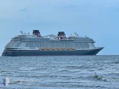
DISNEY WISH
Passenger
Current Trip
| Trip Time | 15 h, 8 mins |
|---|---|
| Trip Distance | 273.42 nm |
| AVG Speed | 18.4 Noeuds |
| MAX Speed | 21 Noeuds |
| Tirant d eau | 8.6 m |
| AVG Wind | 10.6 knots |
| MAX Wind | 17.2 knots |
| MIN Temp | 21.8°C / 71.24°F |
| MAX Temp | 23.6°C / 74.48°F |
| Position reçue | 9 h, 42 m depuis |
Current Position
| Longitude | -77.59698° |
|---|---|
| Latitude | 25.70049° |
| Etat | Under way using engine |
| Vitesse | 19.9 Noeuds |
| Parcours | 158.9° |
| Zone | North Atlantic Ocean |
| Station | T-AIS |
| Position reçue | 9 h, 42 m depuis |
Info
Information
The current position of DISNEY WISH is in North Atlantic Ocean with coordinates 25.70049° / -77.59698° as reported on 2024-04-16 10:12 by AIS to our vessel tracker app. The vessel's current speed is 19.9 Noeuds and is currently inside the port of NASSAU.
The vessel DISNEY WISH (IMO: 9834739, MMSI: 311001098) is a Passenger It's sailing under the flag of [BS] Bahamas.
In this page you can find informations about the vessels current position, last detected port calls, and current voyage information. If the vessels is not in coverage by AIS you will find the latest position.
The current position of DISNEY WISH is detected by our AIS receivers and we are not responsible for the reliability of the data. The last position was recorded while the vessel was in Coverage by the Ais receivers of our vessel tracking app.
The current draught of DISNEY WISH as reported by AIS is 8.6 meters
Weather
| Temperature | 23.7°C / 74.66°F |
|---|---|
| Wind Speed | 18 knots |
| Direction | 69° ENE |
| Pressure | 1018.1 hPa |
| Humidity | 76.7 % |
| Cloud Coverage | --- |
Featured Company
Last Port Calls
| Port | Arrival | Departure | Time In Port |
|---|---|---|---|
| 2024-04-16 12:37 | |||
| 2024-04-15 07:51 | 2024-04-15 21:29 | 13 h | |
| 2024-04-13 12:57 | 2024-04-13 21:54 | 8 h | |
| 2024-04-12 09:13 | 2024-04-12 21:06 | 11 h | |
| 2024-04-09 12:43 | 2024-04-09 21:55 | 9 h | |
| 2024-04-08 09:21 | 2024-04-08 21:29 | 12 h | |
| 2024-04-06 12:42 | 2024-04-06 22:23 | 9 h | |
| 2024-04-05 05:22 | 2024-04-05 21:20 | 15 h | |
| 2024-04-02 12:46 | 2024-04-02 21:47 | 9 h | |
| 2024-04-01 09:17 | 2024-04-01 21:11 | 11 h |
Most Visited Ports (Last year)
| Port | Arrivals | |
|---|---|---|
| 106 | ||
| 94 | ||
| 1 |
Last Trips
| Origin | Departure | Destination | Arrival | Distance | |
|---|---|---|---|---|---|
| 2024-04-15 17:29 | 2024-04-16 08:37 | 273.42 nm | |||
| 2024-04-13 17:54 | 2024-04-15 03:51 | 353.15 nm | |||
| 2024-04-12 17:06 | 2024-04-13 08:57 | 278.10 nm | |||
| 2024-04-09 17:55 | 2024-04-12 05:13 | 453.23 nm | |||
| 2024-04-08 17:29 | 2024-04-09 08:43 | 273.16 nm | |||
| 2024-04-06 18:23 | 2024-04-08 05:21 | 350.68 nm | |||
| 2024-04-05 17:20 | 2024-04-06 08:42 | 272.42 nm | |||
| 2024-04-02 17:47 | 2024-04-05 01:22 | 527.53 nm | |||
| 2024-04-01 17:11 | 2024-04-02 08:46 | 273.35 nm | |||
| 2024-03-30 18:02 | 2024-04-01 05:17 | 356.32 nm |
Events
| Heure | Evenement | Détails | Position/ Destination | Info |
|---|---|---|---|---|
| 2024-04-16 13:01 | Arret |
25.08121 / -77.33984
[BS] NASSAU
|
Vitesse: 0.1 kn Parcours: 103° |
|
| 2024-04-16 12:37 | Port d'arrivée |
|
25.08447 / -77.35074
[BS] NASSAU
|
Vitesse: 10.1 kn Parcours: 149° |
| 2024-04-16 10:16 | Etat Changé | Default Under way using engine |
25.68167 / -77.58833
BS NAS
|
Vitesse: 19.9 kn Parcours: 158.9° |
| 2024-04-16 10:12 | Hors de la zone couverte |
25.70049 / -77.59698
North Atlantic Ocean
BS NAS
|
Vitesse: 19.9 kn Parcours: 158.9° |
|
| 2024-04-16 09:45 | Etat Changé | Under way using engine Default |
25.82829 / -77.67823
BS NAS
|
Vitesse: 19 kn Parcours: 121° |
| 2024-04-16 09:45 | Dans la zone couverte |
25.82214 / -77.67217
North Atlantic Ocean
BS NAS
|
Vitesse: 19.5 kn Parcours: 138.4° |
|
| 2024-04-16 06:29 | Etat Changé | Default Under way using engine |
26.32005 / -78.74043
BS NAS
|
Vitesse: 20 kn Parcours: 113.7° |
| 2024-04-16 06:24 | Hors de la zone couverte |
26.33248 / -78.76963
North Atlantic Ocean
BS NAS
|
Vitesse: 20 kn Parcours: 113.7° |
|
| 2024-04-16 03:44 | Etat Changé | Under way using engine Default |
26.99692 / -79.36337
BS NAS
|
Vitesse: 19 kn Parcours: 150° |
| 2024-04-16 03:10 | Etat Changé | Default Under way using engine |
27.15034 / -79.46867
BS NAS
|
Vitesse: 18.2 kn Parcours: 144.6° |