
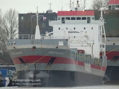
DINTELBORG
General Cargo
Current Trip
| Time Travelled | 1 day |
|---|---|
| Remaining Time | --- |
| Distance Travelled | 455.18 nm |
| Remaining Distance | --- |
| AVG Speed | 11.9 Noeuds |
| MAX Speed | 12.9 Noeuds |
| AVG Wind | 17.2 knots |
| MAX Wind | 23 knots |
| MIN Temp | 14.9°C / 58.82°F |
| MAX Temp | 18.8°C / 65.84°F |
| Tirant d eau | 7.2 m |
| Position reçue | Maintenant |
Current Position
| Longitude | -9.82887° |
|---|---|
| Latitude | 39.84365° |
| Etat | Under way using engine |
| Vitesse | 12.2 Noeuds |
| Parcours | 2.8° |
| Zone | North Atlantic Ocean |
| Station | T-AIS |
| Position reçue | Maintenant |
Info
Information
The current position of DINTELBORG is in North Atlantic Ocean with coordinates 39.84365° / -9.82887° as reported on 2024-04-25 13:33 by AIS to our vessel tracker app. The vessel's current speed is 12.2 Noeuds and is heading at the port of KUNDA. The estimated time of arrival as calculated by MyShipTracking vessel tracking app is 2024-05-03 14:00 LT
The vessel DINTELBORG (IMO: 9163685, MMSI: 245279000) is a General Cargo that was built in 1999 ( 25 Age ). It's sailing under the flag of [NL] Netherlands.
In this page you can find informations about the vessels current position, last detected port calls, and current voyage information. If the vessels is not in coverage by AIS you will find the latest position.
The current position of DINTELBORG is detected by our AIS receivers and we are not responsible for the reliability of the data. The last position was recorded while the vessel was in Coverage by the Ais receivers of our vessel tracking app.
The current draught of DINTELBORG as reported by AIS is 7.2 meters
Weather
| Temperature | 15.1°C / 59.18°F |
|---|---|
| Wind Speed | 16 knots |
| Direction | 327° NNW |
| Pressure | 1014.9 hPa |
| Humidity | 76.9 % |
| Cloud Coverage | 34 % |
Featured Company
Last Port Calls
| Port | Arrival | Departure | Time In Port |
|---|---|---|---|
| 2024-04-22 21:26 | 2024-04-23 23:23 | 1 d | |
| 2024-04-19 17:34 | 2024-04-20 06:13 | 12 h | |
| 2024-04-16 13:05 | 2024-04-17 14:47 | 1 d | |
| 2024-04-15 02:46 | 2024-04-15 12:02 | 9 h | |
| 2024-03-25 17:17 | 2024-03-28 00:57 | 2 d | |
| 2024-03-10 05:44 | 2024-03-18 17:31 | 8 d | |
| 2024-02-14 19:28 | 2024-03-10 05:23 | 24 d | |
| 2024-02-10 19:30 | 2024-02-13 15:15 | 2 d |
Most Visited Ports (Last year)
| Port | Arrivals | |
|---|---|---|
| 4 | ||
| 3 | ||
| 3 | ||
| 2 | ||
| 2 | ||
| 1 |
Last Trips
| Origin | Departure | Destination | Arrival | Distance | |
|---|---|---|---|---|---|
| 2024-04-20 07:13 | 2024-04-22 22:26 | 138.45 nm | |||
| 2024-04-17 15:47 | 2024-04-19 18:34 | 273.41 nm | |||
| 2024-04-15 13:02 | 2024-04-16 14:05 | 195.23 nm | |||
| 2024-03-28 01:57 | 2024-04-15 03:46 | 2880.45 nm | |||
| 2024-03-18 19:31 | 2024-03-25 18:17 | 869.10 nm | |||
| 2024-03-10 07:23 | 2024-03-10 07:44 | 0.56 nm | |||
| 2024-02-13 17:15 | 2024-02-14 21:28 | 310.22 nm | |||
| 2024-01-30 18:57 | 2024-02-10 21:30 | 2369.75 nm |
Events
| Heure | Evenement | Détails | Position/ Destination | Info |
|---|---|---|---|---|
| 2024-04-25 00:53 | Etat Changé | Under way using engine Default |
37.37893 / -9.79234
EEKND
|
Vitesse: 11.5 kn Parcours: 359° |
| 2024-04-25 00:50 | Etat Changé | Default Under way using engine |
37.37035 / -9.79241
EEKND
|
Vitesse: 11.7 kn Parcours: 0.8° |
| 2024-04-24 13:29 | Detecté en mer | Portuguese part of the North Atlantic Ocean |
35.09251 / -9.60795
North Atlantic Ocean
EEKND
|
Vitesse: 12.5 kn Parcours: 355.9° |
| 2024-04-24 12:57 | Etat Changé | Under way using engine Default |
34.98269 / -9.59701
EEKND
|
Vitesse: 12.4 kn Parcours: 355° |
| 2024-04-24 12:53 | Etat Changé | Default Under way using engine |
34.97120 / -9.59592
EEKND
|
Vitesse: 12.5 kn Parcours: 355.8° |
| 2024-04-24 09:11 | Etat Changé | Under way using engine Default |
34.20849 / -9.53888
EEKND
|
Vitesse: 12.6 kn Parcours: 358° |
| 2024-04-24 09:02 | Etat Changé | Default Under way using engine |
34.17333 / -9.53500
EEKND
|
Vitesse: 12.6 kn Parcours: 356.4° |
| 2024-04-24 07:14 | Changement d'ETA | 2024/05/03 14:00 2024/05/03 22:00 |
33.80107 / -9.50549
EEKND
|
Vitesse: 12.6 kn Parcours: 355.9° |
| 2024-04-24 06:32 | Etat Changé | Under way using engine Default |
33.65951 / -9.49276
EEKND
|
Vitesse: 12 kn Parcours: 355° |
| 2024-04-24 06:02 | Etat Changé | Default Under way using engine |
33.55333 / -9.48167
EEKND
|
Vitesse: 12.5 kn Parcours: 356.1° |