
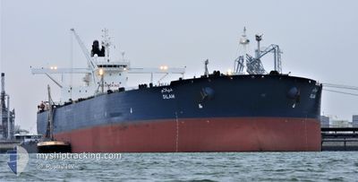
DILAM
Crude Oil Tanker
Current Trip
| Time Travelled | 9 days |
|---|---|
| Remaining Time | --- |
| Distance Travelled | 2135.32 nm |
| Remaining Distance | --- |
| AVG Speed | 11.8 Noeuds |
| MAX Speed | 19.8 Noeuds |
| AVG Wind | 10.2 knots |
| MAX Wind | 24.5 knots |
| MIN Temp | 20.4°C / 68.72°F |
| MAX Temp | 29.7°C / 85.46°F |
| Tirant d eau | 10.3 m |
| Position reçue | 3 d depuis |
Current Position
| Longitude | 39.57884° |
|---|---|
| Latitude | 18.53162° |
| Etat | Under way using engine |
| Vitesse | 11.3 Noeuds |
| Parcours | 151.3° |
| Zone | Red Sea |
| Station | T-AIS |
| Position reçue | 3 d depuis |
Info
Information
The current position of DILAM is in Red Sea with coordinates 18.53162° / 39.57884° as reported on 2024-04-21 06:06 by AIS to our vessel tracker app. The vessel's current speed is 11.3 Noeuds and is heading at the port of KHORFAKKAN. The estimated time of arrival as calculated by MyShipTracking vessel tracking app is 2024-04-28 04:00 LT
The vessel DILAM (IMO: 9448700, MMSI: 403540000) is a Crude Oil Tanker that was built in 2010 ( 14 Age ). It's sailing under the flag of [SA] Saudi Arabia.
In this page you can find informations about the vessels current position, last detected port calls, and current voyage information. If the vessels is not in coverage by AIS you will find the latest position.
The current position of DILAM is detected by our AIS receivers and we are not responsible for the reliability of the data. The last position was recorded while the vessel was in Coverage by the Ais receivers of our vessel tracking app.
The current draught of DILAM as reported by AIS is 10.3 meters
Weather
| Temperature | 28.2°C / 82.76°F |
|---|---|
| Wind Speed | 7 knots |
| Direction | 93° E |
| Pressure | 1010.5 hPa |
| Humidity | 74 % |
| Cloud Coverage | 25 % |
Featured Company
Last Port Calls
| Port | Arrival | Departure | Time In Port |
|---|---|---|---|
| 2024-04-12 23:13 | 2024-04-14 15:48 | 1 d | |
| 2024-03-03 08:46 | 2024-03-04 05:20 | 20 h | |
| 2024-02-08 01:42 | 2024-02-10 00:38 | 1 d |
Most Visited Ports (Last year)
| Port | Arrivals | |
|---|---|---|
| 6 | ||
| 1 | ||
| 1 | ||
| 1 | ||
| 1 | ||
| 1 |
Last Trips
| Origin | Departure | Destination | Arrival | Distance | |
|---|---|---|---|---|---|
| 2024-03-04 08:20 | 2024-04-13 02:13 | 3197.03 nm | |||
| 2024-02-10 09:38 | 2024-03-03 11:46 | 6292.33 nm | |||
| 2024-01-17 14:40 | 2024-02-08 10:42 | 6265.57 nm |
Events
| Heure | Evenement | Détails | Position/ Destination | Info |
|---|---|---|---|---|
| 2024-04-21 13:28 | Démarrage |
18.11347 / 39.75704
AE KLF
|
Vitesse: 7.4 kn Parcours: 131° |
|
| 2024-04-21 12:23 | Arret |
18.11365 / 39.74736
AE KLF
|
Vitesse: 0.3 kn Parcours: 40° |
|
| 2024-04-21 12:08 | Démarrage |
18.10767 / 39.74725
AE KLF
|
Vitesse: 4.1 kn Parcours: 21° |
|
| 2024-04-21 10:14 | Arret |
18.09286 / 39.74968
AE KLF
|
Vitesse: 0.2 kn Parcours: 208° |
|
| 2024-04-21 06:31 | Etat Changé | Default Under way using engine |
18.42289 / 39.64241
AE KLF
|
Vitesse: 11.3 kn Parcours: 151.3° |
| 2024-04-21 06:06 | Hors de la zone couverte |
18.53162 / 39.57884
Red Sea
AE KLF
|
Vitesse: 11.3 kn Parcours: 151.3° |
|
| 2024-04-21 05:24 | Etat Changé | Under way using engine Default |
18.61570 / 39.53221
AE KLF
|
Vitesse: 11.5 kn Parcours: 152° |
| 2024-04-21 05:15 | Etat Changé | Default Under way using engine |
18.63513 / 39.52153
AE KLF
|
Vitesse: 11.5 kn Parcours: 153.2° |
| 2024-04-21 04:49 | Detecté en mer | Sudanese part of the Red Sea |
18.73483 / 39.46864
Red Sea
AE KLF
|
Vitesse: 11.4 kn Parcours: 152.8° |
| 2024-04-21 04:49 | Etat Changé | Under way using engine Default |
18.73483 / 39.46864
AE KLF
|
Vitesse: 11.3 kn Parcours: 152° |