
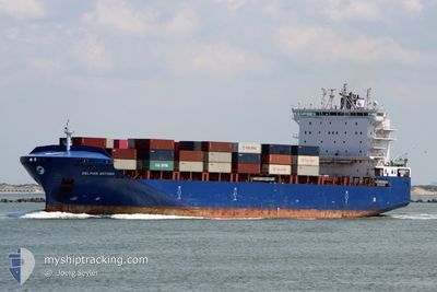
DELPHIS BOTHNIA
Cargo A
Current Trip
| Time Travelled | 5 days |
|---|---|
| Remaining Time | 6 h, 14 mins |
| Distance Travelled | 921.05 nm |
| Remaining Distance | 21.51 nm |
| AVG Speed | 8.2 Noeuds |
| MAX Speed | 15.3 Noeuds |
| AVG Wind | 10.8 knots |
| MAX Wind | 22.8 knots |
| MIN Temp | 15°C / 59°F |
| MAX Temp | 20.4°C / 68.72°F |
| Tirant d eau | 8.8 m |
| Position reçue | 1 m depuis |
Current Position
| Longitude | 23.67434° |
|---|---|
| Latitude | 37.59600° |
| Etat | Under way using engine |
| Vitesse | 1 Noeuds |
| Parcours | 198° |
| Zone | Aegean Sea |
| Station | T-AIS |
| Position reçue | 1 m depuis |
Info
Information
The current position of DELPHIS BOTHNIA is in Aegean Sea with coordinates 37.59600° / 23.67434° as reported on 2024-04-20 02:17 by AIS to our vessel tracker app. The vessel's current speed is 1 Noeuds and is heading at the port of PIRAEUS. The estimated time of arrival as calculated by MyShipTracking vessel tracking app is 2024-04-20 08:32 LT
The vessel DELPHIS BOTHNIA (IMO: 9763710, MMSI: 477537200) is a Cargo A It's sailing under the flag of [HK] Hong Kong.
In this page you can find informations about the vessels current position, last detected port calls, and current voyage information. If the vessels is not in coverage by AIS you will find the latest position.
The current position of DELPHIS BOTHNIA is detected by our AIS receivers and we are not responsible for the reliability of the data. The last position was recorded while the vessel was in Coverage by the Ais receivers of our vessel tracking app.
The current draught of DELPHIS BOTHNIA as reported by AIS is 8.8 meters
Weather
| Temperature | 15°C / 59°F |
|---|---|
| Wind Speed | 16 knots |
| Direction | 253° WSW |
| Pressure | 1000.8 hPa |
| Humidity | 61.5 % |
| Cloud Coverage | 35 % |
Featured Company
Last Port Calls
| Port | Arrival | Departure | Time In Port |
|---|---|---|---|
| 2024-04-13 15:18 | 2024-04-14 07:16 | 15 h | |
| 2024-04-12 01:29 | 2024-04-12 22:49 | 21 h | |
| 2024-04-11 09:00 | 2024-04-11 19:39 | 10 h | |
| 2024-04-08 20:10 | 2024-04-10 06:31 | 1 d | |
| 2024-04-02 14:53 | 2024-04-03 20:40 | 1 d | |
| 2024-03-29 15:58 | 2024-03-30 13:39 | 21 h | |
| 2024-03-25 05:14 | 2024-03-26 12:56 | 1 d | |
| 2024-03-22 07:32 | 2024-03-23 13:13 | 1 d | |
| 2024-03-19 07:02 | 2024-03-20 20:38 | 1 d | |
| 2024-03-16 09:48 | 2024-03-16 10:45 | 57 m |
Last Trips
| Origin | Departure | Destination | Arrival | Distance | |
|---|---|---|---|---|---|
| 2024-04-13 00:49 | 2024-04-13 17:18 | 143.46 nm | |||
| 2024-04-11 21:39 | 2024-04-12 03:29 | 72.17 nm | |||
| 2024-04-10 08:31 | 2024-04-11 11:00 | 425.25 nm | |||
| 2024-04-03 23:40 | 2024-04-08 22:10 | 523.82 nm | |||
| 2024-03-30 14:39 | 2024-04-02 17:53 | 1015.55 nm | |||
| 2024-03-26 14:56 | 2024-03-29 16:58 | 1012.74 nm | |||
| 2024-03-23 14:13 | 2024-03-25 07:14 | 494.36 nm | |||
| 2024-03-20 22:38 | 2024-03-22 08:32 | 477.52 nm | |||
| 2024-03-16 13:45 | 2024-03-19 09:02 | 420.77 nm | |||
| 2024-03-11 17:18 | 2024-03-16 12:48 | 270.42 nm |
Events
| Heure | Evenement | Détails | Position/ Destination | Info |
|---|---|---|---|---|
| 2024-04-20 00:48 | Arret | 9.86 nm, South East of AGIA MARINA |
37.60414 / 23.64977
GRPIR
|
Vitesse: 0.3 kn Parcours: 264° |
| 2024-04-19 23:47 | Démarrage | 12.35 nm, South East of AGIA MARINA |
37.58888 / 23.71076
GRPIR
|
Vitesse: 3.1 kn Parcours: 290° |
| 2024-04-19 20:51 | Arret | 10.47 nm, South East of AGIA MARINA |
37.59796 / 23.66129
GRPIR
|
Vitesse: 0.3 kn Parcours: 255° |
| 2024-04-19 13:36 | Démarrage | 9.77 nm, South East of AGIA MARINA |
37.61864 / 23.67138
GRPIR
|
Vitesse: 3.1 kn Parcours: 162° |
| 2024-04-19 11:24 | Arret | 11.92 nm, South East of AGIA MARINA |
37.58904 / 23.69710
GRPIR
|
Vitesse: 0.3 kn Parcours: 151° |
| 2024-04-19 10:26 | Démarrage | 10.47 nm, South East of AGIA MARINA |
37.59281 / 23.65128
GRPIR
|
Vitesse: 3.1 kn Parcours: 132° |
| 2024-04-19 04:16 | Arret | 10.97 nm, South East of AGIA MARINA |
37.58713 / 23.65946
GRPIR
|
Vitesse: 0.3 kn Parcours: 234° |
| 2024-04-19 02:27 | Démarrage | 11.71 nm, East of POROS |
37.55123 / 23.68919
GRPIR
|
Vitesse: 3.1 kn Parcours: 337° |
| 2024-04-18 23:15 | Arret | 11.08 nm, South East of AGIA MARINA |
37.59036 / 23.67012
GRPIR
|
Vitesse: 0.3 kn Parcours: 311° |
| 2024-04-18 18:20 | Démarrage | 11.62 nm, South East of AGIA MARINA |
37.61038 / 23.71651
GRPIR
|
Vitesse: 3.1 kn Parcours: 242° |