
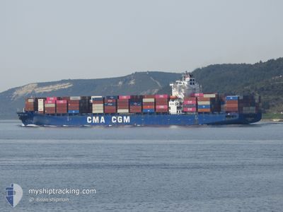
CMA CGM LAPIS
Container Ship
Current Trip
| Time Travelled | 12 days |
|---|---|
| Remaining Time | --- |
| Distance Travelled | 3801.71 nm |
| Remaining Distance | --- |
| AVG Speed | 13.1 Noeuds |
| MAX Speed | 19.6 Noeuds |
| AVG Wind | 16.9 knots |
| MAX Wind | 35.6 knots |
| MIN Temp | 7.5°C / 45.5°F |
| MAX Temp | 19°C / 66.2°F |
| Tirant d eau | 12.1 m |
| Position reçue | Maintenant |
Current Position
| Longitude | -4.91948° |
|---|---|
| Latitude | 36.19829° |
| Etat | Under way using engine |
| Vitesse | 0.6 Noeuds |
| Parcours | 187° |
| Zone | Alboran Sea |
| Station | T-AIS |
| Position reçue | Maintenant |
Info
Information
The current position of CMA CGM LAPIS is in Alboran Sea with coordinates 36.19829° / -4.91948° as reported on 2024-04-19 13:53 by AIS to our vessel tracker app. The vessel's current speed is 0.6 Noeuds
The vessel CMA CGM LAPIS (IMO: 9386495, MMSI: 636014199) is a Container Ship that was built in 2009 ( 15 Age ). It's sailing under the flag of [LR] Liberia.
In this page you can find informations about the vessels current position, last detected port calls, and current voyage information. If the vessels is not in coverage by AIS you will find the latest position.
The current position of CMA CGM LAPIS is detected by our AIS receivers and we are not responsible for the reliability of the data. The last position was recorded while the vessel was in Coverage by the Ais receivers of our vessel tracking app.
The current draught of CMA CGM LAPIS as reported by AIS is 12.1 meters
Weather
| Temperature | 17.1°C / 62.78°F |
|---|---|
| Wind Speed | 19 knots |
| Direction | 88° E |
| Pressure | 1019.1 hPa |
| Humidity | 82.7 % |
| Cloud Coverage | 100 % |
Featured Company
Last Port Calls
| Port | Arrival | Departure | Time In Port |
|---|---|---|---|
| 2024-04-05 21:05 | 2024-04-07 00:52 | 1 d | |
| 2024-04-03 07:04 | 2024-04-04 05:38 | 22 h | |
| 2024-03-30 17:53 | 2024-04-01 22:00 | 2 d | |
| 2024-03-22 11:45 | 2024-03-23 00:59 | 13 h | |
| 2024-03-16 17:20 | 2024-03-18 04:44 | 1 d | |
| 2024-03-16 05:30 | 2024-03-16 11:46 | 6 h | |
| 2024-03-12 10:36 | 2024-03-13 15:57 | 1 d | |
| 2024-03-10 07:44 | 2024-03-11 00:39 | 16 h | |
| 2024-03-07 03:40 | 2024-03-09 13:52 | 2 d | |
| 2024-02-27 05:44 | 2024-02-27 21:43 | 15 h |
Last Trips
| Origin | Departure | Destination | Arrival | Distance | |
|---|---|---|---|---|---|
| 2024-04-04 01:38 | 2024-04-05 17:05 | 526.30 nm | |||
| 2024-04-01 18:00 | 2024-04-03 03:04 | 305.73 nm | |||
| 2024-03-23 01:59 | 2024-03-30 13:53 | 3247.04 nm | |||
| 2024-03-18 05:44 | 2024-03-22 12:45 | 959.96 nm | |||
| 2024-03-16 12:46 | 2024-03-16 18:20 | 73.60 nm | |||
| 2024-03-13 17:57 | 2024-03-16 06:30 | 991.62 nm | |||
| 2024-03-11 03:39 | 2024-03-12 12:36 | 361.72 nm | |||
| 2024-03-09 16:52 | 2024-03-10 10:44 | 259.59 nm | |||
| 2024-02-27 22:43 | 2024-03-07 06:40 | 2719.63 nm | |||
| 2024-02-16 07:27 | 2024-02-27 06:44 | 3767.96 nm |
Events
| Heure | Evenement | Détails | Position/ Destination | Info |
|---|---|---|---|---|
| 2024-04-19 07:22 | Arret |
36.10644 / -4.86078
ESALG
|
Vitesse: 0.3 kn Parcours: 157° |
|
| 2024-04-19 05:47 | Démarrage |
36.22159 / -4.88396
ESALG
|
Vitesse: 3.2 kn Parcours: 181° |
|
| 2024-04-18 21:49 | Arret |
36.12744 / -4.80962
ESALG
|
Vitesse: 0.3 kn Parcours: 172° |
|
| 2024-04-18 13:02 | Changement de zone | Spanish part of the Alboran Sea Spanish part of the Strait of Gibraltar |
35.99200 / -5.31747
Alboran Sea
ESALG
|
Vitesse: 13.2 kn Parcours: 74.6° |
| 2024-04-18 12:50 | Changement de zone | Spanish part of the Strait of Gibraltar Moroccan part of the Strait of Gibraltar |
35.98037 / -5.36680
Strait of Gibraltar
ESALG
|
Vitesse: 12.8 kn Parcours: 73.2° |
| 2024-04-18 10:45 | Etat Changé | Under way using engine Default |
35.89804 / -5.86713
ESALG
|
Vitesse: 12.2 kn Parcours: 87° |
| 2024-04-18 10:38 | Etat Changé | Default Under way using engine |
35.89735 / -5.89485
ESALG
|
Vitesse: 12.3 kn Parcours: 89.3° |
| 2024-04-18 10:29 | Detecté en mer | Moroccan part of the Strait of Gibraltar |
35.89622 / -5.93213
Strait of Gibraltar
ESALG
|
Vitesse: 12.3 kn Parcours: 89.3° |
| 2024-04-18 10:27 | Etat Changé | Under way using engine Default |
35.89616 / -5.94201
ESALG
|
Vitesse: 12.3 kn Parcours: 90° |
| 2024-04-18 10:00 | Etat Changé | Default Under way using engine |
35.89613 / -6.05280
ESALG
|
Vitesse: 12 kn Parcours: 87.9° |