
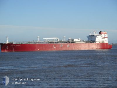
CLIPPER VANGUARD
Tanker
Current Trip
| Time Travelled | --- |
|---|---|
| Remaining Time | 1 day |
| Distance Travelled | 13787.60 nm |
| Remaining Distance | 612.52 nm |
| AVG Speed | 13.4 Noeuds |
| MAX Speed | 18.5 Noeuds |
| AVG Wind | 14.2 knots |
| MAX Wind | 30 knots |
| MIN Temp | 3.8°C / 38.84°F |
| MAX Temp | 30.6°C / 87.08°F |
| Tirant d eau | 7.7 m |
| Position reçue | 9 h, 22 m depuis |
Current Position
| Longitude | -84.78634° |
|---|---|
| Latitude | 20.84476° |
| Etat | Under way using engine |
| Vitesse | 15.9 Noeuds |
| Parcours | 318.1° |
| Zone | Caribbean Sea |
| Station | T-AIS |
| Position reçue | 9 h, 22 m depuis |
Info
Information
The current position of CLIPPER VANGUARD is in Caribbean Sea with coordinates 20.84476° / -84.78634° as reported on 2024-04-23 11:29 by AIS to our vessel tracker app. The vessel's current speed is 15.9 Noeuds and is heading at the port of GALVESTON. The estimated time of arrival as calculated by MyShipTracking vessel tracking app is 2024-04-25 07:57 LT
The vessel CLIPPER VANGUARD (IMO: 9789166, MMSI: 259138000) is a Tanker It's sailing under the flag of [NO] Norway.
In this page you can find informations about the vessels current position, last detected port calls, and current voyage information. If the vessels is not in coverage by AIS you will find the latest position.
The current position of CLIPPER VANGUARD is detected by our AIS receivers and we are not responsible for the reliability of the data. The last position was recorded while the vessel was in Coverage by the Ais receivers of our vessel tracking app.
The current draught of CLIPPER VANGUARD as reported by AIS is 7.7 meters
Weather
| Temperature | 24.9°C / 76.82°F |
|---|---|
| Wind Speed | 11 knots |
| Direction | 66° ENE |
| Pressure | 1017.2 hPa |
| Humidity | 74.4 % |
| Cloud Coverage | 67 % |
Featured Company
Last Port Calls
Most Visited Ports (Last year)
| Port | Arrivals | |
|---|---|---|
| 4 | ||
| 1 | ||
| 1 | ||
| 1 | ||
| 1 | ||
| 1 |
Last Trips
| Origin | Departure | Destination | Arrival | Distance |
|---|
Events
| Heure | Evenement | Détails | Position/ Destination | Info |
|---|---|---|---|---|
| 2024-04-23 11:41 | Etat Changé | Default Under way using engine |
20.88333 / -84.82333
USGLS
|
Vitesse: 15.9 kn Parcours: 318.1° |
| 2024-04-23 11:29 | Hors de la zone couverte |
20.84476 / -84.78634
Caribbean Sea
USGLS
|
Vitesse: 15.9 kn Parcours: 318.1° |
|
| 2024-04-23 09:25 | Etat Changé | Under way using engine Default |
20.42902 / -84.40279
USGLS
|
Vitesse: 15 kn Parcours: 317° |
| 2024-04-23 09:20 | Etat Changé | Default Under way using engine |
20.41167 / -84.38666
USGLS
|
Vitesse: 15.7 kn Parcours: 316.9° |
| 2024-04-23 08:17 | Etat Changé | Under way using engine Default |
20.20826 / -84.18775
USGLS
|
Vitesse: 15.5 kn Parcours: 316° |
| 2024-04-23 08:12 | Dans la zone couverte |
20.20826 / -84.18775
Caribbean Sea
USGLS
|
Vitesse: 15.7 kn Parcours: 316.7° |
|
| 2024-04-23 06:02 | Etat Changé | Default Under way using engine |
19.75097 / -83.76872
USGLS
|
Vitesse: 16.8 kn Parcours: 320.1° |
| 2024-04-23 05:57 | Etat Changé | Under way using engine Default |
19.73062 / -83.75050
USGLS
|
Vitesse: 16.8 kn Parcours: 320° |
| 2024-04-23 05:57 | Hors de la zone couverte |
19.73062 / -83.75050
Caribbean Sea
USGLS
|
Vitesse: 16.8 kn Parcours: 320.1° |
|
| 2024-04-23 05:50 | Etat Changé | Default Under way using engine |
19.70878 / -83.73111
USGLS
|
Vitesse: 16 kn Parcours: 320° |