
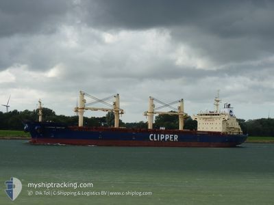
CLIPPER TARPON
Bulk Carrier
Current Trip
| Trip Time | 1 day |
|---|---|
| Trip Distance | 6.18 nm |
| AVG Speed | 2.1 Noeuds |
| MAX Speed | 2.1 Noeuds |
| Tirant d eau | 9 m |
| AVG Wind | 1.9 knots |
| MAX Wind | 4 knots |
| MIN Temp | 20.9°C / 69.62°F |
| MAX Temp | 29.2°C / 84.56°F |
| Position reçue | 8 d depuis |
Current Position
| Longitude | -90.01341° |
|---|---|
| Latitude | 29.78793° |
| Etat | Under way using engine |
| Vitesse | 13.4 Noeuds |
| Parcours | 209° |
| Zone | Gulf of Mexico |
| Station | T-AIS |
| Position reçue | 8 d depuis |
Info
Information
The current position of CLIPPER TARPON is in Gulf of Mexico with coordinates 29.78793° / -90.01341° as reported on 2024-04-11 10:02 by AIS to our vessel tracker app. The vessel's current speed is 13.4 Noeuds and is currently inside the port of KINGSTON (JM).
The vessel CLIPPER TARPON (IMO: 9406099, MMSI: 538007582) is a Bulk Carrier that was built in 2010 ( 14 Age ). It's sailing under the flag of [MH] Marshall Is.
In this page you can find informations about the vessels current position, last detected port calls, and current voyage information. If the vessels is not in coverage by AIS you will find the latest position.
The current position of CLIPPER TARPON is detected by our AIS receivers and we are not responsible for the reliability of the data. The last position was recorded while the vessel was in Coverage by the Ais receivers of our vessel tracking app.
The current draught of CLIPPER TARPON as reported by AIS is 9 meters
Weather
| Temperature | 20.4°C / 68.72°F |
|---|---|
| Wind Speed | 4 knots |
| Direction | 38° NE |
| Pressure | 1013.8 hPa |
| Humidity | 93.1 % |
| Cloud Coverage | 32 % |
Featured Company
Last Port Calls
| Port | Arrival | Departure | Time In Port |
|---|---|---|---|
| 2024-04-18 09:05 | |||
| 2024-04-15 17:45 | 2024-04-17 08:54 | 1 d | |
| 2024-04-15 17:01 | 2024-04-15 17:09 | 8 m | |
| 2024-04-09 16:47 | 2024-04-11 10:11 | 1 d | |
| 2024-04-04 23:00 | 2024-04-06 22:18 | 1 d | |
| 2024-03-26 08:32 | 2024-03-30 20:00 | 4 d | |
| 2024-02-22 10:48 | 2024-03-02 16:31 | 9 d |
Most Visited Ports (Last year)
| Port | Arrivals | |
|---|---|---|
| 3 | ||
| 2 | ||
| 2 | ||
| 1 | ||
| 1 | ||
| 1 |
Last Trips
| Origin | Departure | Destination | Arrival | Distance | |
|---|---|---|---|---|---|
| 2024-04-17 03:54 | 2024-04-18 04:05 | 6.18 nm | |||
| 2024-04-15 12:09 | 2024-04-15 12:45 | 3.64 nm | |||
| 2024-04-11 05:11 | 2024-04-15 12:01 | 1139.28 nm | |||
| 2024-04-06 16:18 | 2024-04-09 11:47 | 777.53 nm | |||
| 2024-03-30 15:00 | 2024-04-04 17:00 | 747.94 nm | |||
| 2024-03-02 13:31 | 2024-03-26 03:32 | 6565.38 nm | |||
| 2024-01-12 00:46 | 2024-02-22 07:48 | 6738.20 nm |
Events
| Heure | Evenement | Détails | Position/ Destination | Info |
|---|---|---|---|---|
| 2024-04-18 09:05 | Port d'arrivée |
|
17.96667 / -76.74532
[JM] KINGSTON (JM)
|
Vitesse: 1.1 kn Parcours: 41° |
| 2024-04-17 09:05 | Arret | 3.78 nm, East of KINGSTON (JM) |
17.95444 / -76.74282
JM KIN
|
Vitesse: 0.1 kn Parcours: 210° |
| 2024-04-17 08:54 | Démarrage | 3.78 nm, East of KINGSTON (JM) |
17.96098 / -76.74215
JM KIN
|
Vitesse: 4.9 kn Parcours: 190° |
| 2024-04-17 08:54 | PORT DE DEPART |
|
17.96098 / -76.74215
JM KIN
|
Vitesse: 3.4 kn Parcours: 142° |
| 2024-04-15 17:45 | Arret |
17.96639 / -76.74496
[JM] KINGSTON (JM)
|
Vitesse: 0.2 kn Parcours: 91° |
|
| 2024-04-15 17:45 | Port d'arrivée |
|
17.96639 / -76.74496
[JM] KINGSTON (JM)
|
Vitesse: 4.3 kn Parcours: 72° |
| 2024-04-15 17:09 | PORT DE DEPART |
|
17.95961 / -76.80736
JM KIN
|
Vitesse: 10.9 kn Parcours: 124° |
| 2024-04-15 17:01 | Port d'arrivée |
|
17.96890 / -76.83056
[JM] KINGSTON (JM)
|
Vitesse: 11.1 kn Parcours: 62° |
| 2024-04-15 11:40 | Démarrage | 14.5 nm, South East of ROCKY POINT |
17.64735 / -76.96249
JM KIN
|
Vitesse: 3.1 kn Parcours: 93° |
| 2024-04-15 10:31 | Arret | 14.7 nm, South East of ROCKY POINT |
17.65095 / -76.95396
JM KIN
|
Vitesse: 0.3 kn Parcours: 143° |