
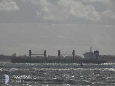
CL CONTIGO
Cargo
Current Trip
| Time Travelled | 9 days |
|---|---|
| Remaining Time | 17 h, 51 mins |
| Distance Travelled | 1578.79 nm |
| Remaining Distance | 205.18 nm |
| AVG Speed | 10.7 Noeuds |
| MAX Speed | 13.8 Noeuds |
| AVG Wind | 8.3 knots |
| MAX Wind | 20.2 knots |
| MIN Temp | 25.1°C / 77.18°F |
| MAX Temp | 33.6°C / 92.48°F |
| Tirant d eau | 8.3 m |
| Position reçue | 2 d depuis |
Current Position
| Longitude | -79.95215° |
|---|---|
| Latitude | 9.82320° |
| Etat | Under way using engine |
| Vitesse | 12.3 Noeuds |
| Parcours | 0.8° |
| Zone | Caribbean Sea |
| Station | T-AIS |
| Position reçue | 2 d depuis |
Info
Information
The current position of CL CONTIGO is in Caribbean Sea with coordinates 9.82320° / -79.95215° as reported on 2024-04-22 23:10 by AIS to our vessel tracker app. The vessel's current speed is 12.3 Noeuds and is heading at the port of PUERTO CORTES. The estimated time of arrival as calculated by MyShipTracking vessel tracking app is 2024-04-26 06:18 LT
The vessel CL CONTIGO (IMO: 9703411, MMSI: 205125000) is a Cargo It's sailing under the flag of [BE] Belgium.
In this page you can find informations about the vessels current position, last detected port calls, and current voyage information. If the vessels is not in coverage by AIS you will find the latest position.
The current position of CL CONTIGO is detected by our AIS receivers and we are not responsible for the reliability of the data. The last position was recorded while the vessel was in Coverage by the Ais receivers of our vessel tracking app.
The current draught of CL CONTIGO as reported by AIS is 8.3 meters
Weather
| Temperature | 27.4°C / 81.32°F |
|---|---|
| Wind Speed | 15 knots |
| Direction | 56° NE |
| Pressure | 1015 hPa |
| Humidity | 74.3 % |
| Cloud Coverage | 1 % |
Featured Company
Last Port Calls
| Port | Arrival | Departure | Time In Port |
|---|---|---|---|
| 2024-04-12 12:27 | 2024-04-16 00:14 | 3 d | |
| 2024-03-08 17:24 | |||
| 2024-02-12 01:22 | 2024-02-15 09:51 | 3 d |
Most Visited Ports (Last year)
| Port | Arrivals | |
|---|---|---|
| 1 | ||
| 1 | ||
| 1 | ||
| 1 | ||
| 1 | ||
| 1 |
Last Trips
| Origin | Departure | Destination | Arrival | Distance | |
|---|---|---|---|---|---|
| 2024-03-09 01:24 | 2024-04-12 06:27 | 8772.13 nm | |||
| 2023-12-19 20:35 | 2024-02-12 09:22 | 9777.18 nm |
Events
| Heure | Evenement | Détails | Position/ Destination | Info |
|---|---|---|---|---|
| 2024-04-22 23:21 | Etat Changé | Default Under way using engine |
9.86325 / -79.95063
HNPCR
|
Vitesse: 12.3 kn Parcours: 0.8° |
| 2024-04-22 23:10 | Hors de la zone couverte |
9.82320 / -79.95215
Caribbean Sea
HNPCR
|
Vitesse: 12.3 kn Parcours: 0.8° |
|
| 2024-04-22 22:57 | Etat Changé | Under way using engine Default |
9.77848 / -79.95517
HNPCR
|
Vitesse: 12.1 kn Parcours: 4° |
| 2024-04-22 22:54 | Etat Changé | Default Under way using engine |
9.76829 / -79.95601
HNPCR
|
Vitesse: 12 kn Parcours: 4.7° |
| 2024-04-22 22:31 | Etat Changé | Under way using engine Default |
9.69055 / -79.96004
HNPCR
|
Vitesse: 11.9 kn Parcours: 360° |
| 2024-04-22 22:26 | Etat Changé | Default Under way using engine |
9.67665 / -79.95995
HNPCR
|
Vitesse: 12 kn Parcours: 349° |
| 2024-04-22 21:53 | Démarrage | 12.14 nm, North of COLON |
9.56918 / -79.93892
HNPCR
|
Vitesse: 11.7 kn Parcours: 347.2° |
| 2024-04-22 21:49 | Etat Changé | Under way using engine Under way sailing |
9.55643 / -79.93560
HNPCR
|
Vitesse: Parcours: 511° |
| 2024-04-22 21:49 | Etat Changé | Under way sailing Under way using engine |
9.55486 / -79.93516
HNPCR
|
Vitesse: 11 kn Parcours: 343° |
| 2024-04-22 21:49 | Arret | 11.25 nm, North of COLON |
9.55486 / -79.93516
HNPCR
|
Vitesse: Parcours: 511° |