
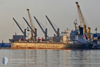
CHIOS LUCK
Bulk Carrier
Current Trip
| Time Travelled | 17 days |
|---|---|
| Remaining Time | 14 h, 53 mins |
| Distance Travelled | 4819.49 nm |
| Remaining Distance | 174.85 nm |
| AVG Speed | 12.2 Noeuds |
| MAX Speed | 14.7 Noeuds |
| AVG Wind | 10.4 knots |
| MAX Wind | 18.6 knots |
| MIN Temp | 18.5°C / 65.3°F |
| MAX Temp | 29.6°C / 85.28°F |
| Tirant d eau | 9 m |
| Position reçue | 3 d depuis |
Current Position
| Longitude | -63.57667° |
|---|---|
| Latitude | 18.12397° |
| Etat | Under way using engine |
| Vitesse | 13 Noeuds |
| Parcours | 316.1° |
| Zone | Caribbean Sea |
| Station | T-AIS |
| Position reçue | 3 d depuis |
Info
Information
The current position of CHIOS LUCK is in Caribbean Sea with coordinates 18.12397° / -63.57667° as reported on 2024-04-20 22:52 by AIS to our vessel tracker app. The vessel's current speed is 13 Noeuds and is heading at the port of CHARLESTON. The estimated time of arrival as calculated by MyShipTracking vessel tracking app is 2024-04-25 03:52 LT
The vessel CHIOS LUCK (IMO: 9643805, MMSI: 241229000) is a Bulk Carrier that was built in 2013 ( 11 Age ). It's sailing under the flag of [GR] Greece.
In this page you can find informations about the vessels current position, last detected port calls, and current voyage information. If the vessels is not in coverage by AIS you will find the latest position.
The current position of CHIOS LUCK is detected by our AIS receivers and we are not responsible for the reliability of the data. The last position was recorded while the vessel was in Coverage by the Ais receivers of our vessel tracking app.
The current draught of CHIOS LUCK as reported by AIS is 9 meters
Weather
| Temperature | 19.3°C / 66.74°F |
|---|---|
| Wind Speed | 5 knots |
| Direction | 246° WSW |
| Pressure | 1022.3 hPa |
| Humidity | 53 % |
| Cloud Coverage | --- |
Featured Company
Last Port Calls
| Port | Arrival | Departure | Time In Port |
|---|---|---|---|
| 2024-04-04 10:25 | 2024-04-06 15:29 | 2 d | |
| 2024-03-12 09:46 |
Most Visited Ports (Last year)
| Port | Arrivals | |
|---|---|---|
| 2 | ||
| 2 | ||
| 1 | ||
| 1 | ||
| 1 | ||
| 1 |
Last Trips
| Origin | Departure | Destination | Arrival | Distance | |
|---|---|---|---|---|---|
| 2024-03-12 06:46 | 2024-04-04 07:25 | 233.52 nm |
Events
| Heure | Evenement | Détails | Position/ Destination | Info |
|---|---|---|---|---|
| 2024-04-20 22:56 | Etat Changé | Default Under way using engine |
18.13500 / -63.58667
US CHS
|
Vitesse: 13 kn Parcours: 316.1° |
| 2024-04-20 22:52 | Hors de la zone couverte |
18.12397 / -63.57667
Caribbean Sea
US CHS
|
Vitesse: 13 kn Parcours: 316.1° |
|
| 2024-04-20 22:44 | Etat Changé | Under way using engine Default |
18.10484 / -63.55742
US CHS
|
Vitesse: 12 kn Parcours: 316° |
| 2024-04-20 22:41 | Etat Changé | Default Under way using engine |
18.09500 / -63.54833
US CHS
|
Vitesse: 13.1 kn Parcours: 316.8° |
| 2024-04-20 22:20 | Changement de zone | Anguilla part of the Caribbean Sea Saint-Martin part of the Caribbean Sea |
18.04022 / -63.49327
Caribbean Sea
US CHS
|
Vitesse: 13.1 kn Parcours: 317.6° |
| 2024-04-20 22:20 | Etat Changé | Under way using engine Default |
18.04022 / -63.49327
US CHS
|
Vitesse: 13 kn Parcours: 316° |
| 2024-04-20 22:17 | Etat Changé | Default Under way using engine |
18.03167 / -63.48500
US CHS
|
Vitesse: 12.9 kn Parcours: 316.8° |
| 2024-04-20 21:49 | Etat Changé | Under way using engine Default |
17.95679 / -63.41255
US CHS
|
Vitesse: 13 kn Parcours: 315° |
| 2024-04-20 21:42 | Etat Changé | Default Under way using engine |
17.93982 / -63.39516
US CHS
|
Vitesse: 13 kn Parcours: 315° |
| 2024-04-20 21:23 | Changement de zone | Saint-Martin part of the Caribbean Sea Saba part of the Caribbean Sea |
17.89067 / -63.34378
Caribbean Sea
US CHS
|
Vitesse: 13 kn Parcours: 314.4° |