
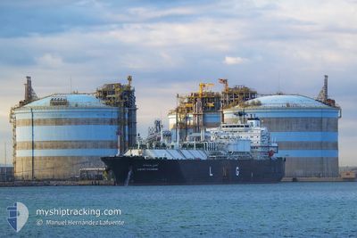
CHEIKH BOUAMAMA
Lng Tanker
Current Trip
| Time Travelled | 1 day |
|---|---|
| Remaining Time | --- |
| Distance Travelled | 379.60 nm |
| Remaining Distance | --- |
| AVG Speed | 10.9 Noeuds |
| MAX Speed | 13.7 Noeuds |
| AVG Wind | 8.8 knots |
| MAX Wind | 19 knots |
| MIN Temp | 16.1°C / 60.98°F |
| MAX Temp | 21.1°C / 69.98°F |
| Tirant d eau | 7.9 m |
| Position reçue | 11 h, 54 m depuis |
Current Position
| Longitude | 6.32428° |
|---|---|
| Latitude | 39.31598° |
| Etat | Under way using engine |
| Vitesse | 13.6 Noeuds |
| Parcours | 165.7° |
| Zone | Mediterranean Sea - Western Basin |
| Station | T-AIS |
| Position reçue | 11 h, 54 m depuis |
Info
Information
The current position of CHEIKH BOUAMAMA is in Mediterranean Sea - Western Basin with coordinates 39.31598° / 6.32428° as reported on 2024-04-15 16:14 by AIS to our vessel tracker app. The vessel's current speed is 13.6 Noeuds
The vessel CHEIKH BOUAMAMA (IMO: 9324344, MMSI: 311006300) is a Lng Tanker that was built in 2008 ( 16 Age ). It's sailing under the flag of [BS] Bahamas.
In this page you can find informations about the vessels current position, last detected port calls, and current voyage information. If the vessels is not in coverage by AIS you will find the latest position.
The current position of CHEIKH BOUAMAMA is detected by our AIS receivers and we are not responsible for the reliability of the data. The last position was recorded while the vessel was in Coverage by the Ais receivers of our vessel tracking app.
The current draught of CHEIKH BOUAMAMA as reported by AIS is 7.9 meters
Weather
| Temperature | 16.7°C / 62.06°F |
|---|---|
| Wind Speed | 19 knots |
| Direction | 292° WNW |
| Pressure | 1012.7 hPa |
| Humidity | 87.2 % |
| Cloud Coverage | 68 % |
Featured Company
Last Port Calls
| Port | Arrival | Departure | Time In Port |
|---|---|---|---|
| 2024-04-13 05:50 | 2024-04-14 17:59 | 1 d | |
| 2024-04-09 14:48 | 2024-04-10 15:02 | 1 d | |
| 2024-04-06 06:21 | 2024-04-08 08:29 | 2 d | |
| 2024-04-03 13:42 | 2024-04-04 20:57 | 1 d | |
| 2024-03-31 08:25 | 2024-04-01 06:26 | 22 h | |
| 2024-03-29 09:26 | 2024-03-30 06:41 | 21 h | |
| 2024-03-26 20:05 | 2024-03-28 01:51 | 1 d | |
| 2024-03-20 13:36 | 2024-03-21 19:58 | 1 d | |
| 2024-03-17 11:45 | 2024-03-17 12:00 | 14 m | |
| 2024-03-13 13:38 | 2024-03-14 16:23 | 1 d |
Most Visited Ports (Last year)
| Port | Arrivals | |
|---|---|---|
| 32 | ||
| 18 | ||
| 11 | ||
| 6 | ||
| 3 | ||
| 2 |
Last Trips
| Origin | Departure | Destination | Arrival | Distance | |
|---|---|---|---|---|---|
| 2024-04-10 16:02 | 2024-04-13 07:50 | 578.27 nm | |||
| 2024-04-08 10:29 | 2024-04-09 15:48 | 463.18 nm | |||
| 2024-04-04 21:57 | 2024-04-06 08:21 | 469.45 nm | |||
| 2024-04-01 08:26 | 2024-04-03 14:42 | 402.71 nm | |||
| 2024-03-30 07:41 | 2024-03-31 10:25 | 383.07 nm | |||
| 2024-03-28 02:51 | 2024-03-29 10:26 | 403.69 nm | |||
| 2024-03-21 20:58 | 2024-03-26 21:05 | 430.90 nm | |||
| 2024-03-17 13:00 | 2024-03-20 14:36 | 424.17 nm | |||
| 2024-03-14 17:23 | 2024-03-17 12:45 | 410.35 nm | |||
| 2024-03-12 04:15 | 2024-03-13 14:38 | 499.88 nm |
Events
| Heure | Evenement | Détails | Position/ Destination | Info |
|---|---|---|---|---|
| 2024-04-15 16:17 | Etat Changé | Default Under way using engine |
39.30167 / 6.32833
DZSKI
|
Vitesse: 13.6 kn Parcours: 165.7° |
| 2024-04-15 16:14 | Changement de zone | Italian part of the Mediterranean Sea - Western Basin Spanish part of the Mediterranean Sea - Western Basin |
39.31598 / 6.32428
Mediterranean Sea - Western Basin
DZSKI
|
Vitesse: 13.6 kn Parcours: 165.7° |
| 2024-04-15 16:14 | Etat Changé | Under way using engine Default |
39.31598 / 6.32428
DZSKI
|
Vitesse: 13.6 kn Parcours: 166° |
| 2024-04-15 16:14 | Hors de la zone couverte |
39.31598 / 6.32428
Mediterranean Sea - Western Basin
DZSKI
|
Vitesse: 13.6 kn Parcours: 165.7° |
|
| 2024-04-15 16:11 | Dans la zone couverte |
39.31598 / 6.32428
Mediterranean Sea - Western Basin
DZSKI
|
Vitesse: 13.6 kn Parcours: 165.7° |
|
| 2024-04-15 12:53 | Etat Changé | Default Under way using engine |
40.03200 / 6.10645
DZSKI
|
Vitesse: 13.3 kn Parcours: 167° |
| 2024-04-15 12:52 | Hors de la zone couverte |
40.03750 / 6.10480
Mediterranean Sea - Western Basin
DZSKI
|
Vitesse: 13.3 kn Parcours: 167° |
|
| 2024-04-15 12:10 | Changement de zone | Spanish part of the Mediterranean Sea - Western Basin French part of the Mediterranean Sea - Western Basin |
40.19173 / 6.05667
Mediterranean Sea - Western Basin
DZSKI
|
Vitesse: 13.4 kn Parcours: 167° |
| 2024-04-15 12:08 | Etat Changé | Under way using engine Default |
40.19779 / 6.05481
DZSKI
|
Vitesse: 13 kn Parcours: 166° |
| 2024-04-15 12:08 | Dans la zone couverte |
40.19173 / 6.05667
Mediterranean Sea - Western Basin
DZSKI
|
Vitesse: 13.4 kn Parcours: 167° |